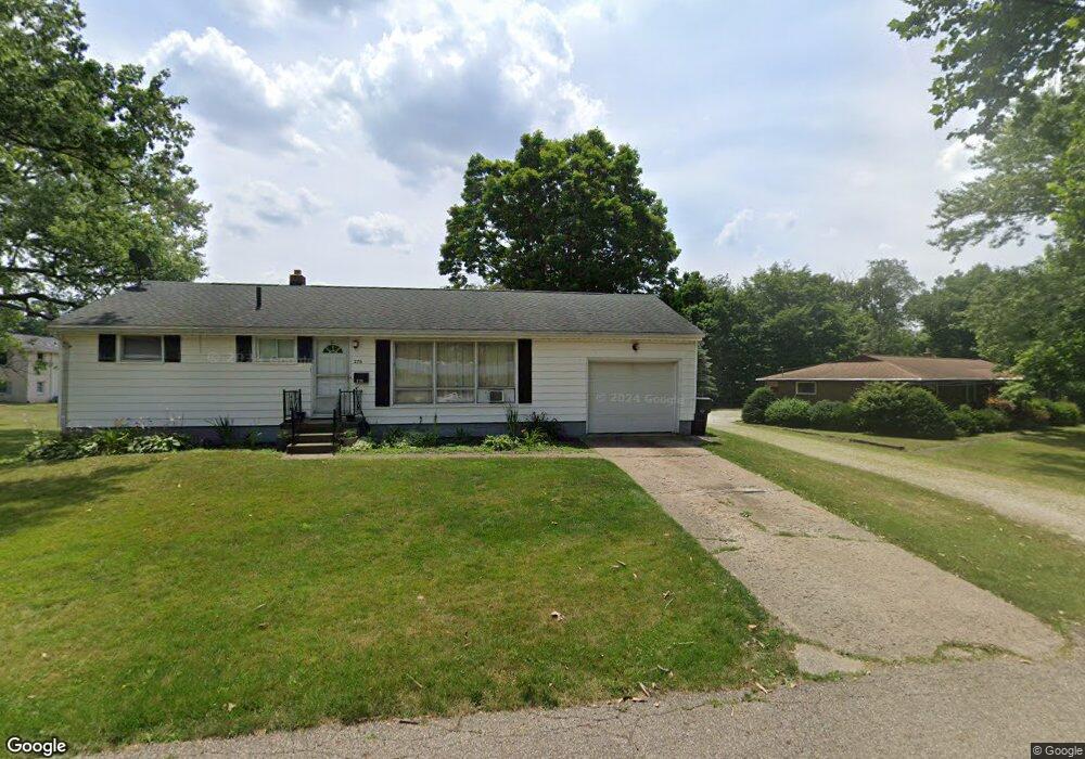
280 Devinney Ave Louisville, OH 44641
Estimated Value: $231,000 - $252,934
4
Beds
2
Baths
1,968
Sq Ft
$122/Sq Ft
Est. Value
About This Home
This home is located at 280 Devinney Ave, Louisville, OH 44641 and is currently estimated at $240,984, approximately $122 per square foot. 280 Devinney Ave is a home located in Stark County with nearby schools including Louisville High School and St. Thomas Aquinas High School & Middle School.
Ownership History
Date
Name
Owned For
Owner Type
Purchase Details
Closed on
Jun 22, 2005
Sold by
Blogna Jody L
Bought by
Myers Ronald P
Current Estimated Value
Home Financials for this Owner
Home Financials are based on the most recent Mortgage that was taken out on this home.
Original Mortgage
$100,000
Outstanding Balance
$52,575
Interest Rate
5.87%
Mortgage Type
Fannie Mae Freddie Mac
Estimated Equity
$188,409
Purchase Details
Closed on
Sep 1, 2004
Sold by
Whitt Robert D
Bought by
Whitt Robert D and Blogna Jody L
Purchase Details
Closed on
Apr 19, 1988
Create a Home Valuation Report for This Property
The Home Valuation Report is an in-depth analysis detailing your home's value as well as a comparison with similar homes in the area
Home Values in the Area
Average Home Value in this Area
Purchase History
| Date | Buyer | Sale Price | Title Company |
|---|---|---|---|
| Myers Ronald P | $125,000 | -- | |
| Whitt Robert D | -- | -- | |
| -- | $62,000 | -- |
Source: Public Records
Mortgage History
| Date | Status | Borrower | Loan Amount |
|---|---|---|---|
| Open | Myers Ronald P | $100,000 | |
| Closed | Myers Ronald P | $25,000 |
Source: Public Records
Tax History Compared to Growth
Tax History
| Year | Tax Paid | Tax Assessment Tax Assessment Total Assessment is a certain percentage of the fair market value that is determined by local assessors to be the total taxable value of land and additions on the property. | Land | Improvement |
|---|---|---|---|---|
| 2025 | -- | $73,330 | $15,540 | $57,790 |
| 2024 | -- | $73,330 | $15,540 | $57,790 |
| 2023 | $2,544 | $58,530 | $13,270 | $45,260 |
| 2022 | $2,549 | $58,530 | $13,270 | $45,260 |
| 2021 | $2,557 | $58,530 | $13,270 | $45,260 |
| 2020 | $2,135 | $52,990 | $11,970 | $41,020 |
| 2019 | $2,144 | $52,330 | $11,310 | $41,020 |
| 2018 | $2,109 | $52,330 | $11,310 | $41,020 |
| 2017 | $1,988 | $47,570 | $9,140 | $38,430 |
| 2016 | $2,028 | $47,570 | $9,140 | $38,430 |
| 2015 | $2,034 | $47,570 | $9,140 | $38,430 |
| 2014 | $1,940 | $42,180 | $8,120 | $34,060 |
| 2013 | $974 | $42,180 | $8,120 | $34,060 |
Source: Public Records
Map
Nearby Homes
- 300 Kennedy St
- 428 Honeycrisp Dr NE
- 3047 Mcintosh Dr NE
- 432 Honeycrisp Dr NE
- 2962 Mcintosh Dr NE
- 2963 Mcintosh Dr NE
- 430 Honeycrisp Dr NE
- 2957 Mcintosh Dr NE
- 614 Reno Dr
- 524 Glenbar St
- 0 Glenbar St
- 1149 Sturbridge Dr
- 1175 Sturbridge Dr
- 0 Brookridge Ave
- 316 E Reno Dr
- 5474 Ravenna Ave
- 325 Lincoln Ave
- 910 Crosswyck Cir
- 3580 Brookridge Ave Lot 15
- 1170 Winding Ridge Ave
- 270 Devinney Ave
- 303 Kennedy St
- 277 Devinney Ave
- 264 Devinney Ave
- 273 Devinney Ave
- 1125 Johnson St
- 1086 Danielle Ave
- 265 Devinney Ave
- 1078 Danielle Ave
- 1096 Danielle Ave
- 1223 Faircliff St
- 1070 Danielle Ave
- 280 Kennedy St
- 246 Devinney Ave
- 259 Devinney Ave
- 1120 Johnson St
- 1064 Danielle Ave
- 272 Kennedy St
- 245 Devinney Ave
- 242 Devinney Ave