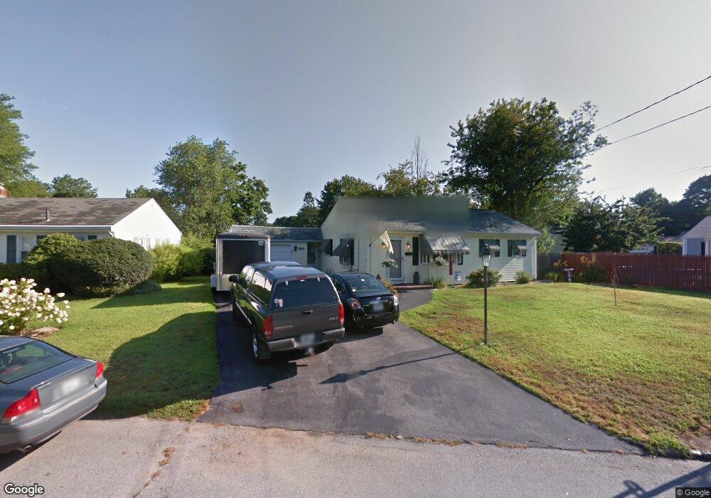
280 Hoxsie Ave Warwick, RI 02889
Hoxie NeighborhoodEstimated Value: $396,000 - $444,000
3
Beds
1
Bath
1,500
Sq Ft
$273/Sq Ft
Est. Value
About This Home
This home is located at 280 Hoxsie Ave, Warwick, RI 02889 and is currently estimated at $410,001, approximately $273 per square foot. 280 Hoxsie Ave is a home located in Kent County with nearby schools including Saint Kevin School and Bishop Hendricken High School.
Ownership History
Date
Name
Owned For
Owner Type
Purchase Details
Closed on
Aug 30, 2021
Sold by
Ekroth Christine H
Bought by
Ekroth Christine H and Ekroth Erik D
Current Estimated Value
Home Financials for this Owner
Home Financials are based on the most recent Mortgage that was taken out on this home.
Original Mortgage
$169,000
Outstanding Balance
$124,635
Interest Rate
2.1%
Mortgage Type
New Conventional
Estimated Equity
$285,366
Purchase Details
Closed on
Mar 3, 2014
Sold by
Burns Christine H
Bought by
Ekroth Christine H
Purchase Details
Closed on
Jun 28, 2004
Sold by
Greene Margaret M
Bought by
Burns Richard E and Burns Christine H
Home Financials for this Owner
Home Financials are based on the most recent Mortgage that was taken out on this home.
Original Mortgage
$200,000
Interest Rate
6.32%
Mortgage Type
Purchase Money Mortgage
Create a Home Valuation Report for This Property
The Home Valuation Report is an in-depth analysis detailing your home's value as well as a comparison with similar homes in the area
Home Values in the Area
Average Home Value in this Area
Purchase History
| Date | Buyer | Sale Price | Title Company |
|---|---|---|---|
| Ekroth Christine H | -- | None Available | |
| Ekroth Christine H | -- | -- | |
| Burns Richard E | $255,000 | -- |
Source: Public Records
Mortgage History
| Date | Status | Borrower | Loan Amount |
|---|---|---|---|
| Open | Ekroth Christine H | $169,000 | |
| Previous Owner | Burns Richard E | $204,100 | |
| Previous Owner | Burns Richard E | $200,000 | |
| Previous Owner | Burns Richard E | $30,000 | |
| Previous Owner | Burns Richard E | $22,000 |
Source: Public Records
Tax History
| Year | Tax Paid | Tax Assessment Tax Assessment Total Assessment is a certain percentage of the fair market value that is determined by local assessors to be the total taxable value of land and additions on the property. | Land | Improvement |
|---|---|---|---|---|
| 2025 | $4,618 | $363,600 | $106,800 | $256,800 |
| 2024 | $4,460 | $308,200 | $88,200 | $220,000 |
| 2023 | $4,373 | $308,200 | $88,200 | $220,000 |
| 2022 | $4,267 | $227,800 | $62,100 | $165,700 |
| 2021 | $4,267 | $227,800 | $62,100 | $165,700 |
| 2020 | $4,267 | $227,800 | $62,100 | $165,700 |
| 2019 | $4,267 | $227,800 | $62,100 | $165,700 |
| 2018 | $3,621 | $174,100 | $55,600 | $118,500 |
| 2017 | $3,524 | $174,100 | $55,600 | $118,500 |
| 2016 | $3,524 | $174,100 | $55,600 | $118,500 |
| 2015 | $3,243 | $156,300 | $58,200 | $98,100 |
| 2014 | $3,135 | $156,300 | $58,200 | $98,100 |
| 2013 | $3,093 | $156,300 | $58,200 | $98,100 |
Source: Public Records
Map
Nearby Homes
- 49 Recess Ln
- 14 Recess Ln
- 33 Recess Ln
- 21 Sarah Ln
- 12 Dean Ct
- 48 Rowe Ave
- 72 W Shore Rd Unit 104
- 72 W Shore Rd Unit 3
- 39 Holiday Ave
- 20 Commodore Ave
- 44 Woodstock Dr
- 52 Dahlia St
- 15 Christopher Rhodes Way
- 6 Christopher Rhodes Way
- 108 Fern St
- 80 Twin Oak Dr
- 0 Bethel St
- 54 Ansonia Rd
- 90 Massachusetts Ave
- 18 Sevilla Ave
- 39 Fairfield Ct
- 272 Hoxsie Ave
- 277 Hoxsie Ave
- 29 Fairfield Ct
- 287 Hoxsie Ave
- 269 Hoxsie Ave
- 188 Hoxsie Ave
- 264 Hoxsie Ave
- 196 Hoxsie Ave
- 295 Hoxsie Ave
- 261 Hoxsie Ave
- 19 Fairfield Ct
- 204 Hoxsie Ave
- 38 Fairfield Ct
- 30 Fairfield Ct
- 303 Hoxsie Ave
- 250 Hoxsie Ave
- 48 Fairfield Ct
- 197 Hoxsie Ave
- 20 Fairfield Ct
Your Personal Tour Guide
Ask me questions while you tour the home.