Estimated Value: $643,000 - $1,234,033
3
Beds
5
Baths
4,920
Sq Ft
$176/Sq Ft
Est. Value
About This Home
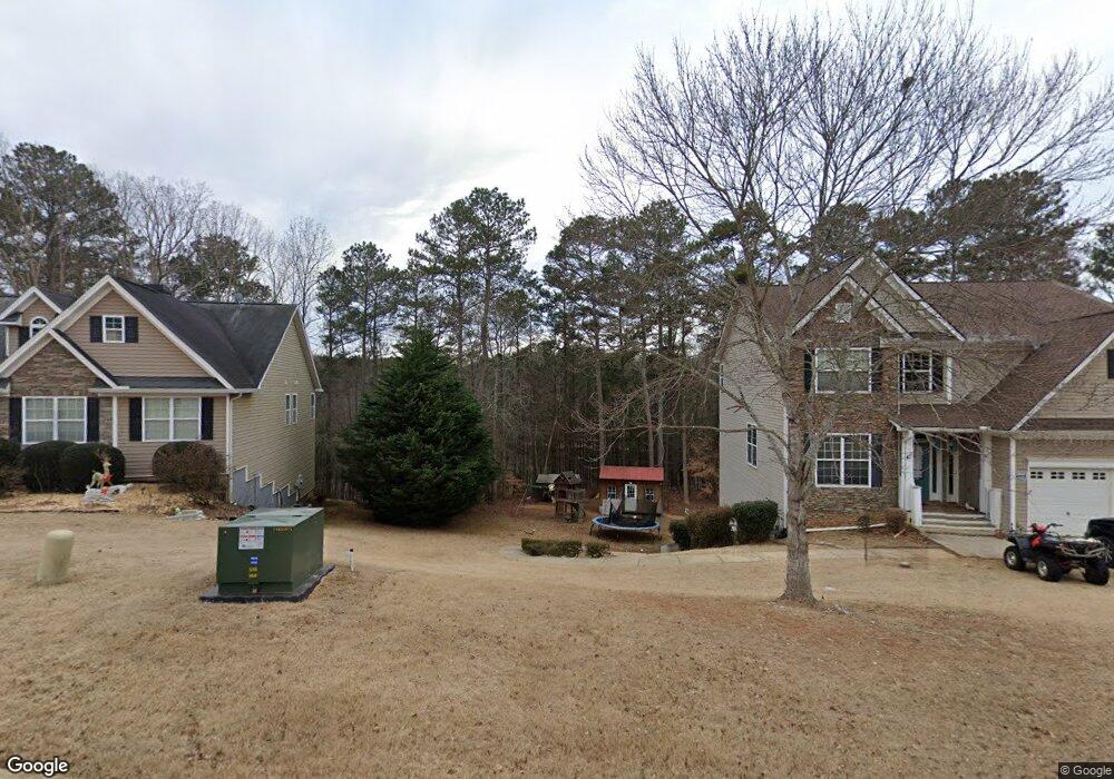
This home is located at 280 Magnolia Path, Hiram, GA 30141 and is currently estimated at $867,678, approximately $176 per square foot. 280 Magnolia Path is a home located in Paulding County with nearby schools including Sam D. Panter Elementary School, J. A. Dobbins Middle School, and Hiram High School.
Ownership History
Date
Name
Owned For
Owner Type
Purchase Details
Closed on
Apr 5, 2012
Sold by
Underwood James C and Underwood Brenda
Current Estimated Value
Purchase Details
Closed on
Dec 12, 2011
Sold by
Underwood James C
Bought by
Underwood James C and Underwood Brenda W
Purchase Details
Closed on
Nov 17, 2010
Sold by
Underwood James C and Underwood Brenda W
Purchase Details
Closed on
Aug 25, 2005
Sold by
Eagles Nest Dev Llc
Bought by
Underwood James C and Underwood Brenda W
Create a Home Valuation Report for This Property
The Home Valuation Report is an in-depth analysis detailing your home's value as well as a comparison with similar homes in the area
Home Values in the Area
Average Home Value in this Area
Purchase History
| Date | Buyer | Sale Price | Title Company |
|---|---|---|---|
| -- | -- | -- | |
| Underwood James C | -- | -- | |
| -- | -- | -- | |
| Underwood James C | -- | -- |
Source: Public Records
Tax History Compared to Growth
Tax History
| Year | Tax Paid | Tax Assessment Tax Assessment Total Assessment is a certain percentage of the fair market value that is determined by local assessors to be the total taxable value of land and additions on the property. | Land | Improvement |
|---|---|---|---|---|
| 2024 | $2,364 | $435,996 | $107,480 | $328,516 |
| 2023 | $2,630 | $418,828 | $104,800 | $314,028 |
| 2022 | $2,386 | $370,488 | $87,320 | $283,168 |
| 2021 | $2,237 | $283,692 | $68,360 | $215,332 |
| 2020 | $2,145 | $258,904 | $64,560 | $194,344 |
| 2019 | $1,969 | $240,004 | $68,360 | $171,644 |
| 2018 | $2,418 | $311,832 | $98,120 | $213,712 |
| 2017 | $2,232 | $284,144 | $93,920 | $190,224 |
| 2016 | $1,794 | $250,932 | $93,920 | $157,012 |
| 2015 | $1,726 | $237,120 | $92,240 | $144,880 |
| 2014 | $1,639 | $214,220 | $0 | $129,540 |
| 2013 | -- | $203,472 | $92,872 | $110,600 |
Source: Public Records
Map
Nearby Homes
- 426 Old Sudie Rd
- 51 Old Teal Rd
- 55 Jessica Dr
- 1707 Hiram Sudie Rd
- 122 Prince Way
- 129 Fawn Trail
- 237 Settlers Mill Run
- 242 Barrington Dr
- 124 Lynn Dr
- 142 Wellspring Point
- 149 Barrington Ln
- 14 Woodmill Ct Unit 2
- 1019 Davis Mill Rd S
- 1379 Rich Davis Rd
- 122 Hale Mountain Ct
- 520 White Pines Dr
- 75 Clay Ct
- 164 Emerald Pines Ln
- 238 Magnolia Path
- 1816 Hiram Sudie Rd
- 556 Old Sudie Rd
- 103 Eagles Nest Dr
- 111 Eagles Nest Dr
- 85 Eagles Nest Dr
- 141 Magnolia Path
- 63 Eagles Nest Dr
- 41 Eagles Nest Dr
- 114 Eagles Nest Dr
- 1850 Hiram Sudie Rd
- 25 Eagles Nest Dr
- 0 Eagles Nest Dr Unit 7341289
- 0 Eagles Nest Dr Unit 8612822
- 0 Eagles Nest Dr Unit 8023772
- 0 Eagles Nest Dr Unit 8835923
- 0 Eagles Nest Dr Unit 3182130
- 0 Eagles Nest Dr
- 236 Sinyard Cir
- 66 Eagles Nest Dr