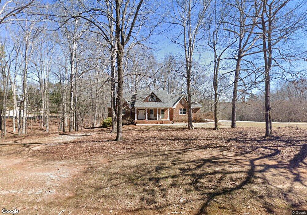
280 Mallard Ln Locust Grove, GA 30248
Estimated Value: $479,000 - $695,000
3
Beds
2
Baths
2,723
Sq Ft
$204/Sq Ft
Est. Value
About This Home
This home is located at 280 Mallard Ln, Locust Grove, GA 30248 and is currently estimated at $555,898, approximately $204 per square foot. 280 Mallard Ln is a home located in Henry County with nearby schools including Bethlehem Elementary School, Luella Middle School, and Luella High School.
Ownership History
Date
Name
Owned For
Owner Type
Purchase Details
Closed on
Jul 26, 2000
Sold by
Zacks Prop Inc
Bought by
Combs Ralph D and Combs Kathy M
Current Estimated Value
Home Financials for this Owner
Home Financials are based on the most recent Mortgage that was taken out on this home.
Original Mortgage
$200,000
Interest Rate
8.12%
Mortgage Type
New Conventional
Create a Home Valuation Report for This Property
The Home Valuation Report is an in-depth analysis detailing your home's value as well as a comparison with similar homes in the area
Home Values in the Area
Average Home Value in this Area
Purchase History
| Date | Buyer | Sale Price | Title Company |
|---|---|---|---|
| Combs Ralph D | $50,000 | -- |
Source: Public Records
Mortgage History
| Date | Status | Borrower | Loan Amount |
|---|---|---|---|
| Closed | Combs Ralph D | $200,000 |
Source: Public Records
Tax History Compared to Growth
Tax History
| Year | Tax Paid | Tax Assessment Tax Assessment Total Assessment is a certain percentage of the fair market value that is determined by local assessors to be the total taxable value of land and additions on the property. | Land | Improvement |
|---|---|---|---|---|
| 2025 | $2,324 | $218,200 | $30,000 | $188,200 |
| 2024 | $2,324 | $211,760 | $30,000 | $181,760 |
| 2023 | $3,468 | $206,120 | $30,000 | $176,120 |
| 2022 | $3,985 | $166,640 | $30,000 | $136,640 |
| 2021 | $3,826 | $159,920 | $30,000 | $129,920 |
| 2020 | $3,603 | $150,480 | $30,000 | $120,480 |
| 2019 | $5,046 | $150,280 | $29,720 | $120,560 |
| 2018 | $4,503 | $133,640 | $25,760 | $107,880 |
| 2016 | $4,130 | $113,680 | $25,760 | $87,920 |
| 2015 | $4,417 | $117,960 | $26,000 | $91,960 |
| 2014 | $3,917 | $104,240 | $24,000 | $80,240 |
Source: Public Records
Map
Nearby Homes
- 51 Mallard Ln
- 1143 Eagles Brooke Dr
- 1615 Avery Dr
- 980 Donegal Dr
- 2200 Golden Eagle Dr
- 705 Kenton Ct
- 1509 Royce Dr
- 2234 Golden Eagle Dr
- 7 Mallard Ln
- 0 Mallard Ln Unit LOT 51
- 0 Lester Mill Rd Unit 10126503
- 1405 Landon Dr
- Meridian II Plan at Kingston
- Wagener Plan at Kingston
- Lauren II Plan at Kingston
- 512 Dolce Rd
- Wynwood Plan at Kingston
- Clarity Plan at Kingston
- Henry II Plan at Kingston
- Rosemary II Plan at Kingston
- 310 Mallard Ln
- 250 Mallard Ln
- 340 Mallard Ln
- 365 Mallard Ln
- 220 Mallard Ln
- 145 Mallard Ln
- 360 Mallard Ln
- 170 Mallard Ln
- 390 Mallard Ln
- 385 Mallard Ln
- 155 Mallard Ln
- 125 Mallard Ln
- 150 Mallard Ln
- 405 Mallard Ln
- 105 Mallard Ln
- 110 Mallard Ln
- 425 Mallard Ln Unit 42 43
- 425 Mallard Ln
- 425 Mallard Ln Unit 42
- 0 Pintail Way Unit 66 7128801