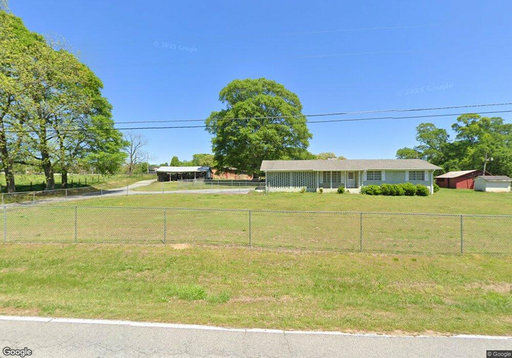
280 McKenzie Bridge Rd Carrollton, GA 30116
Abilene NeighborhoodEstimated Value: $281,000 - $720,242
3
Beds
2
Baths
1,701
Sq Ft
$294/Sq Ft
Est. Value
About This Home
This home is located at 280 McKenzie Bridge Rd, Carrollton, GA 30116 and is currently estimated at $500,621, approximately $294 per square foot. 280 McKenzie Bridge Rd is a home located in Carroll County with nearby schools including Sharp Creek Elementary School, Temple Middle School, and Temple High School.
Ownership History
Date
Name
Owned For
Owner Type
Purchase Details
Closed on
Jun 15, 2016
Sold by
Smith Charles A
Bought by
Smith Charles A
Current Estimated Value
Purchase Details
Closed on
Jun 9, 2015
Sold by
2004 Smith Family Revocabl
Bought by
Moore Kendra M
Purchase Details
Closed on
Mar 18, 2004
Sold by
Smith Charles A and Smith Martha A
Bought by
Smith Charles A & Martha A Trustees
Purchase Details
Closed on
Aug 19, 1958
Bought by
Smith
Create a Home Valuation Report for This Property
The Home Valuation Report is an in-depth analysis detailing your home's value as well as a comparison with similar homes in the area
Home Values in the Area
Average Home Value in this Area
Purchase History
| Date | Buyer | Sale Price | Title Company |
|---|---|---|---|
| Smith Charles A | -- | -- | |
| Moore Kendra M | -- | -- | |
| Smith Charles A & Martha A Trustees | -- | -- | |
| Smith | -- | -- |
Source: Public Records
Tax History Compared to Growth
Tax History
| Year | Tax Paid | Tax Assessment Tax Assessment Total Assessment is a certain percentage of the fair market value that is determined by local assessors to be the total taxable value of land and additions on the property. | Land | Improvement |
|---|---|---|---|---|
| 2024 | $416 | $289,954 | $192,663 | $97,291 |
| 2023 | $416 | $243,312 | $154,131 | $89,181 |
| 2022 | $496 | $174,143 | $102,753 | $71,390 |
| 2021 | $500 | $144,838 | $82,202 | $62,636 |
| 2020 | $502 | $130,193 | $74,729 | $55,464 |
| 2019 | $516 | $126,537 | $74,729 | $51,808 |
| 2018 | $541 | $121,744 | $74,729 | $47,015 |
| 2017 | $546 | $121,744 | $74,729 | $47,015 |
| 2016 | $546 | $121,744 | $74,729 | $47,015 |
| 2015 | $518 | $69,464 | $39,360 | $30,104 |
| 2014 | $524 | $69,464 | $39,360 | $30,104 |
Source: Public Records
Map
Nearby Homes
- 1196 N Highway 113
- 0 Shady Grove Rd Unit 10601173
- 0 Shady Grove Rd Unit 10601172
- 1890 Shady Grove Rd
- 255 Emerald Pointe Dr
- 138 Zachary Dr
- 1015 Mote Rd
- 0 Knight Dr W
- 0 Center Point Rd Unit TR 3 10274074
- 0 Center Point Rd Unit 7361099
- 2580 Shady Grove Rd
- 25 Adalee Rd
- 70 W Meadowcliff Cir
- 0 Old Airport Rd Unit 10599783
- 0 Old Airport Rd Unit 7642336
- 0 Old Airport Rd Unit 10599779
- 131 Hunter Way
- 221 Turtle Cove
- 183 Muse Bridge Rd
- 133 Deerfield Ln
- 359 McKenzie Bridge Rd
- 297 McKenzie Bridge Rd
- 0 McKenzie Bridge Rd Unit 8829215
- 0 McKenzie Bridge Rd Unit 8702548
- 0 McKenzie Bridge Rd Unit 8567481
- 0 McKenzie Bridge Rd Unit 7048145
- 0 McKenzie Bridge Rd Unit 2918566
- 0 McKenzie Bridge Rd
- 271 McKenzie Bridge Rd
- 260 McKenzie Bridge Rd
- 227 McKenzie Bridge Rd
- 464 McKenzie Bridge Rd
- 220 McKenzie Bridge Rd
- 200 McKenzie Bridge Rd
- 200 McKenzie Bridge Rd
- 205 McKenzie Bridge Rd
- 449 McKenzie Bridge Rd
- 516 McKenzie Bridge Rd
- 461 McKenzie Bridge Rd
- 190 McKenzie Bridge Rd