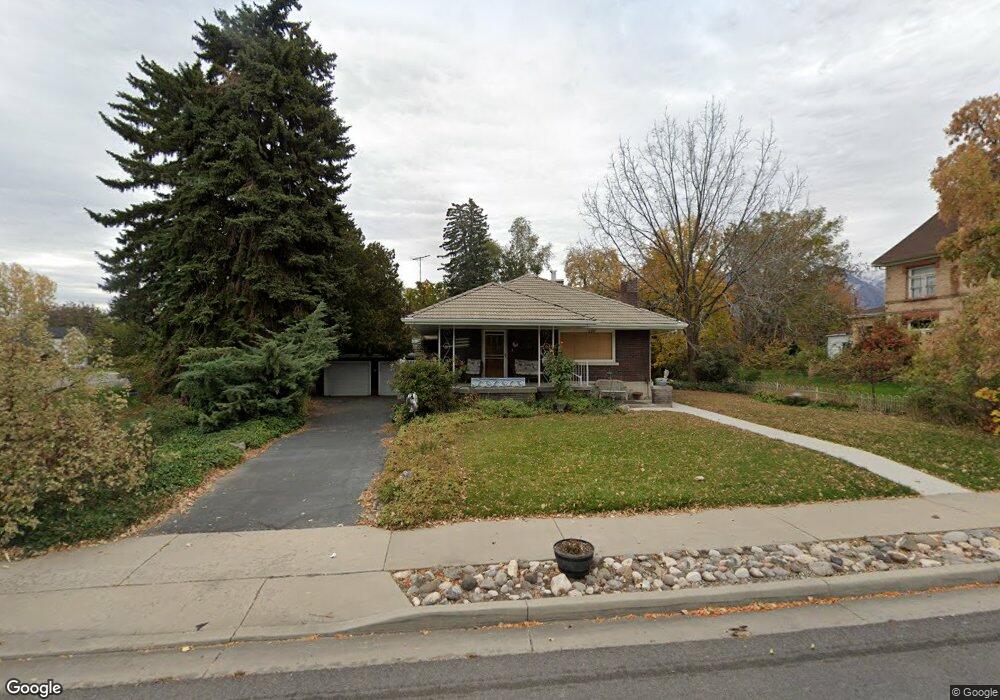
280 N Main St Payson, UT 84651
Estimated Value: $471,000 - $513,947
3
Beds
3
Baths
1,600
Sq Ft
$302/Sq Ft
Est. Value
About This Home
This home is located at 280 N Main St, Payson, UT 84651 and is currently estimated at $483,487, approximately $302 per square foot. 280 N Main St is a home located in Utah County with nearby schools including Barnett Elementary School, Salem Junior High School, and Valley View Middle School.
Ownership History
Date
Name
Owned For
Owner Type
Purchase Details
Closed on
Oct 26, 2018
Sold by
Kirk Caren C
Bought by
Kirk Caren C and The Caren C Kirk Revocable Tru
Current Estimated Value
Purchase Details
Closed on
Feb 21, 2001
Sold by
Henderson Jon L and Henderson Leslie M
Bought by
Double L Properties Llc
Purchase Details
Closed on
Feb 7, 2000
Sold by
Kirk Don L
Bought by
Kirk Don L and Kirk Caren C
Create a Home Valuation Report for This Property
The Home Valuation Report is an in-depth analysis detailing your home's value as well as a comparison with similar homes in the area
Home Values in the Area
Average Home Value in this Area
Purchase History
We collect this data history from publicly available records. To have your information removed, we recommend requesting removal directly through your county’s website.
| Date | Buyer | Sale Price | Title Company |
|---|---|---|---|
| Kirk Caren C | -- | None Available | |
| Double L Properties Llc | -- | -- | |
| Double L Properties Llc | -- | -- | |
| Kirk Don L | -- | -- |
Source: Public Records
Tax History
| Year | Tax Paid | Tax Assessment Tax Assessment Total Assessment is a certain percentage of the fair market value that is determined by local assessors to be the total taxable value of land and additions on the property. | Land | Improvement |
|---|---|---|---|---|
| 2025 | $2,260 | $265,100 | -- | -- |
| 2024 | $2,260 | $230,010 | $0 | $0 |
| 2023 | $2,175 | $221,980 | $0 | $0 |
| 2022 | $2,015 | $202,290 | $0 | $0 |
| 2021 | $1,709 | $275,100 | $100,900 | $174,200 |
| 2020 | $1,583 | $249,300 | $87,700 | $161,600 |
| 2019 | $1,400 | $226,100 | $78,900 | $147,200 |
| 2018 | $1,250 | $194,600 | $66,600 | $128,000 |
| 2017 | $1,146 | $95,920 | $0 | $0 |
| 2016 | $1,089 | $90,530 | $0 | $0 |
| 2015 | $1,067 | $88,110 | $0 | $0 |
| 2014 | $979 | $81,455 | $0 | $0 |
Source: Public Records
Map
Nearby Homes
Your Personal Tour Guide
Ask me questions while you tour the home.