Estimated Value: $206,185 - $229,000
2
Beds
2
Baths
1,722
Sq Ft
$125/Sq Ft
Est. Value
About This Home
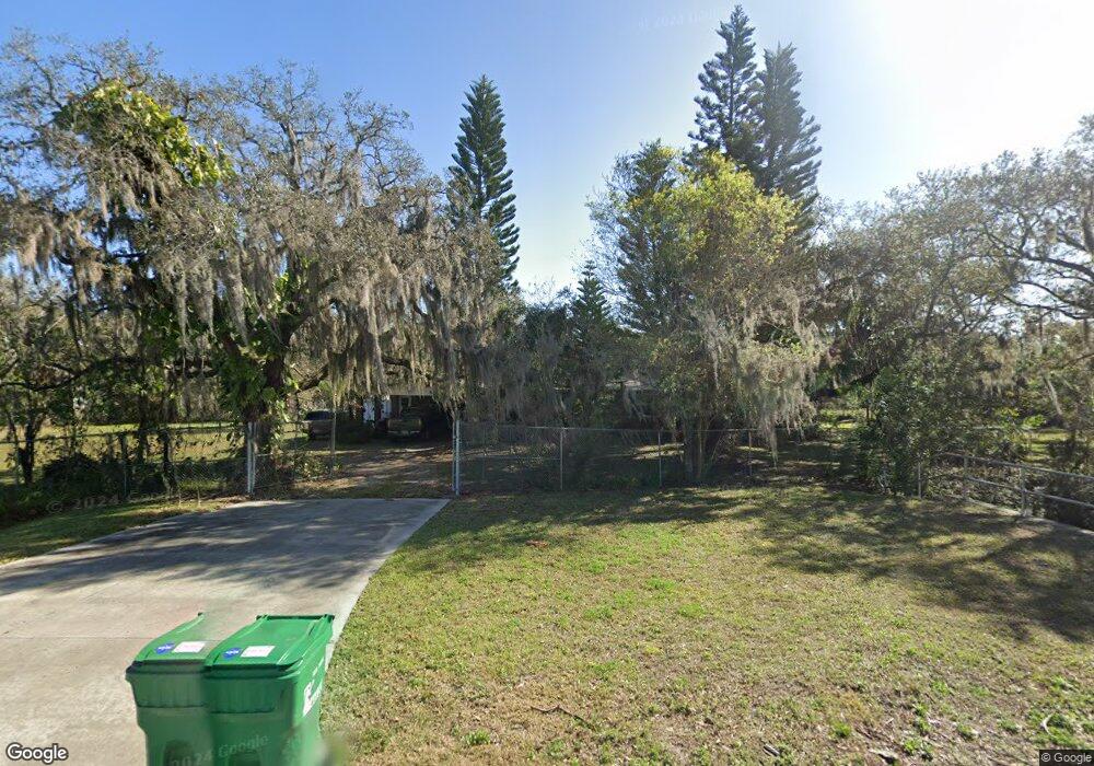
This home is located at 280 N Range Rd, Cocoa, FL 32926 and is currently estimated at $215,046, approximately $124 per square foot. 280 N Range Rd is a home located in Brevard County with nearby schools including Saturn Elementary School, Cocoa High School, and Emma Jewel Charter Academy.
Ownership History
Date
Name
Owned For
Owner Type
Purchase Details
Closed on
Feb 8, 2017
Sold by
Hungerman Grace H and Hungerman Grace H
Bought by
Horton Audree Allen
Current Estimated Value
Purchase Details
Closed on
May 4, 2010
Sold by
Hungerman Grace H
Bought by
Hungerman Grace H and Grace H Hungerman Living Trust
Purchase Details
Closed on
Aug 14, 2009
Sold by
Hungerman Grace H
Bought by
Brevard County Florida
Purchase Details
Closed on
Jan 7, 2008
Sold by
Allawas Evelyn
Bought by
Hungerman Grace H
Create a Home Valuation Report for This Property
The Home Valuation Report is an in-depth analysis detailing your home's value as well as a comparison with similar homes in the area
Home Values in the Area
Average Home Value in this Area
Purchase History
| Date | Buyer | Sale Price | Title Company |
|---|---|---|---|
| Horton Audree Allen | -- | Attorney | |
| Hungerman Grace H | -- | Attorney | |
| Brevard County Florida | -- | None Available | |
| Hungerman Grace H | $125,000 | North American Title Company |
Source: Public Records
Tax History
| Year | Tax Paid | Tax Assessment Tax Assessment Total Assessment is a certain percentage of the fair market value that is determined by local assessors to be the total taxable value of land and additions on the property. | Land | Improvement |
|---|---|---|---|---|
| 2025 | $1,125 | $84,710 | -- | -- |
| 2024 | $1,091 | $82,330 | -- | -- |
| 2023 | $1,091 | $79,940 | $0 | $0 |
| 2022 | $1,012 | $77,620 | $0 | $0 |
| 2021 | $1,000 | $75,360 | $16,070 | $59,290 |
| 2020 | $976 | $76,480 | $0 | $0 |
| 2019 | $912 | $74,770 | $0 | $0 |
| 2018 | $914 | $73,380 | $16,070 | $57,310 |
| 2017 | $1,354 | $63,590 | $16,070 | $47,520 |
| 2016 | $1,331 | $60,920 | $16,070 | $44,850 |
| 2015 | $1,245 | $53,360 | $16,070 | $37,290 |
| 2014 | $1,219 | $51,080 | $16,070 | $35,010 |
Source: Public Records
Map
Nearby Homes
- 2409 Granger Rd
- 695 Lantana St
- 2472 Victor Rd
- 2511 Hathaway Dr
- 2442 Dianne Dr
- 2475 Mercury Dr
- 766 Lunar Lake Cir
- 764 Lunar Lake Cir
- 472 Carley Ln
- 717 Lunar Lake Cir
- 703 Venus Dr
- 408 Stowe Ln
- 1703 Spartan St Unit SRO737
- 1301 N Range Rd
- 1628 Sue Dr Unit B
- 1666 Terrace St
- 1686 Ritzcraft St Unit 326
- 0000 N Range Rd
- 0 State Route 520 Unit MFRV4947135
- 369 Western Ave
- 0 Gray Rd
- 221 Martino Way
- 2495 Lake Dr
- 971 Tupelo Cir
- 2485 Lake Dr
- 0002 N Range Rd
- 0001 N Range Rd
- 0003 N Range Rd
- 2475 Lake Dr
- 0 Lake Dr Unit 528389
- 0 Lake Dr Unit 551209
- 0 Lake Dr Unit 561352
- 0 Lake Dr Unit 568161
- 0 Lake Dr Unit 594426
- 0 Lake Dr Unit 597385
- 0 Lake Dr Unit 633075
- 0 Lake Dr Unit 679595
- 0 Lake Dr Unit 726562
- 0 Lake Dr Unit 772751
- 0 Lake Dr Unit 787992
Your Personal Tour Guide
Ask me questions while you tour the home.