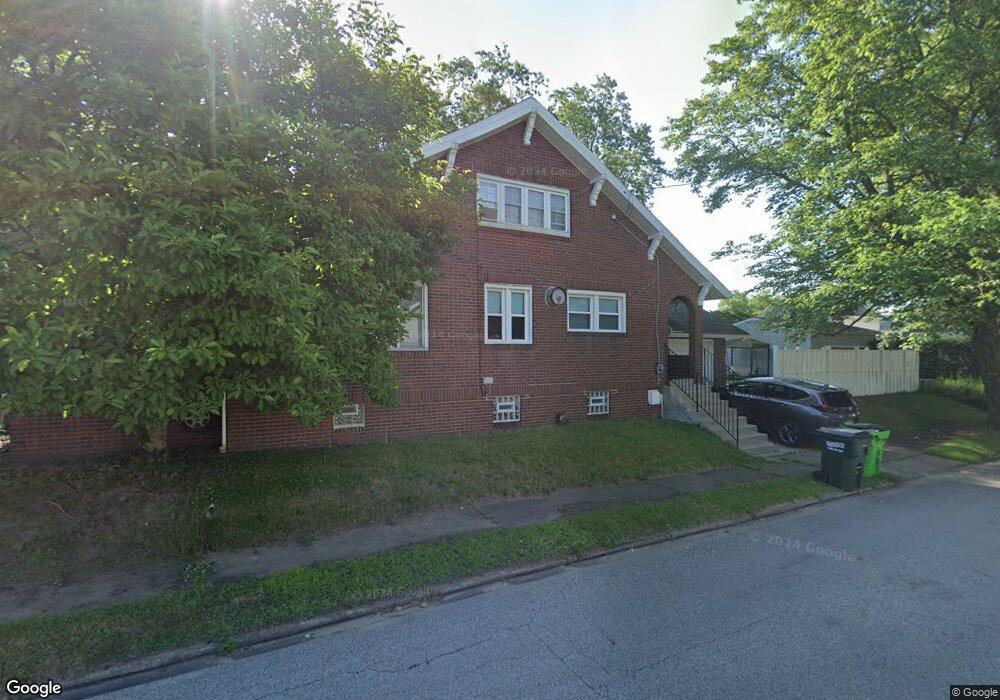
280 Norton Ave Barberton, OH 44203
North Barberton NeighborhoodEstimated Value: $169,000 - $180,000
3
Beds
2
Baths
1,646
Sq Ft
$107/Sq Ft
Est. Value
About This Home
This home is located at 280 Norton Ave, Barberton, OH 44203 and is currently estimated at $176,368, approximately $107 per square foot. 280 Norton Ave is a home located in Summit County with nearby schools including Barberton Middle School, Barberton High School, and St Augustine Elementary School.
Ownership History
Date
Name
Owned For
Owner Type
Purchase Details
Closed on
Apr 2, 2002
Sold by
Metz Mark and Metz Natasia
Bought by
Fullen Brian and Fullen Alissa
Current Estimated Value
Home Financials for this Owner
Home Financials are based on the most recent Mortgage that was taken out on this home.
Original Mortgage
$118,750
Interest Rate
8.75%
Create a Home Valuation Report for This Property
The Home Valuation Report is an in-depth analysis detailing your home's value as well as a comparison with similar homes in the area
Home Values in the Area
Average Home Value in this Area
Purchase History
| Date | Buyer | Sale Price | Title Company |
|---|---|---|---|
| Fullen Brian | $125,000 | Northeast Title Agency Inc | |
| Metz Mark | $94,000 | Northeast Title Agency Inc |
Source: Public Records
Mortgage History
| Date | Status | Borrower | Loan Amount |
|---|---|---|---|
| Closed | Fullen Brian | $118,750 |
Source: Public Records
Tax History Compared to Growth
Tax History
| Year | Tax Paid | Tax Assessment Tax Assessment Total Assessment is a certain percentage of the fair market value that is determined by local assessors to be the total taxable value of land and additions on the property. | Land | Improvement |
|---|---|---|---|---|
| 2025 | $2,285 | $45,725 | $9,223 | $36,502 |
| 2024 | $2,285 | $45,725 | $9,223 | $36,502 |
| 2023 | $2,285 | $45,725 | $9,223 | $36,502 |
| 2022 | $1,607 | $27,878 | $5,621 | $22,257 |
| 2021 | $1,605 | $27,878 | $5,621 | $22,257 |
| 2020 | $1,571 | $27,880 | $5,620 | $22,260 |
| 2019 | $1,638 | $26,330 | $5,340 | $20,990 |
| 2018 | $1,613 | $26,330 | $5,340 | $20,990 |
| 2017 | $1,634 | $26,330 | $5,340 | $20,990 |
| 2016 | $1,637 | $26,330 | $5,340 | $20,990 |
| 2015 | $1,634 | $26,330 | $5,340 | $20,990 |
| 2014 | $1,625 | $26,330 | $5,340 | $20,990 |
| 2013 | $1,573 | $26,420 | $5,340 | $21,080 |
Source: Public Records
Map
Nearby Homes
- 613 Wooster Rd N
- 645 Madison Ave
- 0 Wooster Rd N
- 46 Brown St
- 320 Lincoln Ave Unit 322
- 690 Saint Clair Ave
- 44 W Summit St
- 412 Grandview Ave
- 387 4th St NW
- 103 Mitchell St
- 583 Creedmore Ave
- 30 W Hiram St
- 357 E Paige Ave
- 213 Hermann St
- 610 Creedmore Ave
- 146 Hermann St
- 564 W Hopocan Ave
- 250 Evergreen St
- 818 N Summit St
- 137 Hermann St
- 276 Norton Ave
- 290 Norton Ave
- 281 Ontario St
- 268 Norton Ave
- 277 Ontario St
- 294 Norton Ave
- 482 Erie St
- 271 Ontario St
- 285 Norton Ave
- 478 Erie St
- 298 Norton Ave Unit 298 1/2
- 298 Norton Ave
- 275 Norton Ave
- 267 Ontario St
- 273 Norton Ave Unit 275
- 289 Norton Ave
- 474 Erie St
- 263 Ontario St
- 295 Norton Ave
- 470 Erie St