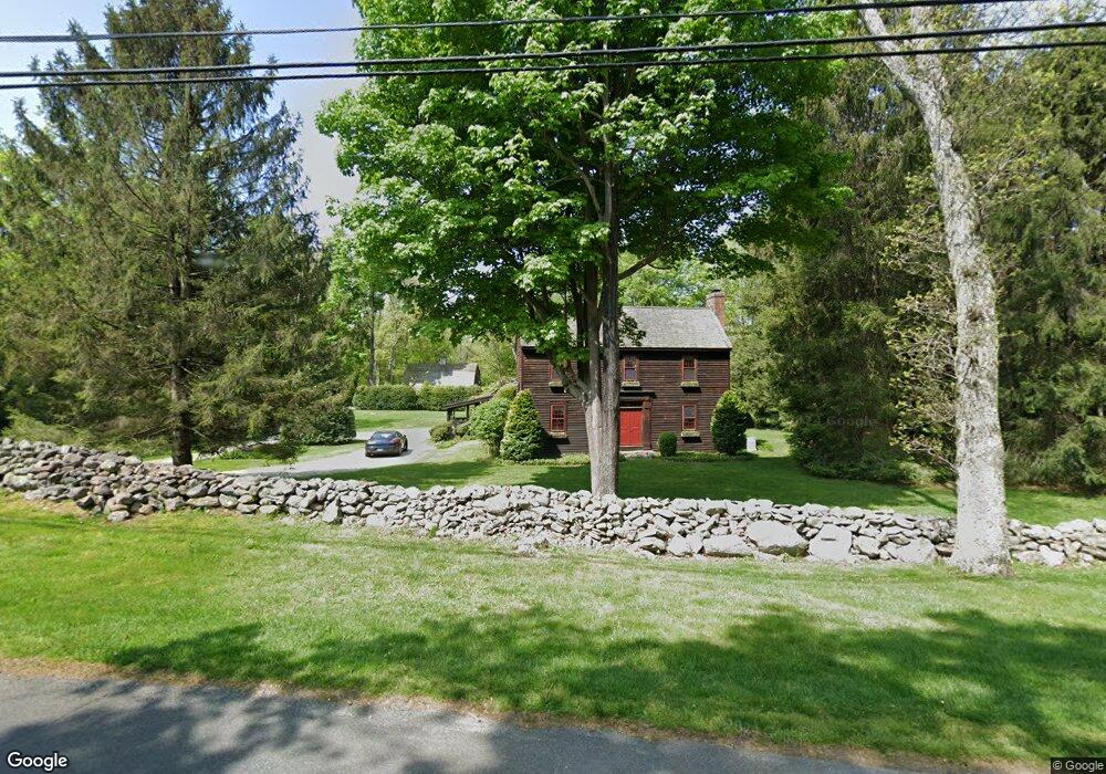
280 Redding Rd Unit REAR Easton, CT 06612
Estimated Value: $811,000 - $1,275,000
2
Beds
2
Baths
1,225
Sq Ft
$874/Sq Ft
Est. Value
About This Home
This home is located at 280 Redding Rd Unit REAR, Easton, CT 06612 and is currently estimated at $1,070,462, approximately $873 per square foot. 280 Redding Rd Unit REAR is a home located in Fairfield County with nearby schools including Samuel Staples Elementary School, Helen Keller Middle School, and Joel Barlow High School.
Ownership History
Date
Name
Owned For
Owner Type
Purchase Details
Closed on
Jul 18, 2024
Sold by
Foley James E
Bought by
James E Foley Ret and Foley
Current Estimated Value
Purchase Details
Closed on
Oct 1, 2021
Sold by
Rassiga-Foley Suzanne
Bought by
Foley James E
Home Financials for this Owner
Home Financials are based on the most recent Mortgage that was taken out on this home.
Original Mortgage
$500,000
Interest Rate
2.8%
Mortgage Type
New Conventional
Purchase Details
Closed on
Jun 8, 2020
Sold by
Foley James E and Foley Suzanne R
Bought by
Foley James E and Foley Suzanne R
Create a Home Valuation Report for This Property
The Home Valuation Report is an in-depth analysis detailing your home's value as well as a comparison with similar homes in the area
Home Values in the Area
Average Home Value in this Area
Purchase History
| Date | Buyer | Sale Price | Title Company |
|---|---|---|---|
| James E Foley Ret | -- | None Available | |
| James E Foley Ret | -- | None Available | |
| James E Foley Ret | -- | None Available | |
| Foley James E | -- | None Available | |
| Foley James E | -- | None Available | |
| Foley James E | -- | None Available | |
| Foley James E | -- | None Available | |
| Foley James E | -- | None Available | |
| Foley James E | -- | None Available |
Source: Public Records
Mortgage History
| Date | Status | Borrower | Loan Amount |
|---|---|---|---|
| Previous Owner | Foley James E | $500,000 |
Source: Public Records
Tax History Compared to Growth
Tax History
| Year | Tax Paid | Tax Assessment Tax Assessment Total Assessment is a certain percentage of the fair market value that is determined by local assessors to be the total taxable value of land and additions on the property. | Land | Improvement |
|---|---|---|---|---|
| 2025 | $19,050 | $614,530 | $262,710 | $351,820 |
| 2024 | $18,153 | $614,530 | $262,710 | $351,820 |
| 2023 | $17,797 | $614,530 | $262,710 | $351,820 |
| 2022 | $17,477 | $614,530 | $262,710 | $351,820 |
| 2021 | $20,896 | $645,950 | $328,310 | $317,640 |
| 2020 | $20,024 | $645,950 | $328,310 | $317,640 |
| 2019 | $20,238 | $645,950 | $328,310 | $317,640 |
| 2018 | $20,270 | $645,950 | $328,310 | $317,640 |
| 2017 | $21,562 | $645,950 | $328,310 | $317,640 |
| 2016 | $22,282 | $723,200 | $415,810 | $307,390 |
| 2015 | $21,971 | $723,200 | $415,810 | $307,390 |
| 2014 | $21,624 | $723,200 | $415,810 | $307,390 |
Source: Public Records
Map
Nearby Homes
- 100 E Common Rd
- 90 Redding Rd
- 111 & 115 Old Easton Turnpike
- 2775 North St
- 85-95 Old Easton Turnpike
- 3 Mayflower Ln
- 76 Burr St
- 102 11 O Clock Rd
- 80 Gilbert Hwy
- 1375 Westport Turnpike
- 0 Old Easton Turnpike
- 64 Old Redding Rd
- 180 Catamount Rd
- 354 Black Rock Turnpike
- 18 Wells Hill Rd
- 158 Coventry Ln
- 18 Cardinal Rd
- 4800 Congress St
- 22 Brett Rd
- 18 Hunt Ln
- 280 Redding Rd
- 270 Redding Rd
- 270 Redding Rd Unit 280
- 11 West Rd
- 285 Redding Rd
- 285 Redding Rd
- 290 Redding (& 4079) Rd Unit LAND
- 290 Redding (& 4079) Rd
- 290 Redding Rd
- 269 Redding Rd
- 257 Redding Rd
- 260 Redding Rd
- 260 Redding Rd
- 260 Redding Rd
- 301 Redding Rd
- 4079 Redding (& 290) Rd
- 35 West Rd
- 30 West Rd
- 4075 Redding Rd
- 210 Mile Common Rd