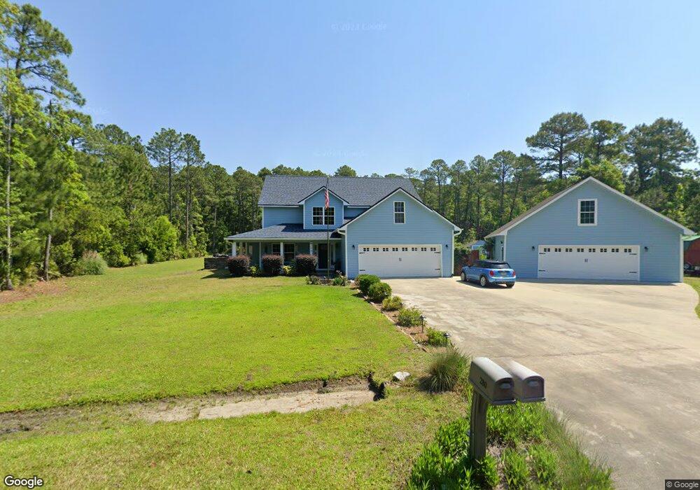
280 Serenity Farms Rd Woodbine, GA 31569
Estimated Value: $461,929 - $609,000
4
Beds
3
Baths
3,454
Sq Ft
$161/Sq Ft
Est. Value
About This Home
This home is located at 280 Serenity Farms Rd, Woodbine, GA 31569 and is currently estimated at $555,482, approximately $160 per square foot. 280 Serenity Farms Rd is a home located in Camden County with nearby schools including Mamie Lou Gross Elementary School, Saint Marys Middle School, and Camden County High School.
Ownership History
Date
Name
Owned For
Owner Type
Purchase Details
Closed on
Oct 31, 2011
Sold by
Federal National Mtg
Bought by
Jones Kevin L
Current Estimated Value
Home Financials for this Owner
Home Financials are based on the most recent Mortgage that was taken out on this home.
Original Mortgage
$233,500
Interest Rate
4.09%
Mortgage Type
VA
Purchase Details
Closed on
Sep 6, 2011
Sold by
Bank Of America
Bought by
Federal National Mtg
Home Financials for this Owner
Home Financials are based on the most recent Mortgage that was taken out on this home.
Original Mortgage
$233,500
Interest Rate
4.09%
Mortgage Type
VA
Purchase Details
Closed on
Jun 29, 2005
Sold by
Mccollough Investments Inc
Bought by
Craig Thomas R
Home Financials for this Owner
Home Financials are based on the most recent Mortgage that was taken out on this home.
Original Mortgage
$244,750
Interest Rate
5.54%
Mortgage Type
New Conventional
Create a Home Valuation Report for This Property
The Home Valuation Report is an in-depth analysis detailing your home's value as well as a comparison with similar homes in the area
Home Values in the Area
Average Home Value in this Area
Purchase History
| Date | Buyer | Sale Price | Title Company |
|---|---|---|---|
| Jones Kevin L | $233,500 | -- | |
| Federal National Mtg | $288,759 | -- | |
| Bank Of America | $288,759 | -- | |
| Craig Thomas R | $40,000 | -- |
Source: Public Records
Mortgage History
| Date | Status | Borrower | Loan Amount |
|---|---|---|---|
| Closed | Bank Of America | $233,500 | |
| Previous Owner | Craig Thomas R | $244,750 |
Source: Public Records
Tax History Compared to Growth
Tax History
| Year | Tax Paid | Tax Assessment Tax Assessment Total Assessment is a certain percentage of the fair market value that is determined by local assessors to be the total taxable value of land and additions on the property. | Land | Improvement |
|---|---|---|---|---|
| 2025 | $219 | $179,509 | $18,360 | $161,149 |
| 2024 | $373 | $162,669 | $14,960 | $147,709 |
| 2023 | $603 | $162,669 | $14,960 | $147,709 |
| 2022 | $3,828 | $157,217 | $14,960 | $142,257 |
| 2021 | $4,047 | $136,390 | $13,600 | $122,790 |
| 2020 | $4,163 | $137,078 | $13,600 | $123,478 |
| 2019 | $4,195 | $137,078 | $13,600 | $123,478 |
| 2018 | $3,770 | $137,078 | $13,600 | $123,478 |
| 2017 | $3,839 | $129,260 | $13,600 | $115,660 |
| 2016 | $3,827 | $129,027 | $13,600 | $115,427 |
| 2015 | $3,708 | $129,027 | $13,600 | $115,427 |
| 2014 | $3,692 | $129,027 | $13,600 | $115,427 |
Source: Public Records
Map
Nearby Homes
- 381 Serenity Farms Rd
- 46 Pintail Ln
- 295 Mallard Pointe Dr
- 321 Mallard Pointe Dr
- 220 Deerwood Village Dr
- VL/45 PINE DRIV Pine Dr
- 273 Village Dr
- 493 Harbor View Dr
- 183 Rainbow Ln
- Simons Bluff Rd
- 88 Rainbow Ln
- 81 Retreat Place
- 0 Simmons Bluff Rd Unit 10371213
- 0 Simmons Bluff Rd Unit 147462
- 0 Sheffield Island Rd Unit 2
- 0 Sheffield Island Rd Unit 1657713
- 0 Sheffield Island Rd Unit 5 10597696
- 0 Sheffield Island Rd Unit 1657408
- 0 Sheffield Island Rd Unit 7
- 0 Sheffield Island Rd Unit 3
- 304 Serenity Farms Rd
- 256 Serenity Farms Rd
- Lot #10 Serenity Farms Rd
- 29 Seabreeze Ct
- 240 Serenity Farms Rd
- V/L 26 Serenity Farms Rd
- 18 Serenity Farms Rd
- 328 Serenity Farms Rd
- 206 Serenity Farms Rd
- 5075 Harrietts Bluff Rd
- 147 Serenity Farms Rd
- 115 Trace Chain Rd
- 5041 Harrietts Bluff Rd
- 97 Serenity Farms Rd
- 515 Serenity Farms Rd
- Lots 16 & 17 Serenity Farms Rd
- 8 Serenity Farms Rd
- 26 Serenity Farms Rd
- 24 Serenity Farms Rd
- 0 Buie Unit LOT 15 2959737