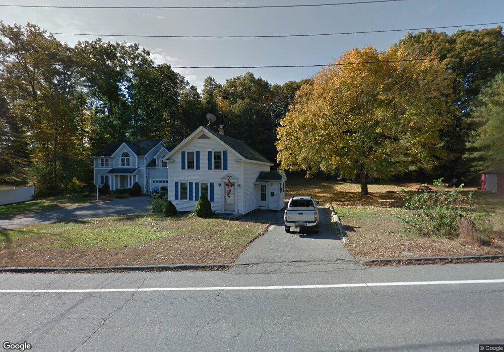
280 Sterling St Clinton, MA 01510
Estimated Value: $354,000 - $417,000
3
Beds
1
Bath
986
Sq Ft
$391/Sq Ft
Est. Value
About This Home
This home is located at 280 Sterling St, Clinton, MA 01510 and is currently estimated at $385,965, approximately $391 per square foot. 280 Sterling St is a home located in Worcester County with nearby schools including Clinton Elementary School, Clinton Senior High School, and Clinton Middle School.
Ownership History
Date
Name
Owned For
Owner Type
Purchase Details
Closed on
Dec 20, 2007
Sold by
Moore Nancy L and Townsend Nancy L
Bought by
Chase Catherine R and Lussier John C
Current Estimated Value
Home Financials for this Owner
Home Financials are based on the most recent Mortgage that was taken out on this home.
Original Mortgage
$200,000
Outstanding Balance
$126,592
Interest Rate
6.3%
Mortgage Type
Purchase Money Mortgage
Estimated Equity
$259,373
Create a Home Valuation Report for This Property
The Home Valuation Report is an in-depth analysis detailing your home's value as well as a comparison with similar homes in the area
Home Values in the Area
Average Home Value in this Area
Purchase History
| Date | Buyer | Sale Price | Title Company |
|---|---|---|---|
| Chase Catherine R | $200,000 | -- |
Source: Public Records
Mortgage History
| Date | Status | Borrower | Loan Amount |
|---|---|---|---|
| Open | Chase Catherine R | $200,000 |
Source: Public Records
Tax History Compared to Growth
Tax History
| Year | Tax Paid | Tax Assessment Tax Assessment Total Assessment is a certain percentage of the fair market value that is determined by local assessors to be the total taxable value of land and additions on the property. | Land | Improvement |
|---|---|---|---|---|
| 2025 | $3,962 | $297,900 | $96,800 | $201,100 |
| 2024 | $3,624 | $275,800 | $96,800 | $179,000 |
| 2023 | $3,391 | $253,600 | $87,900 | $165,700 |
| 2022 | $3,382 | $226,800 | $80,000 | $146,800 |
| 2021 | $3,564 | $192,800 | $76,400 | $116,400 |
| 2020 | $2,986 | $192,800 | $76,400 | $116,400 |
| 2019 | $2,836 | $178,000 | $74,100 | $103,900 |
| 2018 | $3,119 | $183,700 | $83,000 | $100,700 |
| 2017 | $2,617 | $148,100 | $69,700 | $78,400 |
| 2016 | $2,649 | $153,400 | $69,700 | $83,700 |
| 2015 | $2,449 | $147,000 | $68,900 | $78,100 |
| 2014 | $2,374 | $147,000 | $68,900 | $78,100 |
Source: Public Records
Map
Nearby Homes
- 51 Rigby St
- 19 Magnolia Ave
- 22 Forest Ave
- 1 Grady St
- 55 Sterling St Unit 306
- 55 Sterling St Unit 314
- 55 Sterling St Unit 212
- 57 Clark St
- 201-203 Stone St
- 201 Stone St Unit 203
- 23 Ash St
- 54 S Meadow Rd
- 0 Parker Rd
- 459 High St
- 290 Sterling St
- 216 Walnut St
- 89 1/2 Walnut St
- 53 Beach Point Rd
- 13 Simon Ct
- 38 Lane Ave Unit B
- 270 Sterling St
- 287 Sterling St
- 287 Sterling St Unit 1
- 289 Sterling St
- 291 Sterling St
- 306 Sterling St
- 275 Sterling St
- 256 Sterling St
- 265 Sterling St
- 90 Willow St
- 90 Willow St Unit 2
- 82 Willow St
- 82 Willow St Unit 2
- 82 Willow St Unit 1
- 82 Willow St Unit 3
- 66 Willow St
- 78 Willow St
- 316 Sterling St Unit 2
- 316 Sterling St
- 309 Sterling St