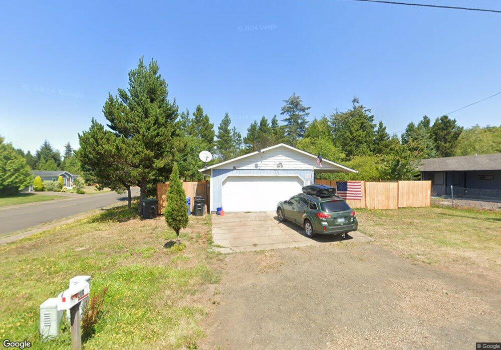
280 SW Range Dr Waldport, OR 97394
Estimated Value: $309,000 - $400,000
3
Beds
2
Baths
1,242
Sq Ft
$289/Sq Ft
Est. Value
About This Home
This home is located at 280 SW Range Dr, Waldport, OR 97394 and is currently estimated at $359,163, approximately $289 per square foot. 280 SW Range Dr is a home located in Lincoln County with nearby schools including Crestview Heights School, Waldport High and Middle School, and Angell JCC.
Ownership History
Date
Name
Owned For
Owner Type
Purchase Details
Closed on
Oct 17, 2024
Sold by
Hermanson John George
Bought by
Pdxf2 Llc
Current Estimated Value
Home Financials for this Owner
Home Financials are based on the most recent Mortgage that was taken out on this home.
Original Mortgage
$170,000
Outstanding Balance
$160,464
Interest Rate
6.35%
Mortgage Type
Seller Take Back
Estimated Equity
$198,699
Purchase Details
Closed on
Jun 27, 2017
Sold by
Hatch Forrest L and Brown Linda M
Bought by
Hermanson John George
Create a Home Valuation Report for This Property
The Home Valuation Report is an in-depth analysis detailing your home's value as well as a comparison with similar homes in the area
Home Values in the Area
Average Home Value in this Area
Purchase History
| Date | Buyer | Sale Price | Title Company |
|---|---|---|---|
| Pdxf2 Llc | $200,000 | Frontier Title & Escrow | |
| Hermanson John George | $170,000 | Western Title & Escrow |
Source: Public Records
Mortgage History
| Date | Status | Borrower | Loan Amount |
|---|---|---|---|
| Open | Pdxf2 Llc | $170,000 |
Source: Public Records
Tax History Compared to Growth
Tax History
| Year | Tax Paid | Tax Assessment Tax Assessment Total Assessment is a certain percentage of the fair market value that is determined by local assessors to be the total taxable value of land and additions on the property. | Land | Improvement |
|---|---|---|---|---|
| 2025 | $3,164 | $185,170 | -- | -- |
| 2024 | $2,995 | $179,780 | -- | -- |
| 2023 | $2,908 | $174,550 | $0 | $0 |
| 2022 | $2,808 | $169,470 | $0 | $0 |
| 2021 | $2,738 | $164,540 | $0 | $0 |
| 2020 | $2,684 | $159,750 | $0 | $0 |
| 2019 | $2,582 | $155,100 | $0 | $0 |
| 2018 | $2,534 | $150,590 | $0 | $0 |
| 2017 | $2,453 | $146,210 | $0 | $0 |
| 2016 | $2,389 | $141,960 | $0 | $0 |
| 2015 | $1,988 | $137,830 | $0 | $0 |
| 2014 | $1,982 | $137,310 | $0 | $0 |
| 2013 | -- | $132,400 | $0 | $0 |
Source: Public Records
Map
Nearby Homes
- 125 SW Range Dr Unit 2
- 415 SW Range Dr
- 1410 SW Forest Pkwy
- 1345 SW Fairway Dr
- 1420 SW Fairway Dr
- 1445 S Crestline Dr
- 1590 SW Fairway Dr
- TL 10200 SW Chad Dr
- 165 SE Rose St
- 760 SW Range Dr
- 2220 SW Green Ln
- 700 Blk SW Kelsie Ln
- 925 SW Dolores Dr
- TL 300 SW Dolores Dr
- 1200 Blk Sw Norwood Drive Tl0120
- 1200 Blk Norwood Dr Tl012
- 2520 S Crestline Dr
- 845 SE Ball Blvd
- 125 SW View Dr
- 745 SE Bird Ave
- 260 SW Range Dr
- 320 SW Range Dr
- 240 SW Range Dr
- 1540 SW Masters Dr
- 295 SW Range Dr
- xxx SW Masters Dr
- 285 SW Range Dr
- 340 SW Range Dr
- 275 SW Range Dr
- 305 SW Range Dr
- 220 SW Range Dr
- 255 SW Range Dr
- 265 SW Range Dr
- 345 Double Eagle
- 345 SW Double Eagle Dr
- 335 SW Range Dr
- 360 SW Range Dr
- 365 SW Double Eagle Dr
- 355 SW Range Dr
- 125 SW Range Dr Unit 4