S
Seller's Agent in 2025
Scott Koop
Greenridge Realty (EGR)
(616) 450-5161
3 in this area
92 Total Sales
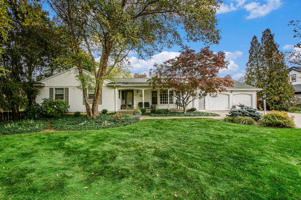


Peaceful, gracious and inviting best describe this home in the popular Michigan Oaks neighborhood. With 4 bedrooms, 3.5 baths, an over sized rec room in the walkout, an abundance of closet space, and a large mudroom that is plumbed to provide a main floor laundry. Generously sized gathering areas include a living room and open concept family room and dining area which flows into the remodeled kitchen; perfect for entertaining! The quiet non through street and beautifully landscaped nearly 1/2 acre yard with expansive patio and pergola are ideal for outdoor gatherings. A new furnace and A/C provide peace of mind. Quality 1950's construction: 6 panel doors, slate entry, 3 masonry fireplace hearths, all within 5 minutes of downtown! NOTE: Seller reserves the right to set an offer deadline.
Last Agent to Sell the Property
Greenridge Realty (EGR) License #6501210051 Listed on: 11/13/2025
| Date | Type | Sale Price | Title Company |
|---|---|---|---|
| Warranty Deed | -- | None Listed On Document | |
| Warranty Deed | $182,500 | -- |
| Date | Event | Price | List to Sale | Price per Sq Ft |
|---|---|---|---|---|
| 12/11/2025 12/11/25 | Sold | $600,000 | +4.3% | $198 / Sq Ft |
| 11/17/2025 11/17/25 | Pending | -- | -- | -- |
| 11/13/2025 11/13/25 | For Sale | $575,000 | -- | $190 / Sq Ft |
| Year | Tax Paid | Tax Assessment Tax Assessment Total Assessment is a certain percentage of the fair market value that is determined by local assessors to be the total taxable value of land and additions on the property. | Land | Improvement |
|---|---|---|---|---|
| 2025 | $3,697 | $256,700 | $0 | $0 |
| 2024 | $3,697 | $226,200 | $0 | $0 |
| 2023 | $3,751 | $202,300 | $0 | $0 |
| 2022 | $3,561 | $192,300 | $0 | $0 |
| 2021 | $3,482 | $171,500 | $0 | $0 |
| 2020 | $3,358 | $152,700 | $0 | $0 |
| 2019 | $3,513 | $147,800 | $0 | $0 |
| 2018 | $3,394 | $139,800 | $0 | $0 |
| 2017 | $3,304 | $120,600 | $0 | $0 |
| 2016 | $3,344 | $106,600 | $0 | $0 |
| 2015 | $3,109 | $106,600 | $0 | $0 |
| 2013 | -- | $93,400 | $0 | $0 |
S
Seller's Agent in 2025
Scott Koop
Greenridge Realty (EGR)
(616) 450-5161
3 in this area
92 Total Sales
R
Buyer's Agent in 2025
Rebecca Dickenson
RE/MAX Michigan
(616) 801-3790
2 in this area
88 Total Sales

Buyer Co-Listing Agent in 2025
Cheryl Grant
RE/MAX Michigan
(616) 822-3206
4 in this area
172 Total Sales
Source: MichRIC
MLS Number: 25058076
APN: 41-14-28-230-017
Disclaimer: Certain information contained herein is derived from information provided by parties other than Homes.com. All information provided is deemed reliable, but is not guaranteed to be accurate and should be independently verified.
![]() Information is deemed reliable but not guaranteed.
Information is deemed reliable but not guaranteed.
Copyright 2025 MichRIC, LLC. All rights reserved.