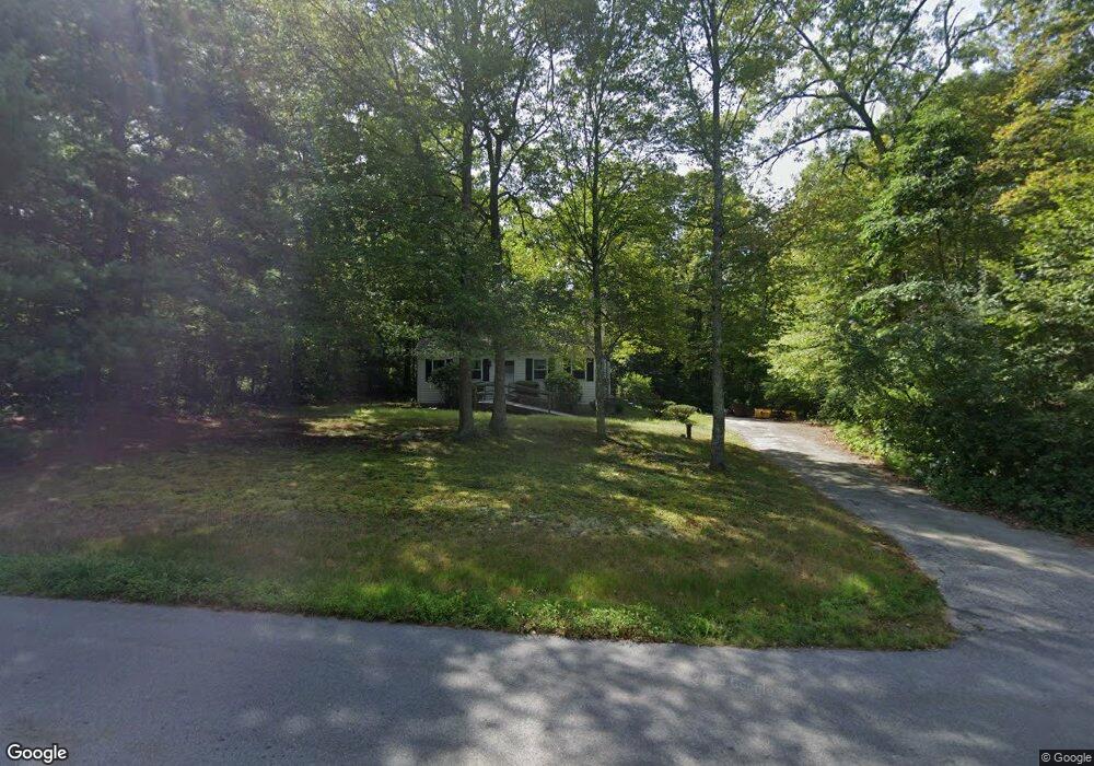
2800 Anderson Dr Dighton, MA 02715
Estimated Value: $545,000 - $625,000
4
Beds
3
Baths
1,974
Sq Ft
$292/Sq Ft
Est. Value
About This Home
This home is located at 2800 Anderson Dr, Dighton, MA 02715 and is currently estimated at $575,631, approximately $291 per square foot. 2800 Anderson Dr is a home located in Bristol County with nearby schools including Dighton-Rehoboth Regional High School, SCEC Life Academy, and Swansea Wood School.
Ownership History
Date
Name
Owned For
Owner Type
Purchase Details
Closed on
Apr 20, 1977
Bought by
Morin Norman E and Morin Carolyn
Current Estimated Value
Create a Home Valuation Report for This Property
The Home Valuation Report is an in-depth analysis detailing your home's value as well as a comparison with similar homes in the area
Home Values in the Area
Average Home Value in this Area
Purchase History
| Date | Buyer | Sale Price | Title Company |
|---|---|---|---|
| Morin Norman E | $41,000 | -- |
Source: Public Records
Mortgage History
| Date | Status | Borrower | Loan Amount |
|---|---|---|---|
| Open | Morin Norman E | $10,122 | |
| Open | Morin Norman E | $60,000 |
Source: Public Records
Tax History Compared to Growth
Tax History
| Year | Tax Paid | Tax Assessment Tax Assessment Total Assessment is a certain percentage of the fair market value that is determined by local assessors to be the total taxable value of land and additions on the property. | Land | Improvement |
|---|---|---|---|---|
| 2025 | $5,201 | $414,100 | $133,700 | $280,400 |
| 2024 | $5,177 | $378,400 | $133,700 | $244,700 |
| 2023 | $4,924 | $353,200 | $133,700 | $219,500 |
| 2022 | $4,734 | $331,300 | $130,200 | $201,100 |
| 2021 | $4,773 | $302,100 | $117,600 | $184,500 |
| 2020 | $4,518 | $301,600 | $131,600 | $170,000 |
| 2019 | $4,383 | $292,400 | $131,600 | $160,800 |
| 2018 | $4,031 | $271,100 | $111,500 | $159,600 |
| 2017 | $3,896 | $260,800 | $129,800 | $131,000 |
| 2016 | $3,908 | $256,600 | $133,700 | $122,900 |
| 2015 | $3,844 | $259,700 | $137,600 | $122,100 |
| 2014 | $3,844 | $252,400 | $137,600 | $114,800 |
Source: Public Records
Map
Nearby Homes
- 3075 Club House Dr
- 3064 Clubhouse Dr
- 3055 Clubhouse Dr Unit 80
- 3051 Clubhouse Dr Unit 78
- 3049 Clubhouse Dr Unit 77
- 3035 Clubhouse Dr
- 3035 Clubhouse Dr Unit 8
- 3035 Clubhouse Dr Unit 7
- 3035 Clubhouse Dr Unit 6
- 3035 Clubhouse Dr Unit 5
- 3035 Clubhouse Dr Unit 4
- 3035 Clubhouse Dr Unit 3
- 3035 Clubhouse Dr Unit 2
- 3035 Clubhouse Dr Unit 1
- 3057 Clubhouse Dr
- 32 Clubhouse Dr Unit RR32
- R61 Clubhouse Dr Unit R61
- 48 Laurie Ln
- 2535 Williams St
- 172 High Hill Rd
- 2922 Anderson Dr
- 2933 Anderson Dr
- 2955 Anderson Dr
- 2944 Anderson Dr
- 2977 Anderson Dr
- 2966 Anderson Dr
- 2877 Anderson Dr
- 2766 Anderson Dr
- 2999 Anderson Dr
- 2988 Anderson Dr
- 3339 Sharps Lot Rd
- 2700 Anderson Dr
- 2855 Anderson Dr
- 3349 Sharps Lot Rd
- 2633 Anderson Dr
- 3033 Anderson Dr
- 3000 Anderson Dr
- 2600 Anderson Dr
- Lot 1 Miranda Dr
- 3147 Sharps Lot Rd