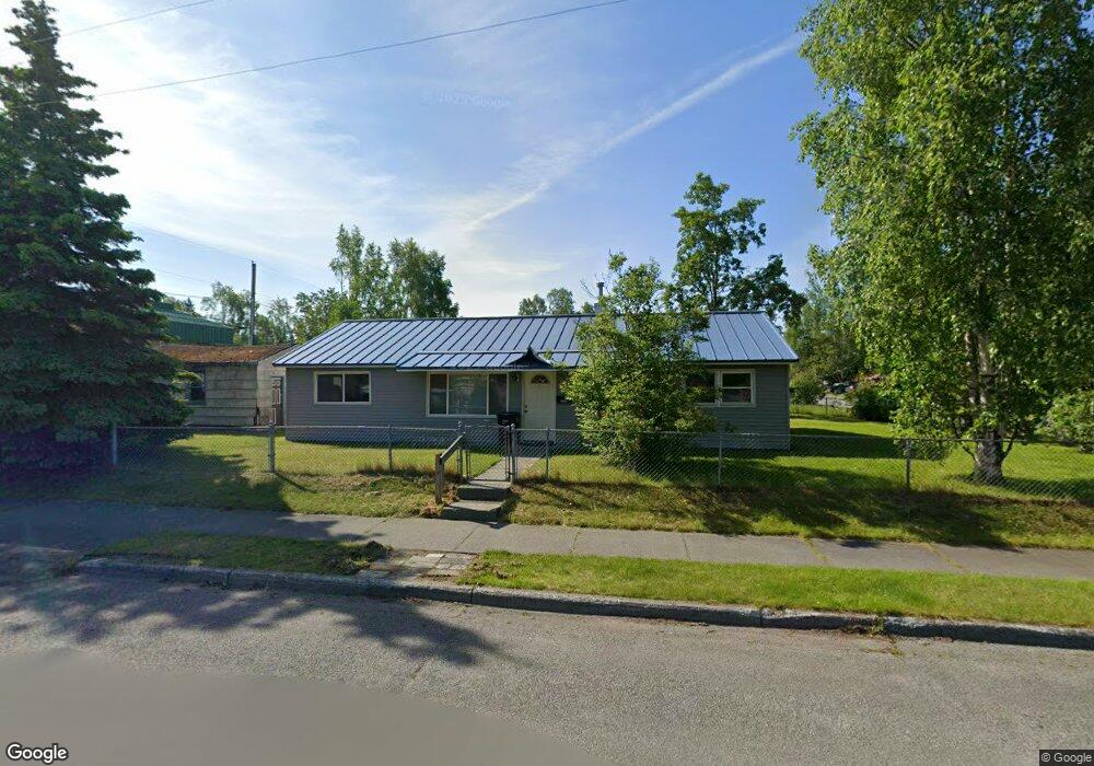
2800 E 18th Ave Anchorage, AK 99508
Airport Heights NeighborhoodEstimated Value: $174,000 - $377,000
4
Beds
1
Bath
1,152
Sq Ft
$241/Sq Ft
Est. Value
About This Home
This home is located at 2800 E 18th Ave, Anchorage, AK 99508 and is currently estimated at $277,868, approximately $241 per square foot. 2800 E 18th Ave is a home located in Anchorage Municipality with nearby schools including Airport Heights Elementary School, Wendler Middle School, and Bettye Davis East Anchorage High School.
Ownership History
Date
Name
Owned For
Owner Type
Purchase Details
Closed on
Oct 24, 2022
Sold by
Sanborn Rodney M and Sanborn Rod M
Bought by
Northern Ventures Trust
Current Estimated Value
Purchase Details
Closed on
Jan 24, 2019
Sold by
Lottie Michael
Bought by
Sanborn Rod M
Purchase Details
Closed on
Jan 22, 2019
Sold by
Sanborn Rod M
Bought by
Lottie Michael
Purchase Details
Closed on
Oct 22, 2007
Sold by
Pearce Amy
Bought by
Sanborn Rod M
Home Financials for this Owner
Home Financials are based on the most recent Mortgage that was taken out on this home.
Original Mortgage
$193,500
Interest Rate
6.42%
Mortgage Type
Purchase Money Mortgage
Create a Home Valuation Report for This Property
The Home Valuation Report is an in-depth analysis detailing your home's value as well as a comparison with similar homes in the area
Home Values in the Area
Average Home Value in this Area
Purchase History
| Date | Buyer | Sale Price | Title Company |
|---|---|---|---|
| Northern Ventures Trust | -- | None Listed On Document | |
| Sanborn Rod M | -- | Accommodation | |
| Lottie Michael | -- | None Available | |
| Sanborn Rod M | -- | Pnt |
Source: Public Records
Mortgage History
| Date | Status | Borrower | Loan Amount |
|---|---|---|---|
| Previous Owner | Sanborn Rod M | $193,500 |
Source: Public Records
Tax History
| Year | Tax Paid | Tax Assessment Tax Assessment Total Assessment is a certain percentage of the fair market value that is determined by local assessors to be the total taxable value of land and additions on the property. | Land | Improvement |
|---|---|---|---|---|
| 2025 | $5,082 | $332,300 | $106,600 | $225,700 |
| 2024 | $5,082 | $314,800 | $106,600 | $208,200 |
| 2023 | $4,877 | $286,400 | $106,600 | $179,800 |
| 2022 | $4,847 | $287,800 | $106,600 | $181,200 |
| 2021 | $4,660 | $258,600 | $106,600 | $152,000 |
| 2020 | $4,457 | $262,200 | $106,600 | $155,600 |
| 2019 | $4,213 | $257,500 | $106,600 | $150,900 |
| 2018 | $4,239 | $258,500 | $106,600 | $151,900 |
| 2017 | $4,089 | $261,100 | $106,600 | $154,500 |
| 2016 | $3,441 | $244,600 | $89,600 | $155,000 |
| 2015 | $3,441 | $239,600 | $89,600 | $150,000 |
| 2014 | $3,441 | $233,900 | $82,500 | $151,400 |
Source: Public Records
Map
Nearby Homes
- 1703 Alder Dr
- 1701 Aleutian St
- 3215 E 18th Cir
- 1414 Airport Heights Dr
- 1524 Rosemary St
- 000 Tr A Thurston
- 1760 Eastridge Dr
- 3401 E 15th Ave
- 1536 Valarian St
- 2007 Parkview Cir
- 1655 Sitka St Unit 103
- 1913 Parkview Cir
- 3714 E 17th Ave
- 2601 Darby Cir
- 2124 Sorbus Way
- 3964 Reka Dr Unit D3
- 4010 Reka Dr Unit F6
- 1715 Katrina Cir
- 1421 E 17th Ave Unit 3
- 1403 Nelchina St
- 1815 Alder Dr
- 2824 E 18th Ave
- 2801 E 18th Ave
- 1825 Alder Dr
- 1800 Alder Dr
- 1812 Alder Dr
- 1746 Alder Dr
- 2825 E 18th Ave
- 1820 Alder Dr
- 1715 Alder Dr
- 1837 Alder Dr
- 1736 Alder Dr
- 1830 Alder Dr
- 1714 Birchwood St
- 1840 Alder Dr
- 2762 E 17th Ave
- 1822 Sunrise Dr
- 1811 Kuskokwim St
- 1834 Sunrise Dr
- 2900 E 18th Ave