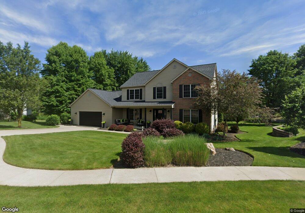
2800 Emily Cir NW Massillon, OH 44647
East Brookfield NeighborhoodEstimated Value: $323,000 - $446,000
4
Beds
3
Baths
2,710
Sq Ft
$146/Sq Ft
Est. Value
About This Home
This home is located at 2800 Emily Cir NW, Massillon, OH 44647 and is currently estimated at $397,011, approximately $146 per square foot. 2800 Emily Cir NW is a home located in Stark County with nearby schools including Massillon Intermediate School, Massillon Junior High School, and Washington High School.
Ownership History
Date
Name
Owned For
Owner Type
Purchase Details
Closed on
Sep 6, 2001
Sold by
D W P Inc
Bought by
Pedro Vincent E and Pedro Lorie S
Current Estimated Value
Home Financials for this Owner
Home Financials are based on the most recent Mortgage that was taken out on this home.
Original Mortgage
$186,960
Outstanding Balance
$70,299
Interest Rate
6.5%
Mortgage Type
Construction
Estimated Equity
$326,712
Create a Home Valuation Report for This Property
The Home Valuation Report is an in-depth analysis detailing your home's value as well as a comparison with similar homes in the area
Home Values in the Area
Average Home Value in this Area
Purchase History
| Date | Buyer | Sale Price | Title Company |
|---|---|---|---|
| Pedro Vincent E | $34,900 | -- |
Source: Public Records
Mortgage History
| Date | Status | Borrower | Loan Amount |
|---|---|---|---|
| Open | Pedro Vincent E | $186,960 |
Source: Public Records
Tax History Compared to Growth
Tax History
| Year | Tax Paid | Tax Assessment Tax Assessment Total Assessment is a certain percentage of the fair market value that is determined by local assessors to be the total taxable value of land and additions on the property. | Land | Improvement |
|---|---|---|---|---|
| 2025 | -- | $142,210 | $32,060 | $110,150 |
| 2024 | -- | $142,210 | $32,060 | $110,150 |
| 2023 | $5,293 | $103,540 | $26,430 | $77,110 |
| 2022 | $5,294 | $103,540 | $26,430 | $77,110 |
| 2021 | $5,380 | $103,540 | $26,430 | $77,110 |
| 2020 | $4,667 | $84,530 | $21,670 | $62,860 |
| 2019 | $4,600 | $84,530 | $21,670 | $62,860 |
| 2018 | $4,573 | $84,530 | $21,670 | $62,860 |
| 2017 | $4,500 | $77,700 | $18,760 | $58,940 |
| 2016 | $4,549 | $77,250 | $18,760 | $58,490 |
| 2015 | $4,493 | $77,250 | $18,760 | $58,490 |
| 2014 | $492 | $74,660 | $18,130 | $56,530 |
| 2013 | $2,253 | $74,660 | $18,130 | $56,530 |
Source: Public Records
Map
Nearby Homes
- 2527 Lincoln Way NW
- 350 Noble Place NW
- 2790 Lee Ave NW
- 2760 Relda Cir SW
- 3130 Lincoln Way W
- 822 32nd St NW
- 3069 Castle West Cir NW
- 728 Hillside Place SW
- 1835 Main Ave W
- 1735 Woodruff Ave NW
- 1725 Auburn Ave NW
- 429 18th St NW
- 540 Carver St NW
- 309 15th St NW
- 1605 Tremont Ave SW
- 104 16th St SW
- 830 Standish Cir NW
- 315 14th St SW
- 1301 Lincoln Way NW
- 121 13th St SW
- 2810 Emily Cir NW
- 440 Joshua St NW
- 425 Joshua St NW
- 2820 Emily Cir NW
- 430 Joshua St NW
- 2811 Emily Cir NW
- 420 Joshua St NW
- 2735 Duane Ave NW
- 2800 Turning Leaf Ave NW
- 2810 Turning Leaf Ave NW
- 410 Joshua St NW
- 368 Ford St NW
- 2820 Turning Leaf Ave NW
- 389 Ford St NW
- 2830 Turning Leaf Ave NW
- 400 Joshua St NW
- 2719 Duane Ave NW
- 376 Ford St NW
- 327 27th St NW
- 395 Ford St NW