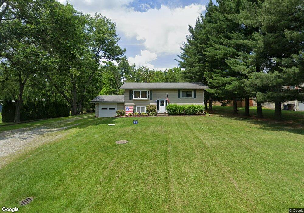
2801 Lyman Dr Clinton, OH 44216
Estimated Value: $234,891 - $275,000
4
Beds
2
Baths
1,660
Sq Ft
$149/Sq Ft
Est. Value
About This Home
This home is located at 2801 Lyman Dr, Clinton, OH 44216 and is currently estimated at $246,973, approximately $148 per square foot. 2801 Lyman Dr is a home located in Summit County with nearby schools including Norton Primary Elementary School, Norton Middle School, and Norton High School.
Ownership History
Date
Name
Owned For
Owner Type
Purchase Details
Closed on
Mar 31, 2022
Sold by
Collins Bradford T
Bought by
Collins Bradford T and Mitchell Lynda M
Current Estimated Value
Purchase Details
Closed on
Mar 1, 2022
Sold by
Collins Bradford T
Bought by
Collins Bradford T and Mitchell Lynda M
Purchase Details
Closed on
Mar 2, 2011
Sold by
Lenihan Nancy J and Lenihan Timothy M
Bought by
Collins Bradford T
Home Financials for this Owner
Home Financials are based on the most recent Mortgage that was taken out on this home.
Original Mortgage
$115,983
Interest Rate
4.75%
Mortgage Type
FHA
Purchase Details
Closed on
Oct 29, 2008
Sold by
Estate Of Donald L Wood Jr
Bought by
Wood Nancy J
Create a Home Valuation Report for This Property
The Home Valuation Report is an in-depth analysis detailing your home's value as well as a comparison with similar homes in the area
Home Values in the Area
Average Home Value in this Area
Purchase History
| Date | Buyer | Sale Price | Title Company |
|---|---|---|---|
| Collins Bradford T | -- | None Listed On Document | |
| Collins Bradford T | -- | None Listed On Document | |
| Collins Bradford T | $119,000 | Landamerica | |
| Wood Nancy J | -- | None Available |
Source: Public Records
Mortgage History
| Date | Status | Borrower | Loan Amount |
|---|---|---|---|
| Previous Owner | Collins Bradford T | $115,983 |
Source: Public Records
Tax History Compared to Growth
Tax History
| Year | Tax Paid | Tax Assessment Tax Assessment Total Assessment is a certain percentage of the fair market value that is determined by local assessors to be the total taxable value of land and additions on the property. | Land | Improvement |
|---|---|---|---|---|
| 2025 | $2,253 | $56,347 | $12,653 | $43,694 |
| 2024 | $2,253 | $56,347 | $12,653 | $43,694 |
| 2023 | $2,253 | $56,347 | $12,653 | $43,694 |
| 2022 | $2,086 | $42,371 | $9,373 | $32,998 |
| 2021 | $2,093 | $42,371 | $9,373 | $32,998 |
| 2020 | $2,053 | $42,370 | $9,370 | $33,000 |
| 2019 | $2,415 | $44,980 | $8,900 | $36,080 |
| 2018 | $2,374 | $44,980 | $8,900 | $36,080 |
| 2017 | $2,243 | $44,980 | $8,900 | $36,080 |
| 2016 | $2,218 | $38,220 | $8,900 | $29,320 |
| 2015 | $2,243 | $38,220 | $8,900 | $29,320 |
| 2014 | $2,224 | $38,220 | $8,900 | $29,320 |
| 2013 | $2,048 | $35,500 | $8,900 | $26,600 |
Source: Public Records
Map
Nearby Homes
- 2536 Emmons Dr
- 5239 Monroe Square E
- V/L Monroe Square
- V/L Bishop Oval
- 0 Grill Rd
- 3241 Grill Rd
- 455 S Van Buren Ave
- 1081 Stratford St
- 000 Haynes Ave
- 1216 Stratford St
- 1099 Prospect St
- 1232 Stratford St
- 1125 Prospect St
- 1480 Maple St
- 1144 Benton St
- 1413 Ries St
- 1212 Benton St
- 1240 Benton St
- 1361 Prospect St
- 132 31st St SW
- 2791 Lyman Dr
- 5561 Fairland Rd
- 2781 Lyman Dr
- 5571 Fairland Rd
- 2800 Lyman Dr
- 2771 Lyman Dr
- 2806 Vanderhoof Rd
- 5543 Fairland Rd
- 2816 Vanderhoof Rd
- 2790 Lyman Dr
- 2776 Vanderhoof Rd
- 2774 Lyman Dr
- 5597 Fairland Rd
- 2761 Lyman Dr
- 2820 Vanderhoof Rd
- 2762 Lyman Dr
- 2764 Vanderhoof Rd
- 5560 Fairland Rd
- 5607 Fairland Rd
- 2751 Lyman Dr