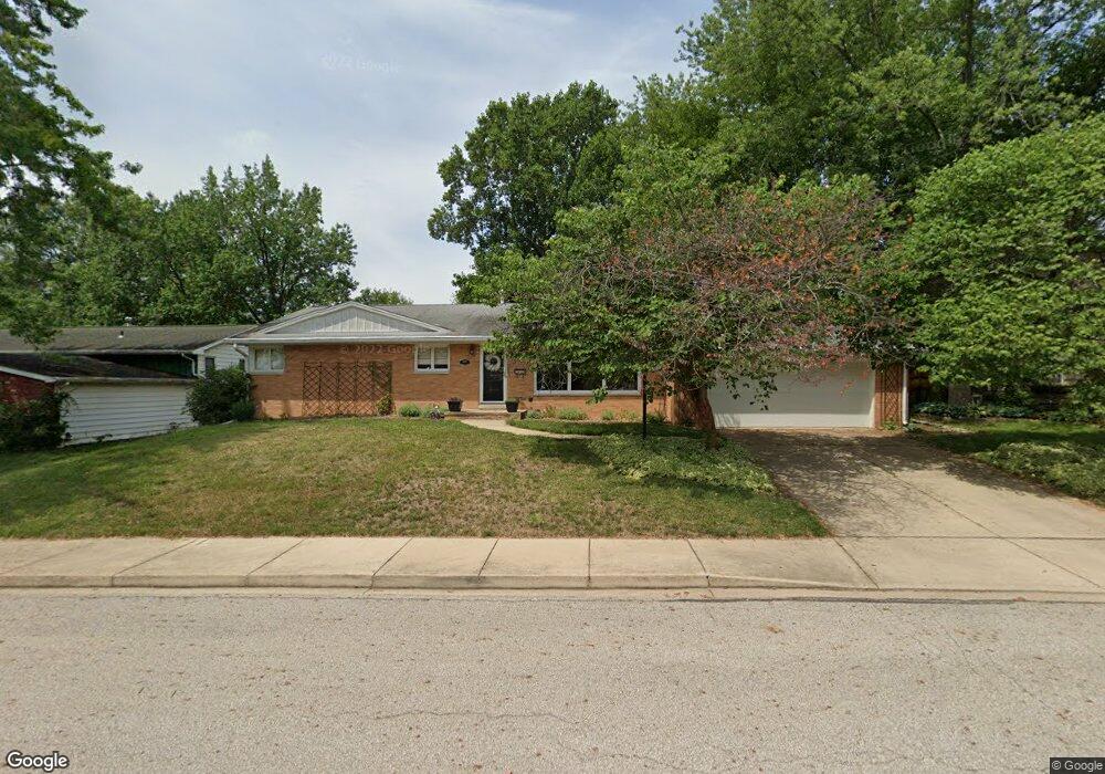
2801 N Elmcroft Dr Peoria, IL 61604
Wardcliffe NeighborhoodEstimated Value: $193,000 - $212,000
2
Beds
2
Baths
1,932
Sq Ft
$103/Sq Ft
Est. Value
About This Home
This home is located at 2801 N Elmcroft Dr, Peoria, IL 61604 and is currently estimated at $198,144, approximately $102 per square foot. 2801 N Elmcroft Dr is a home located in Peoria County with nearby schools including Dr Maude A Sanders Primary School, Sterling Middle School, and Peoria High School.
Ownership History
Date
Name
Owned For
Owner Type
Purchase Details
Closed on
Jun 12, 2015
Sold by
Logue Janet K
Bought by
Foster Gregory T and Foster Elizabeth K
Current Estimated Value
Home Financials for this Owner
Home Financials are based on the most recent Mortgage that was taken out on this home.
Original Mortgage
$108,000
Outstanding Balance
$85,114
Interest Rate
4.25%
Mortgage Type
New Conventional
Estimated Equity
$113,030
Create a Home Valuation Report for This Property
The Home Valuation Report is an in-depth analysis detailing your home's value as well as a comparison with similar homes in the area
Home Values in the Area
Average Home Value in this Area
Purchase History
| Date | Buyer | Sale Price | Title Company |
|---|---|---|---|
| Foster Gregory T | $135,000 | Attorney Only |
Source: Public Records
Mortgage History
| Date | Status | Borrower | Loan Amount |
|---|---|---|---|
| Open | Foster Gregory T | $108,000 |
Source: Public Records
Tax History Compared to Growth
Tax History
| Year | Tax Paid | Tax Assessment Tax Assessment Total Assessment is a certain percentage of the fair market value that is determined by local assessors to be the total taxable value of land and additions on the property. | Land | Improvement |
|---|---|---|---|---|
| 2024 | $4,655 | $57,460 | $8,440 | $49,020 |
| 2023 | $4,395 | $52,710 | $7,740 | $44,970 |
| 2022 | $4,158 | $49,110 | $7,470 | $41,640 |
| 2021 | $4,053 | $46,770 | $7,110 | $39,660 |
| 2020 | $4,039 | $46,310 | $7,040 | $39,270 |
| 2019 | $4,109 | $47,250 | $7,180 | $40,070 |
| 2018 | $4,062 | $47,710 | $7,250 | $40,460 |
| 2017 | $4,067 | $48,190 | $7,320 | $40,870 |
| 2016 | $4,517 | $48,190 | $7,320 | $40,870 |
| 2015 | $4,328 | $47,250 | $7,180 | $40,070 |
| 2014 | $4,329 | $47,020 | $7,210 | $39,810 |
| 2013 | -- | $47,590 | $7,300 | $40,290 |
Source: Public Records
Map
Nearby Homes
- 2905 W Kingston Ct
- 2635 N Kingston Dr
- 3018 W Wardcliffe Dr
- 2602 N Woodhaven Dr
- 2523 N Rockwood Dr
- 2315 W Hudson St
- 3423 N El Vista Ave
- 2029 W Forrest Hill Ave
- 1908 N Idaho St
- 2021 W Newman Pkwy
- 3623 N Sterling Ave Unit b-17
- 2829 N Harper Terrace
- 3444 N Gale Ave
- 3220 N Gale Ave
- 3129 N Finnell Ave
- 2036 W Richwoods Blvd
- 2705 W Millbrook Ct
- 3520 N Finnell Ave
- 2822 N Easton Place
- 3516 W Richwoods Blvd Unit 10
- 2721 N Elmcroft Dr
- 2805 N Elmcroft Dr
- 2722 N Millbrook Dr
- 2726 N Millbrook Dr
- 2716 N Millbrook Dr
- 2713 N Elmcroft Dr
- 2813 N Elmcroft Dr
- 2722 N Elmcroft Dr
- 2810 N Elmcroft Dr
- 2802 N Millbrook Dr
- 2710 N Millbrook Dr
- 2714 N Elmcroft Dr
- 2819 N Elmcroft Dr
- 2929 W Parkridge Dr
- 2808 N Millbrook Dr
- 2814 N Elmcroft Dr
- 2937 W Parkridge Dr
- 2708 N Elmcroft Dr
- 2721 N Millbrook Dr
- 2727 N Millbrook Dr