Estimated Value: $255,000 - $273,059
3
Beds
2
Baths
1,568
Sq Ft
$169/Sq Ft
Est. Value
About This Home
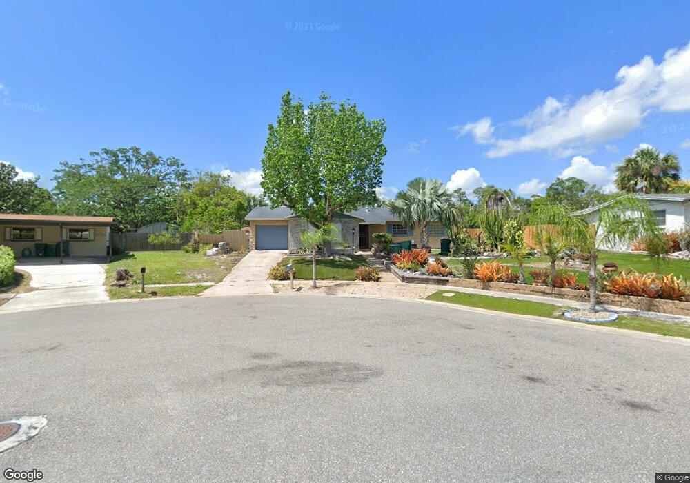
This home is located at 2801 Slippery Rock Dr, Cocoa, FL 32926 and is currently estimated at $264,515, approximately $168 per square foot. 2801 Slippery Rock Dr is a home located in Brevard County with nearby schools including Cambridge Elementary Magnet School, Cocoa High School, and Space Coast Christian Academy.
Ownership History
Date
Name
Owned For
Owner Type
Purchase Details
Closed on
Aug 14, 2024
Sold by
Addeo Joseph A and Addeo Kimberly D
Bought by
Addeo Family Trust and Addeo
Current Estimated Value
Purchase Details
Closed on
Oct 3, 2002
Sold by
Houser Stephen C
Bought by
Addeo Joseph A and Addeo Kimberly D
Home Financials for this Owner
Home Financials are based on the most recent Mortgage that was taken out on this home.
Original Mortgage
$82,000
Interest Rate
6.21%
Mortgage Type
Purchase Money Mortgage
Purchase Details
Closed on
Sep 26, 2002
Sold by
Stanton Arch Harold and Stanton Arch H
Bought by
Addeo Joseph A and Addeo Kimberly D
Home Financials for this Owner
Home Financials are based on the most recent Mortgage that was taken out on this home.
Original Mortgage
$82,000
Interest Rate
6.21%
Mortgage Type
Purchase Money Mortgage
Purchase Details
Closed on
May 9, 1995
Sold by
Brown Quincy Alice S and Brown Hargus
Bought by
Quincy Alice S Brown Rev Tr Agr
Create a Home Valuation Report for This Property
The Home Valuation Report is an in-depth analysis detailing your home's value as well as a comparison with similar homes in the area
Home Values in the Area
Average Home Value in this Area
Purchase History
| Date | Buyer | Sale Price | Title Company |
|---|---|---|---|
| Addeo Family Trust | $100 | None Listed On Document | |
| Addeo Joseph A | $82,000 | -- | |
| Addeo Joseph A | -- | -- | |
| Quincy Alice S Brown Rev Tr Agr | -- | -- |
Source: Public Records
Mortgage History
| Date | Status | Borrower | Loan Amount |
|---|---|---|---|
| Previous Owner | Addeo Joseph A | $82,000 |
Source: Public Records
Tax History
| Year | Tax Paid | Tax Assessment Tax Assessment Total Assessment is a certain percentage of the fair market value that is determined by local assessors to be the total taxable value of land and additions on the property. | Land | Improvement |
|---|---|---|---|---|
| 2025 | $1,236 | $81,850 | -- | -- |
| 2024 | $1,137 | $79,550 | -- | -- |
| 2023 | $1,137 | $73,040 | $0 | $0 |
| 2022 | $1,058 | $70,920 | $0 | $0 |
| 2021 | $1,051 | $68,860 | $0 | $0 |
| 2020 | $1,026 | $67,910 | $0 | $0 |
| 2019 | $1,005 | $66,390 | $0 | $0 |
| 2018 | $812 | $65,160 | $0 | $0 |
| 2017 | $815 | $63,820 | $0 | $0 |
| 2016 | $816 | $62,510 | $19,000 | $43,510 |
| 2015 | $825 | $62,080 | $19,000 | $43,080 |
| 2014 | $778 | $61,590 | $19,000 | $42,590 |
Source: Public Records
Map
Nearby Homes
- 00 N Unknown
- 2111 Otterbein Ave
- 1933 Quail Ridge Ct Unit 1101
- 1956 Quail Ridge Ct Unit 1802
- 1627 Calvados Dr
- 2426 Granville Dr
- 1612 Calvados Dr
- 2406 Mercer Dr
- 2713 Winchester Dr
- 2702 Winchester Dr
- 2314 Mercer Dr
- 3120 Winchester Dr
- 2209 Iona Dr
- 2801 2801
- Xxx Rosetine St
- 3057 Skyline Dr
- 0 University Ln
- 0000 Null Unknown
- 2211 Longbow Rd
- 117 Gary Ln
- 2137 Muskingum Ave
- 2805 Slippery Rock Dr
- 3 Vacant Lots Satellite Blv
- 0 Brothy Unit 507540
- 0 0000 Unit 520165
- 0 Brothy Unit 543106
- 0 Ardelle Lane and Pioneer Unit 555933
- 000 No Name
- 0 W of Areca Palm Sec 32 Unit 741251
- 0 E of Grissom Sec 1 B 12 L9 Unit 741314
- 3891-3861 Us1 Dr
- 0 Brothy Unit 489593
- 0 No Road Access Unit 661069
- 0 No Road Access Unit 333657
- 0 No Road Access Unit 942297
- 2809 Slippery Rock Dr
- 2133 Muskingum Ave
- 2138 Muskingum Ave
- 2808 Slippery Rock Dr
- 2134 Muskingum Ave