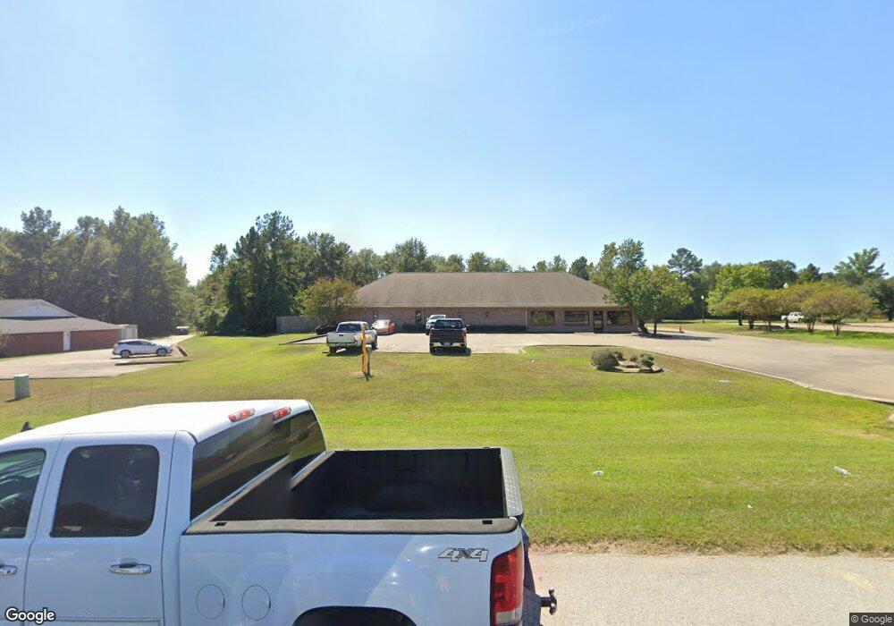
2802 S John Redditt Dr Lufkin, TX 75904
Studio
--
Bath
5,536
Sq Ft
6.24
Acres
About This Home
This home is located at 2802 S John Redditt Dr, Lufkin, TX 75904. 2802 S John Redditt Dr is a home located in Angelina County with nearby schools including Trout Primary School, Brookhollow Elementary School, and Lufkin Middle School.
Ownership History
Date
Name
Owned For
Owner Type
Purchase Details
Closed on
Jul 2, 2024
Sold by
Badger Travis C
Bought by
Sterling Bank
Purchase Details
Closed on
Jul 8, 2016
Sold by
Belmont Real Estate Llp
Bought by
Carroway Funeral Home Ltd
Home Financials for this Owner
Home Financials are based on the most recent Mortgage that was taken out on this home.
Original Mortgage
$147,000
Interest Rate
3.64%
Mortgage Type
New Conventional
Purchase Details
Closed on
Dec 16, 2013
Sold by
E & G Properties Inc
Bought by
Centerpoint Energy Resources Corp
Create a Home Valuation Report for This Property
The Home Valuation Report is an in-depth analysis detailing your home's value as well as a comparison with similar homes in the area
Purchase History
| Date | Buyer | Sale Price | Title Company |
|---|---|---|---|
| Sterling Bank | $3,500,000 | None Listed On Document | |
| Carroway Funeral Home Ltd | $147,000 | None Available | |
| Centerpoint Energy Resources Corp | -- | None Available | |
| E & G Properties Inc | -- | None Available |
Source: Public Records
Mortgage History
| Date | Status | Borrower | Loan Amount |
|---|---|---|---|
| Previous Owner | Carroway Funeral Home Ltd | $147,000 |
Source: Public Records
Tax History
| Year | Tax Paid | Tax Assessment Tax Assessment Total Assessment is a certain percentage of the fair market value that is determined by local assessors to be the total taxable value of land and additions on the property. | Land | Improvement |
|---|---|---|---|---|
| 2025 | $15,708 | $751,660 | $196,200 | $555,460 |
| 2024 | $16,048 | $767,930 | $196,200 | $571,730 |
| 2023 | $15,586 | $784,330 | $196,200 | $588,130 |
| 2022 | $13,251 | $581,790 | $147,150 | $434,640 |
| 2021 | $11,340 | $460,350 | $147,150 | $313,200 |
| 2020 | $11,609 | $472,380 | $147,150 | $325,230 |
| 2019 | $12,134 | $466,810 | $147,150 | $319,660 |
| 2018 | $11,007 | $462,580 | $147,150 | $315,430 |
| 2017 | $11,007 | $461,730 | $147,150 | $314,580 |
| 2016 | $11,171 | $468,600 | $147,150 | $321,450 |
| 2015 | $9,720 | $477,350 | $147,150 | $330,200 |
| 2014 | $9,720 | $402,860 | $147,150 | $255,710 |
Source: Public Records
Map
Nearby Homes
- 201 Mott Dr
- 203 Mott Dr
- 01 Lane Dr
- 2121 S First St
- Lot 3 Hwy 59 Frontage
- Lot 2
- 201 Kentwood Dr
- 1435 Feagin Dr
- 825 Hanks St
- 214 Brooks St
- 1904 S John Redditt Dr
- Lot 2 Tulane Dr
- Lot 4 Tulane Dr
- Lot 3 Tulane Dr
- 000 Tulane Dr
- 1008 Tom Temple Dr
- 2127 S First St
- 102 Saddle Creek Dr
- 112 Saddle Creek Dr
- 207 Echo Ln
- 2808 S John Redditt Dr
- 101 Christie St
- 2816 S John Redditt Dr
- 202 Christie St
- 305 Sandyland Dr
- 220 Christie St
- 301 Sandyland Dr
- 116 Christie Dr
- 210 Christie St
- 0 Christie St
- 306 Mott Rd
- 107 Christie St
- 401 Sandyland Dr
- 110 Christie St
- 200 Christie St
- 206 Christie St
- 509 Lane Dr
- 507 Lane Dr
- 204 Christie Dr
- 204 Christie St