Estimated Value: $351,042 - $744,000
Studio
--
Bath
--
Sq Ft
5,489
Sq Ft Lot
About This Home
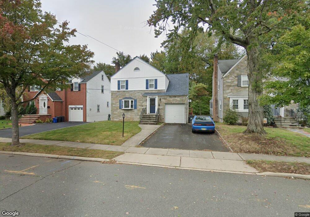
This home is located at 2803 Carol Rd, Union, NJ 07083 and is currently estimated at $587,261. 2803 Carol Rd is a home located in Union County with nearby schools including Battle Hill Elementary School, Burnet Middle School, and Union High School.
Ownership History
Date
Name
Owned For
Owner Type
Purchase Details
Closed on
Apr 27, 2001
Sold by
Galante Victor J and Galante Francine A
Bought by
Fisher John F and Fisher Theresa A
Current Estimated Value
Home Financials for this Owner
Home Financials are based on the most recent Mortgage that was taken out on this home.
Original Mortgage
$200,000
Outstanding Balance
$73,684
Interest Rate
6.85%
Estimated Equity
$513,577
Create a Home Valuation Report for This Property
The Home Valuation Report is an in-depth analysis detailing your home's value as well as a comparison with similar homes in the area
Home Values in the Area
Average Home Value in this Area
Purchase History
| Date | Buyer | Sale Price | Title Company |
|---|---|---|---|
| Fisher John F | $275,000 | Fidelity National Title Ins |
Source: Public Records
Mortgage History
| Date | Status | Borrower | Loan Amount |
|---|---|---|---|
| Open | Fisher John F | $200,000 |
Source: Public Records
Tax History
| Year | Tax Paid | Tax Assessment Tax Assessment Total Assessment is a certain percentage of the fair market value that is determined by local assessors to be the total taxable value of land and additions on the property. | Land | Improvement |
|---|---|---|---|---|
| 2025 | $12,718 | $56,900 | $20,800 | $36,100 |
| 2024 | $12,330 | $56,900 | $20,800 | $36,100 |
Source: Public Records
Map
Nearby Homes
- 1042 Battle Hill Terrace
- 2785 Larchmont Rd
- 2853 Allen Ave
- 2766 Alice Terrace
- 2620 Eleanor Terrace
- 2659 Hawthorne Ave
- 1 Perry Place
- 960 Moessner Ave
- 2636 Frederick Terrace
- 14 Bashford Ave Unit 14
- 5 Bashford Ave Unit 5
- 17 Alvin Terrace
- 67 Battle Hill Ave
- 6 Bashford Ave Unit 6
- 20 Maple Ave
- 148 Jockey Hollow Way
- 105 Battle Hill Ave
- 2543 Branford Ave
- 933 Douglas Terrace
- 33 Haran Cir
- 2799 Carol Rd
- 2807 Carol Rd
- 2811 Carol Rd
- 2795 Carol Rd
- 2815 Carol Rd
- 2791 Carol Rd
- 1093 Mayfair Rd
- 2808 Carol Rd
- 2798 Carol Rd
- 2812 Carol Rd
- 2789 Carol Rd
- 2819 Carol Rd
- 2792 Carol Rd
- 2816 Carol Rd
- 1094 Battle Hill Terrace
- 1087 Mayfair Rd
- 2787 Carol Rd
- 1086 Mayfair Rd
- 2820 Carol Rd
- 1086 Battle Hill Terrace
Your Personal Tour Guide
Ask me questions while you tour the home.