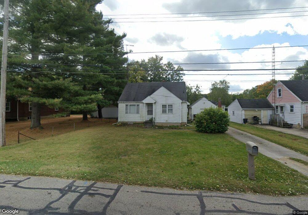
2803 Dwight Rd Springfield, OH 45503
Estimated Value: $136,000 - $147,000
3
Beds
1
Bath
1,116
Sq Ft
$128/Sq Ft
Est. Value
About This Home
This home is located at 2803 Dwight Rd, Springfield, OH 45503 and is currently estimated at $142,993, approximately $128 per square foot. 2803 Dwight Rd is a home located in Clark County with nearby schools including Warder Park-Wayne Elementary School, Schaefer Middle School, and Springfield High School.
Ownership History
Date
Name
Owned For
Owner Type
Purchase Details
Closed on
Jul 13, 2018
Sold by
Kelly David S and Kelly Sandra L
Bought by
Bennington Taylor E
Current Estimated Value
Home Financials for this Owner
Home Financials are based on the most recent Mortgage that was taken out on this home.
Original Mortgage
$64,100
Outstanding Balance
$55,202
Interest Rate
4.5%
Mortgage Type
New Conventional
Estimated Equity
$87,791
Purchase Details
Closed on
Jan 15, 2010
Sold by
Houck Betty J
Bought by
Kelly David S and Kelly Sandra L
Home Financials for this Owner
Home Financials are based on the most recent Mortgage that was taken out on this home.
Original Mortgage
$57,600
Interest Rate
4.78%
Mortgage Type
New Conventional
Create a Home Valuation Report for This Property
The Home Valuation Report is an in-depth analysis detailing your home's value as well as a comparison with similar homes in the area
Home Values in the Area
Average Home Value in this Area
Purchase History
| Date | Buyer | Sale Price | Title Company |
|---|---|---|---|
| Bennington Taylor E | $67,900 | M & M Title Co | |
| Kelly David S | $72,000 | Sterling Land Title N Llc |
Source: Public Records
Mortgage History
| Date | Status | Borrower | Loan Amount |
|---|---|---|---|
| Open | Bennington Taylor E | $64,100 | |
| Previous Owner | Kelly David S | $57,600 |
Source: Public Records
Tax History
| Year | Tax Paid | Tax Assessment Tax Assessment Total Assessment is a certain percentage of the fair market value that is determined by local assessors to be the total taxable value of land and additions on the property. | Land | Improvement |
|---|---|---|---|---|
| 2025 | $1,525 | $35,260 | $7,130 | $28,130 |
| 2024 | $1,487 | $29,730 | $5,930 | $23,800 |
| 2023 | $1,487 | $29,730 | $5,930 | $23,800 |
| 2022 | $1,522 | $29,730 | $5,930 | $23,800 |
| 2021 | $1,317 | $23,380 | $4,630 | $18,750 |
| 2020 | $1,320 | $23,380 | $4,630 | $18,750 |
| 2019 | $1,323 | $23,380 | $4,630 | $18,750 |
| 2018 | $1,218 | $20,540 | $3,470 | $17,070 |
| 2017 | $1,217 | $20,542 | $3,472 | $17,070 |
| 2016 | $1,218 | $20,542 | $3,472 | $17,070 |
| 2015 | $1,207 | $19,919 | $3,472 | $16,447 |
| 2014 | $1,202 | $19,919 | $3,472 | $16,447 |
| 2013 | $1,190 | $19,919 | $3,472 | $16,447 |
Source: Public Records
Map
Nearby Homes
- 2845 Columbus Ave Unit 5
- 907 Bellevue Ave
- 207 Roseland Ave W
- 515 Bellevue Ave
- 2226 Columbus Ave
- 2201 Woodside Ave
- 419 Bellevue Ave
- 2224-2226 Columbus Ave
- 129 N Burnett Rd
- 2124 Woodside Ave
- 2210 Larch St
- 2691 Tecumseh Ave
- 1519 Edgewood Ave
- 2111 Beatrice St
- 2702 Maplewood Ave
- 2023 Cleveland Ave
- 2020 Woodside Ave
- 121 Willis Ave
- 3114 Columbus Ave
- 743 N Belmont Ave
- 2801 Dwight Rd
- 2809 Dwight Rd
- 731 Patrick Rd
- 2745 Dwight Rd
- 2813 Dwight Rd
- 738 Patrick Rd
- 2810 Marshall Rd
- 2741 Dwight Rd
- 2817 Dwight Rd
- 726 Patrick Rd
- 2744 Dwight Rd
- 2735 Dwight Rd
- 737 Patrick Rd
- 2740 Dwight Rd
- 2816 Marshall Rd
- 2821 Dwight Rd
- 2820 Marshall Rd
- 2729 Dwight Rd
- 725 Patrick Rd
- 735 Dwight Rd
Your Personal Tour Guide
Ask me questions while you tour the home.