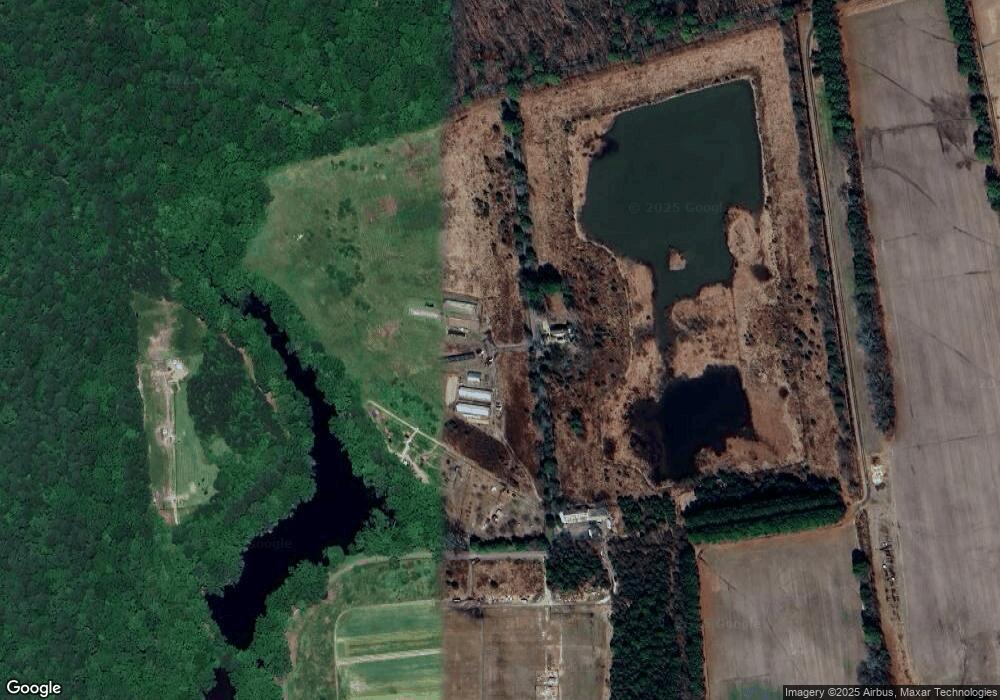
28038 Goldsborough Neck Rd Easton, MD 21601
Estimated Value: $2,007,000 - $3,955,836
--
Bed
3
Baths
6,331
Sq Ft
$486/Sq Ft
Est. Value
About This Home
This home is located at 28038 Goldsborough Neck Rd, Easton, MD 21601 and is currently estimated at $3,074,945, approximately $485 per square foot. 28038 Goldsborough Neck Rd is a home located in Talbot County with nearby schools including St. Michaels Elementary School, St. Michaels Middle/High School, and Easton High School.
Ownership History
Date
Name
Owned For
Owner Type
Purchase Details
Closed on
Feb 16, 2012
Sold by
Tyler Alfred and Braver Cleo P
Bought by
Tyler Alfred and Braver Cleo P
Current Estimated Value
Home Financials for this Owner
Home Financials are based on the most recent Mortgage that was taken out on this home.
Original Mortgage
$500,000
Interest Rate
3.88%
Mortgage Type
New Conventional
Purchase Details
Closed on
May 22, 2008
Sold by
Tyler Alfred
Bought by
Tyler Alfred 2Nd and Braver, Cleo P.
Purchase Details
Closed on
May 15, 2008
Sold by
Tyler Alfred
Bought by
Tyler Alfred 2Nd and Braver, Cleo P.
Purchase Details
Closed on
Dec 23, 1996
Sold by
Travelstead G Ware
Bought by
Cottingham Llc
Purchase Details
Closed on
Nov 20, 1995
Sold by
Willis J Mckenny
Bought by
Travelstead G Ware
Create a Home Valuation Report for This Property
The Home Valuation Report is an in-depth analysis detailing your home's value as well as a comparison with similar homes in the area
Home Values in the Area
Average Home Value in this Area
Purchase History
| Date | Buyer | Sale Price | Title Company |
|---|---|---|---|
| Tyler Alfred | -- | Home Title Co | |
| Tyler Alfred 2Nd | -- | -- | |
| Tyler Alfred 2Nd | -- | -- | |
| Cottingham Llc | $3,250,000 | -- | |
| Travelstead G Ware | $3,250,000 | -- |
Source: Public Records
Mortgage History
| Date | Status | Borrower | Loan Amount |
|---|---|---|---|
| Closed | Tyler Alfred | $500,000 |
Source: Public Records
Tax History Compared to Growth
Tax History
| Year | Tax Paid | Tax Assessment Tax Assessment Total Assessment is a certain percentage of the fair market value that is determined by local assessors to be the total taxable value of land and additions on the property. | Land | Improvement |
|---|---|---|---|---|
| 2025 | $11,649 | $2,438,867 | $0 | $0 |
| 2024 | $11,649 | $2,323,200 | $834,100 | $1,489,100 |
| 2023 | $11,076 | $2,305,100 | $0 | $0 |
| 2022 | $10,350 | $2,287,000 | $0 | $0 |
| 2021 | $9,812 | $2,268,900 | $834,100 | $1,434,800 |
| 2020 | $9,812 | $2,268,900 | $834,100 | $1,434,800 |
| 2019 | $9,812 | $2,268,900 | $834,100 | $1,434,800 |
| 2018 | $9,523 | $2,287,400 | $934,100 | $1,353,300 |
| 2017 | $9,107 | $2,272,067 | $0 | $0 |
| 2016 | $8,620 | $2,256,733 | $0 | $0 |
| 2015 | $7,389 | $2,241,400 | $0 | $0 |
| 2014 | $7,389 | $2,241,400 | $0 | $0 |
Source: Public Records
Map
Nearby Homes
- 9361 Woodstock Ln
- 9517 Gulleys Cove Ln
- 9900 Eagle Dr
- 27413 Ferry Bridge Rd
- 27460 Rest Cir
- 0 Unionville Rd Unit MDTA2008824
- 8629 Unionville Rd
- 27843 Saint Michaels Rd
- 8534 Northbend Rd
- 10118 Hiners Ln
- 28309 Village Lake Way
- 365 Glebe Rd
- 106 Sycamore Ave
- 13 Sandy Ln
- 18 Sandy Ln
- 27240 Hayward Trail
- 356 Saint Aubins Terrace
- 14 Sandy Ln
- 26972 Tunis Mills Rd
- 0 Ocean Gateway Unit MDTA2008568
- 9361 Woodstock Ln Unit 7
- 9361 Woodstock Ln Unit 1
- 9361 Wwoodstock Ln
- 9621 Myrtle Grove Ln
- 9379 Woodstock Ln
- 9383 Woodstock Ln
- 28026 Villa Rd
- 26812 Glebe Rd
- 27852 Villa Rd
- 9753 Bantry Rd
- 9437 Gulleys Cove Ln
- 9741 Bantry Rd
- 9703 Bantry Rd
- 9465 Gulleys Cove Ln
- 28030 Villa Rd
- 9643 Bantry Rd
- 9829 Bantry Rd
- 9795 Bantry Rd
- 9629 Bantry Rd
- 27850 Villa Rd
