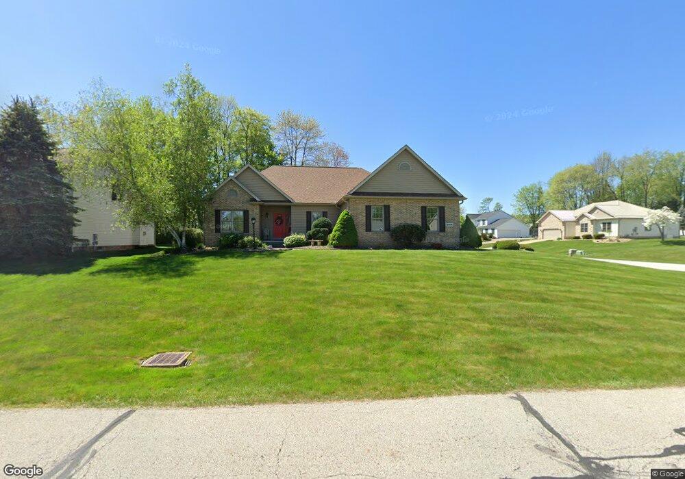
2804 Crows Nest Cir Uniontown, OH 44685
Estimated Value: $394,498 - $439,000
3
Beds
2
Baths
2,155
Sq Ft
$191/Sq Ft
Est. Value
About This Home
This home is located at 2804 Crows Nest Cir, Uniontown, OH 44685 and is currently estimated at $410,625, approximately $190 per square foot. 2804 Crows Nest Cir is a home located in Summit County with nearby schools including Greenwood Elementary School, Green Primary School, and Green Intermediate Elementary School.
Ownership History
Date
Name
Owned For
Owner Type
Purchase Details
Closed on
Oct 4, 2017
Sold by
Holliday Jeffrey J and Holliday Dora C
Bought by
Hollidry Jeffrey J
Current Estimated Value
Purchase Details
Closed on
Feb 7, 2003
Sold by
Union Commerce Corp
Bought by
Donaldson James L and Donaldson Onnolee
Home Financials for this Owner
Home Financials are based on the most recent Mortgage that was taken out on this home.
Original Mortgage
$248,457
Interest Rate
5.94%
Create a Home Valuation Report for This Property
The Home Valuation Report is an in-depth analysis detailing your home's value as well as a comparison with similar homes in the area
Home Values in the Area
Average Home Value in this Area
Purchase History
| Date | Buyer | Sale Price | Title Company |
|---|---|---|---|
| Hollidry Jeffrey J | -- | None Available | |
| Donaldson James L | $51,900 | Endress/Lawyers Title |
Source: Public Records
Mortgage History
| Date | Status | Borrower | Loan Amount |
|---|---|---|---|
| Previous Owner | Donaldson James L | $248,457 |
Source: Public Records
Tax History Compared to Growth
Tax History
| Year | Tax Paid | Tax Assessment Tax Assessment Total Assessment is a certain percentage of the fair market value that is determined by local assessors to be the total taxable value of land and additions on the property. | Land | Improvement |
|---|---|---|---|---|
| 2025 | $5,110 | $107,856 | $21,658 | $86,198 |
| 2024 | $5,110 | $107,856 | $21,658 | $86,198 |
| 2023 | $5,110 | $107,856 | $21,658 | $86,198 |
| 2022 | $4,590 | $86,979 | $17,465 | $69,514 |
| 2021 | $4,306 | $86,979 | $17,465 | $69,514 |
| 2020 | $4,223 | $86,980 | $17,470 | $69,510 |
| 2019 | $4,060 | $78,330 | $16,770 | $61,560 |
| 2018 | $4,149 | $78,330 | $16,770 | $61,560 |
| 2017 | $3,860 | $78,330 | $16,770 | $61,560 |
| 2016 | $3,842 | $68,340 | $16,770 | $51,570 |
| 2015 | $3,860 | $68,340 | $16,770 | $51,570 |
| 2014 | $3,835 | $68,340 | $16,770 | $51,570 |
| 2013 | $3,920 | $69,450 | $16,770 | $52,680 |
Source: Public Records
Map
Nearby Homes
- 3217 Deborah Ct
- 3212 Deborah Ct
- 3979 Northdale St NW
- 2944 Sunset Dr
- 2771 Superior Dr
- 2500 Marlborough Dr
- Northwood Plan at Spring Hill - Spring Hill Villas
- Kenai Plan at Spring Hill - Spring Hill Villas
- Bradbern Plan at Spring Hill - Spring Hill Villas
- Sarasota Plan at Spring Hill - Spring Hill Villas
- Holston Plan at Spring Hill - Spring Hill Villas
- Chester Plan at Spring Hill - Spring Hill Villas
- 2418 Island Dr
- 0 Pine St NW
- 3534 Chanticleer Ct
- 3514 Chanticleer Ct
- 2511 Royal County Down
- 2518 Glenshire Cir Unit 36A
- 3541 Elmhurst Cir
- 2535 Royal County Down Unit B
- 2812 Crows Nest Cir
- 2791 Alexandria Ct
- 3054 Bear Hollow Rd
- 2799 Alexandria Ct
- 2820 Crows Nest Cir
- 3062 Bear Hollow Rd
- 2805 Crows Nest Cir
- 2797 Crows Nest Cir
- 2821 Crows Nest Cir
- 2807 Alexandria Ct
- 3070 Bear Hollow Rd
- 0 Crows Nest Cir Unit 3347236
- 0 Crows Nest Cir Unit 3400734
- 0 Crows Nest Cir Unit 3457016
- 0 Crows Nest Cir Unit 3613166
- 0 Crows Nest Cir Unit 3629794
- 0 Crows Nest Cir Unit 3629793
- 0 Crows Nest Cir Unit 3629792
- 0 Crows Nest Cir Unit 3629791
- 0 Crows Nest Cir Unit 3668915