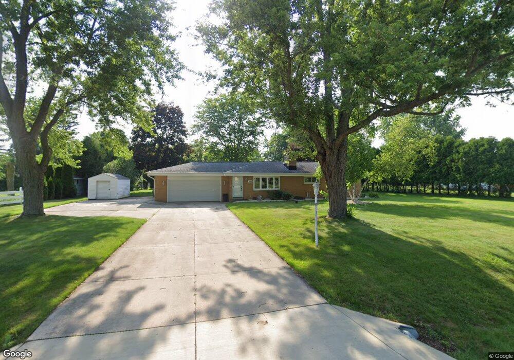
2805 Harmony Cir Brookfield, WI 53045
Brookfield Town NeighborhoodEstimated Value: $367,261 - $496,000
Studio
--
Bath
--
Sq Ft
20,473
Sq Ft
About This Home
This home is located at 2805 Harmony Cir, Brookfield, WI 53045 and is currently estimated at $427,815. 2805 Harmony Cir is a home located in Waukesha County with nearby schools including Brookfield Elementary School, Wisconsin Hills Middle School, and Brookfield Central High School.
Ownership History
Date
Name
Owned For
Owner Type
Purchase Details
Closed on
May 18, 2012
Sold by
Ward Carol A and Ward Carol
Bought by
Carol A Ward Living Trust
Current Estimated Value
Purchase Details
Closed on
May 21, 2004
Sold by
Czajkowski Michael and Vyskocil Czajkowski Terri L
Bought by
Ward Carol
Home Financials for this Owner
Home Financials are based on the most recent Mortgage that was taken out on this home.
Original Mortgage
$60,000
Interest Rate
6.06%
Mortgage Type
Purchase Money Mortgage
Purchase Details
Closed on
Jun 4, 1999
Sold by
Paulus Andrew G and Paulus Julie A
Bought by
Czajkowski Michael and Vyskocil Czajkowski Terri L
Home Financials for this Owner
Home Financials are based on the most recent Mortgage that was taken out on this home.
Original Mortgage
$120,000
Interest Rate
7.12%
Mortgage Type
Purchase Money Mortgage
Create a Home Valuation Report for This Property
The Home Valuation Report is an in-depth analysis detailing your home's value as well as a comparison with similar homes in the area
Home Values in the Area
Average Home Value in this Area
Purchase History
| Date | Buyer | Sale Price | Title Company |
|---|---|---|---|
| Carol A Ward Living Trust | -- | None Available | |
| Ward Carol | $180,000 | -- | |
| Czajkowski Michael | $153,000 | -- |
Source: Public Records
Mortgage History
| Date | Status | Borrower | Loan Amount |
|---|---|---|---|
| Closed | Ward Carol | $60,000 | |
| Previous Owner | Czajkowski Michael | $120,000 |
Source: Public Records
Tax History
| Year | Tax Paid | Tax Assessment Tax Assessment Total Assessment is a certain percentage of the fair market value that is determined by local assessors to be the total taxable value of land and additions on the property. | Land | Improvement |
|---|---|---|---|---|
| 2024 | $3,415 | $306,900 | $83,400 | $223,500 |
| 2023 | $3,332 | $306,900 | $83,400 | $223,500 |
| 2022 | $3,569 | $306,900 | $83,400 | $223,500 |
| 2021 | $3,640 | $253,500 | $69,500 | $184,000 |
| 2020 | $3,763 | $253,500 | $69,500 | $184,000 |
| 2019 | $3,721 | $253,500 | $69,500 | $184,000 |
| 2018 | $3,528 | $231,600 | $66,000 | $165,600 |
| 2017 | $3,425 | $231,600 | $66,000 | $165,600 |
| 2016 | $3,086 | $207,000 | $66,000 | $141,000 |
| 2015 | $3,069 | $207,000 | $66,000 | $141,000 |
| 2014 | $3,145 | $207,000 | $66,000 | $141,000 |
| 2013 | $3,145 | $192,600 | $63,000 | $129,600 |
Source: Public Records
Map
Nearby Homes
- 2550 Harmony Cir
- 2465 Lionel Ct
- W221N3075 Greenwood Ct
- 2820 Norman Dr
- W224N2507 Ridgewood Ln
- 20305 Downing Ct
- Lt118 Berwick Ct
- Lt120 Berwick Ct
- Lt116 Berwick Ct
- Lt114 Berwick Ct
- 1930 Cotton Tail Ln
- 21445 Gumina Rd
- 1825 Derrin Ln
- 2000 Kathlynn Ct
- 19260 Brookdale Dr
- 19775 Trilby Ct
- N37W22910 Wyndemere Dr
- 18860 N Hills Dr
- 18850 N Hills Dr
- 19475 Summerhill Ln
- 2835 Harmony Cir
- 2785 Harmony Cir
- 2800 Flagstone Dr
- 2820 Flagstone Dr
- 2810 Harmony Cir
- 2830 Harmony Cir
- 2790 Flagstone Dr
- 2855 Harmony Cir
- 2755 Harmony Cir
- 2850 Harmony Cir
- 2780 Harmony Cir
- 2840 Flagstone Dr
- 2760 Harmony Cir
- 21825 Oakmont Ln
- 2770 Flagstone Dr
- 2875 Harmony Cir
- 2870 Harmony Cir
- 2795 Almesbury Ave
- 2735 Harmony Cir
- 2775 Almesbury Ave
Your Personal Tour Guide
Ask me questions while you tour the home.