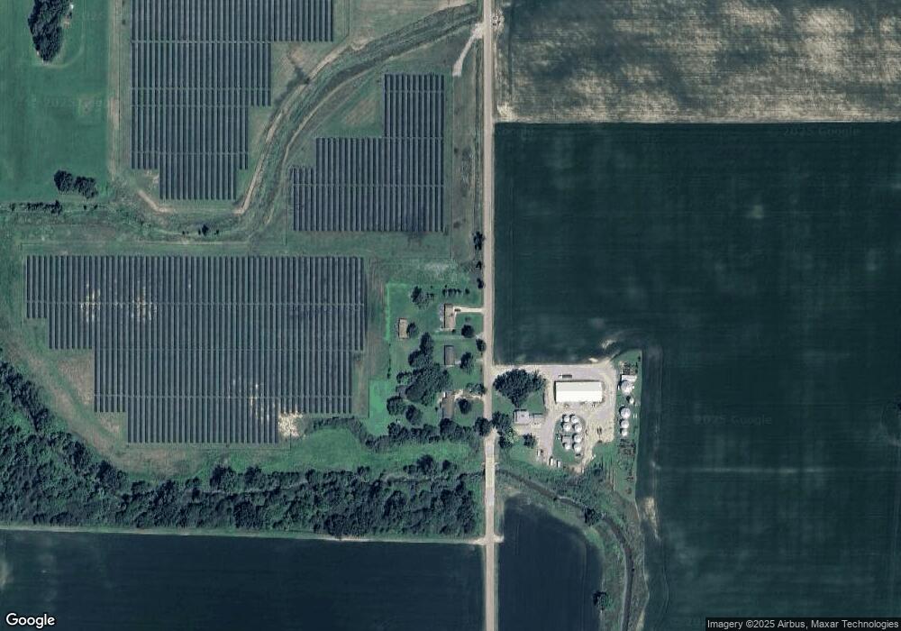
2805 N Byron Rd Lennon, MI 48449
Venice Township NeighborhoodEstimated Value: $174,000 - $226,000
--
Bed
--
Bath
--
Sq Ft
0.9
Acres
About This Home
This home is located at 2805 N Byron Rd, Lennon, MI 48449 and is currently estimated at $204,110. 2805 N Byron Rd is a home located in Shiawassee County with nearby schools including Corunna High School.
Ownership History
Date
Name
Owned For
Owner Type
Purchase Details
Closed on
Sep 10, 2024
Sold by
Conklin David and Conklin Donna
Bought by
Homola Brandon and Homola Nicole
Current Estimated Value
Home Financials for this Owner
Home Financials are based on the most recent Mortgage that was taken out on this home.
Original Mortgage
$97,600
Outstanding Balance
$96,503
Interest Rate
6.47%
Mortgage Type
New Conventional
Estimated Equity
$107,607
Purchase Details
Closed on
Feb 9, 2024
Sold by
Starr Neil A and Starr Lucille V
Bought by
Homola Brandon and Homola Nicole
Create a Home Valuation Report for This Property
The Home Valuation Report is an in-depth analysis detailing your home's value as well as a comparison with similar homes in the area
Home Values in the Area
Average Home Value in this Area
Purchase History
| Date | Buyer | Sale Price | Title Company |
|---|---|---|---|
| Homola Brandon | $74,000 | Mason Burgess Title Agency | |
| Homola Brandon | $74,000 | Mason Burgess Title Agency | |
| Homola Brandon | $150,000 | Crossroads Title | |
| Homola Brandon | $150,000 | Crossroads Title |
Source: Public Records
Mortgage History
| Date | Status | Borrower | Loan Amount |
|---|---|---|---|
| Open | Homola Brandon | $97,600 | |
| Closed | Homola Brandon | $97,600 |
Source: Public Records
Tax History Compared to Growth
Tax History
| Year | Tax Paid | Tax Assessment Tax Assessment Total Assessment is a certain percentage of the fair market value that is determined by local assessors to be the total taxable value of land and additions on the property. | Land | Improvement |
|---|---|---|---|---|
| 2025 | $1,725 | $108,000 | $0 | $0 |
| 2024 | $1,613 | $104,000 | $0 | $0 |
| 2023 | $699 | $92,200 | $0 | $0 |
| 2022 | $666 | $77,600 | $0 | $0 |
| 2021 | $1,487 | $72,600 | $0 | $0 |
| 2020 | $1,458 | $70,800 | $0 | $0 |
| 2019 | $1,434 | $54,800 | $0 | $0 |
| 2018 | $1,428 | $55,600 | $0 | $0 |
| 2017 | $1,363 | $52,500 | $0 | $0 |
| 2016 | -- | $52,500 | $0 | $0 |
| 2015 | -- | $51,200 | $0 | $0 |
| 2014 | $323 | $50,500 | $0 | $0 |
Source: Public Records
Map
Nearby Homes
- 3330 Sheridan Rd
- 9651 Juddville Rd
- 241 Raleigh Place
- TBD E Brooks Rd N of Us 69 W of M13
- 4101 lot 171 S Sheridan
- 12502 W Corunna Rd
- 8110 Middleton Rd
- 11358 W Carpenter Rd Rd
- 11424 Corunna Rd
- 9585 Henderson Rd
- 10167 W Pierson Rd
- 805 Oak St
- 908 Tyler Rd
- 2548 S Sheridan Rd
- V/L S Sheridan Rd
- 1475 S Nichols Rd
- 3372 Woodridge Dr
- 3462 Woodridge Dr
- 3470 Longmeadow Dr
- 11295 E Lytle Rd
- 2835 N Byron Rd
- 2845 N Byron Rd
- 11009 Cronk Rd
- 11059 Cronk Rd
- 11059 Cronk Rd
- 11075 Cronk Rd
- 10689 Cronk Rd
- 10687 Cronk Rd
- 11121 Cronk Rd
- 3100 N Byron Rd
- 10600 Cronk Rd
- 10600 Cronk Rd
- 344 Wilcox St
- 10500 Cronk Rd
- 10500 Cronk Rd
- 10441 Cronk Rd
- 10441 Cronk Rd
- 10425 Cronk Rd
- 2251 N Byron Rd
- 10385 Cronk Rd
