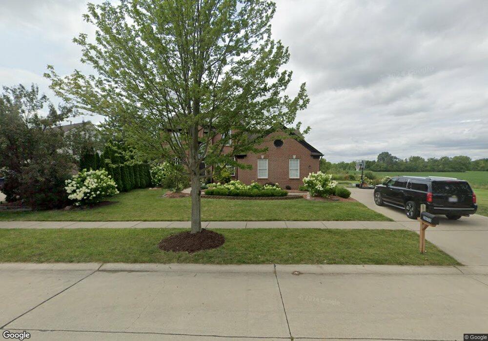
28050 Regency Dr Flat Rock, MI 48134
Estimated Value: $414,229 - $481,000
3
Beds
3
Baths
2,363
Sq Ft
$192/Sq Ft
Est. Value
About This Home
This home is located at 28050 Regency Dr, Flat Rock, MI 48134 and is currently estimated at $452,557, approximately $191 per square foot. 28050 Regency Dr is a home located in Wayne County with nearby schools including Ethel C. Bobcean Elementary School, John M. Barnes Elementary School, and Thomas Simpson Middle School.
Ownership History
Date
Name
Owned For
Owner Type
Purchase Details
Closed on
Aug 31, 2009
Sold by
Burns Jean Luc and Burns Elaine Nora
Bought by
Awad Mahmoud M
Current Estimated Value
Home Financials for this Owner
Home Financials are based on the most recent Mortgage that was taken out on this home.
Original Mortgage
$178,703
Outstanding Balance
$117,345
Interest Rate
5.27%
Mortgage Type
FHA
Estimated Equity
$335,212
Purchase Details
Closed on
Jan 24, 2005
Sold by
Pulte Land Co Llc
Bought by
Burns Jean Luc
Create a Home Valuation Report for This Property
The Home Valuation Report is an in-depth analysis detailing your home's value as well as a comparison with similar homes in the area
Home Values in the Area
Average Home Value in this Area
Purchase History
| Date | Buyer | Sale Price | Title Company |
|---|---|---|---|
| Awad Mahmoud M | $182,000 | None Available | |
| Burns Jean Luc | $304,440 | Metropolitan Title Company |
Source: Public Records
Mortgage History
| Date | Status | Borrower | Loan Amount |
|---|---|---|---|
| Open | Awad Mahmoud M | $178,703 |
Source: Public Records
Tax History
| Year | Tax Paid | Tax Assessment Tax Assessment Total Assessment is a certain percentage of the fair market value that is determined by local assessors to be the total taxable value of land and additions on the property. | Land | Improvement |
|---|---|---|---|---|
| 2025 | $5,232 | $208,900 | $0 | $0 |
| 2024 | $5,080 | $215,100 | $0 | $0 |
| 2023 | $4,713 | $185,400 | $0 | $0 |
| 2022 | $5,706 | $161,400 | $0 | $0 |
| 2021 | $5,391 | $147,800 | $0 | $0 |
| 2020 | $5,319 | $142,600 | $0 | $0 |
| 2019 | $5,221 | $132,700 | $0 | $0 |
| 2018 | $4,057 | $130,600 | $0 | $0 |
| 2017 | $2,136 | $123,900 | $0 | $0 |
| 2016 | $4,910 | $116,900 | $0 | $0 |
| 2015 | $9,038 | $113,900 | $0 | $0 |
| 2013 | $8,755 | $94,100 | $0 | $0 |
| 2012 | $3,352 | $85,500 | $15,300 | $70,200 |
Source: Public Records
Map
Nearby Homes
- 23965 Gibraltar Rd
- 24946 Peters Rd
- 00 Gibraltar Rd
- VL Gibraltar Rd
- 24943 Mayfair St
- 25182 Frontier Cir
- 28336 Sheeks Blvd N
- 26609 Laramie Ln
- 27200 Telegraph Rd
- 23897 Romero
- 26152 Ypsilanti St
- 23855 Romero
- 26767 Emma Ave
- 23911 Romero
- 29715 Walnut St
- 23883 Romero
- 23869 Romero
- 29530 Cambridge St
- 23841 Romero
- 23827 Romero
- 24702 Summer Ln
- 24726 Summer Ln
- 24695 Summer Ln
- 24678 Summer Ln
- 24750 Summer Ln
- 24671 Summer Ln
- 24654 Summer Ln
- 28059 Aspen Blvd
- 28093 Aspen Blvd
- 28037 Aspen Blvd
- 28121 Aspen Blvd
- 24647 Summer Ln
- 24630 Summer Ln
- 24686 Fairlawn Dr
- 24774 Summer Ln
- 24743 Summer Ln
- 24623 Summer Ln
- 24606 Summer Ln
- 28135 Aspen Blvd
- 24767 Summer Ln
Your Personal Tour Guide
Ask me questions while you tour the home.