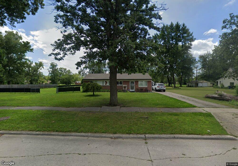
28059 Powers St Westland, MI 48186
Estimated Value: $130,000 - $169,000
--
Bed
1
Bath
1,219
Sq Ft
$124/Sq Ft
Est. Value
About This Home
This home is located at 28059 Powers St, Westland, MI 48186 and is currently estimated at $150,723, approximately $123 per square foot. 28059 Powers St is a home located in Wayne County with nearby schools including Taylor Parks Elementary School, Hoover Middle School, and Taylor High School.
Ownership History
Date
Name
Owned For
Owner Type
Purchase Details
Closed on
Jan 24, 2017
Sold by
Us Bank Usa Na
Bought by
Boomer Consolidated Llc
Current Estimated Value
Purchase Details
Closed on
Oct 20, 2016
Sold by
Roach James L and Roach Marcella
Bought by
Hsbc Bank Usa Na and Home Equity Loan Trust
Create a Home Valuation Report for This Property
The Home Valuation Report is an in-depth analysis detailing your home's value as well as a comparison with similar homes in the area
Home Values in the Area
Average Home Value in this Area
Purchase History
| Date | Buyer | Sale Price | Title Company |
|---|---|---|---|
| Boomer Consolidated Llc | $37,919 | None Available | |
| Hsbc Bank Usa Na | $101,490 | None Available |
Source: Public Records
Tax History Compared to Growth
Tax History
| Year | Tax Paid | Tax Assessment Tax Assessment Total Assessment is a certain percentage of the fair market value that is determined by local assessors to be the total taxable value of land and additions on the property. | Land | Improvement |
|---|---|---|---|---|
| 2025 | $1,371 | $72,600 | $0 | $0 |
| 2024 | $1,371 | $71,600 | $0 | $0 |
| 2023 | $1,410 | $59,000 | $0 | $0 |
| 2022 | $1,656 | $49,000 | $0 | $0 |
| 2021 | $1,561 | $41,500 | $0 | $0 |
| 2020 | $1,541 | $32,400 | $0 | $0 |
| 2019 | $1,729 | $28,200 | $0 | $0 |
| 2018 | $1,412 | $25,900 | $0 | $0 |
| 2017 | $537 | $24,100 | $0 | $0 |
| 2016 | $1,136 | $24,800 | $0 | $0 |
| 2015 | $2,456 | $24,560 | $0 | $0 |
| 2013 | $2,627 | $27,290 | $0 | $0 |
| 2012 | $1,094 | $27,750 | $0 | $0 |
Source: Public Records
Map
Nearby Homes
- POWERS Powers St
- 27523 Powers St
- 28919 Powers St
- 4120 Ash St
- 4315 Isabelle St
- 28951 Powers St
- 28654 N Maple St Unit 131
- 4133 Moore St
- 6002 Frederick St Unit 81
- 6018 Frederick St Unit 83
- 5926 Esther St
- 5898 W Maple St Unit 177
- 4054 Moore St
- 29025 Powers St
- 29006 Eton St
- 5526 Sylvia St
- 4080 Isabelle St
- 5912 Georgia Unit 212
- 6041 W Maple St Unit 144
- 27285 Colgate St
- 28121 Powers St
- 28082 Powers St
- 28050 Powers St
- 28114 Powers St
- 28114 Powers St
- 28013 Powers St
- 28128 Powers St
- 28018 Powers St
- 28175 Powers St
- 5329 Admiral St
- 28148 Powers St
- 28086 Hanover Blvd
- 28187 Powers St
- 27650 Powers St
- 27633 Powers St
- 27634 Powers St
- 28110 Hanover Blvd
- 28126 Hanover Blvd
- 28064 Hanover Blvd
- 28073 Eton St