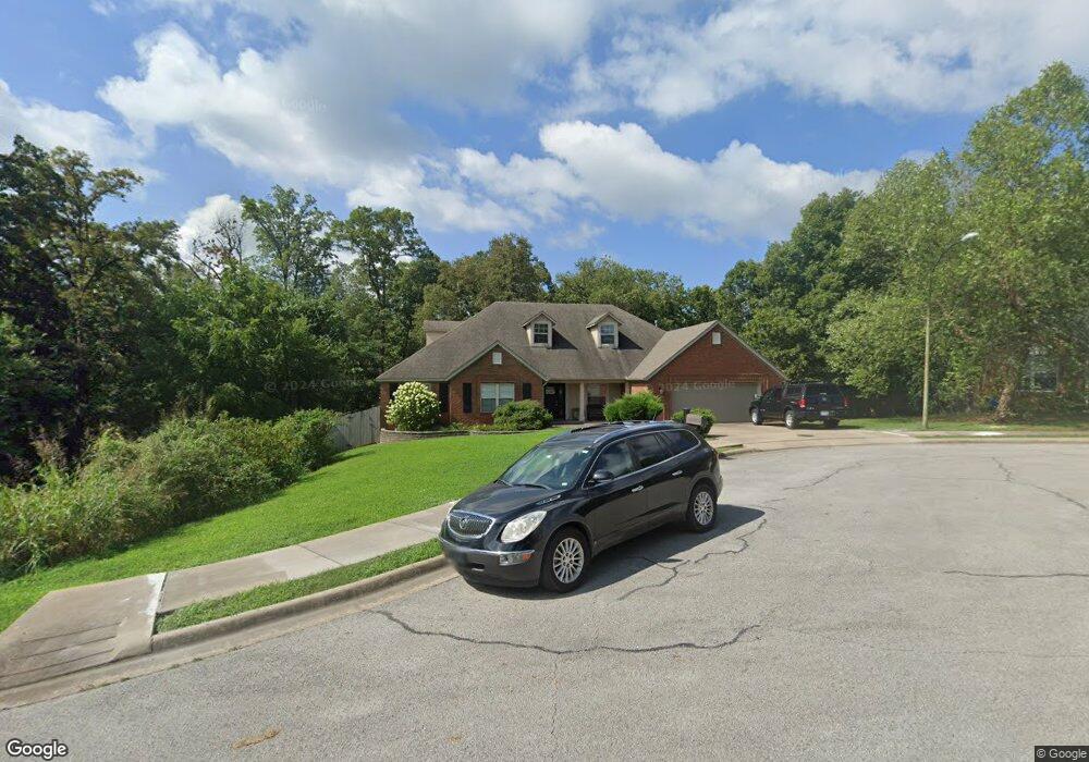
2806 Cortney Cir Siloam Springs, AR 72761
Estimated Value: $436,000 - $532,000
4
Beds
2
Baths
2,662
Sq Ft
$178/Sq Ft
Est. Value
About This Home
This home is located at 2806 Cortney Cir, Siloam Springs, AR 72761 and is currently estimated at $475,002, approximately $178 per square foot. 2806 Cortney Cir is a home located in Benton County with nearby schools including Northside Elementary School, Southside Elementary School, and Delbert Pete & Pat Allen Elementary School.
Ownership History
Date
Name
Owned For
Owner Type
Purchase Details
Closed on
Jan 10, 2011
Sold by
French James R and French Michelle D
Bought by
Smith Brett Dale and Smith Tiffinie Barker
Current Estimated Value
Home Financials for this Owner
Home Financials are based on the most recent Mortgage that was taken out on this home.
Original Mortgage
$100,000
Outstanding Balance
$67,456
Interest Rate
4.56%
Mortgage Type
Unknown
Estimated Equity
$407,546
Purchase Details
Closed on
Jan 29, 2009
Sold by
Federal National Mortgage Association
Bought by
French Ii James R and French Michelle D
Purchase Details
Closed on
Jul 1, 2008
Sold by
Blair Jimmy and Blair Carla
Bought by
Federal National Mortgage Association
Purchase Details
Closed on
May 13, 2003
Bought by
Blair
Create a Home Valuation Report for This Property
The Home Valuation Report is an in-depth analysis detailing your home's value as well as a comparison with similar homes in the area
Home Values in the Area
Average Home Value in this Area
Purchase History
| Date | Buyer | Sale Price | Title Company |
|---|---|---|---|
| Smith Brett Dale | $200,000 | Rtc | |
| French Ii James R | $95,000 | None Available | |
| Federal National Mortgage Association | $197,466 | None Available | |
| Blair | $20,000 | -- |
Source: Public Records
Mortgage History
| Date | Status | Borrower | Loan Amount |
|---|---|---|---|
| Open | Smith Brett Dale | $100,000 |
Source: Public Records
Tax History Compared to Growth
Tax History
| Year | Tax Paid | Tax Assessment Tax Assessment Total Assessment is a certain percentage of the fair market value that is determined by local assessors to be the total taxable value of land and additions on the property. | Land | Improvement |
|---|---|---|---|---|
| 2025 | $4,100 | $94,414 | $8,400 | $86,014 |
| 2024 | $3,857 | $94,414 | $8,400 | $86,014 |
| 2023 | $3,506 | $60,870 | $7,200 | $53,670 |
| 2022 | $3,503 | $60,870 | $7,200 | $53,670 |
| 2021 | $3,321 | $60,870 | $7,200 | $53,670 |
| 2020 | $3,029 | $52,590 | $2,400 | $50,190 |
| 2019 | $3,029 | $52,590 | $2,400 | $50,190 |
| 2018 | $3,029 | $52,590 | $2,400 | $50,190 |
| 2017 | $2,974 | $52,590 | $2,400 | $50,190 |
| 2016 | $2,974 | $52,590 | $2,400 | $50,190 |
| 2015 | $2,704 | $46,940 | $2,600 | $44,340 |
| 2014 | $2,396 | $41,600 | $2,600 | $39,000 |
Source: Public Records
Map
Nearby Homes
- 2711 Summitt Dr
- 2786 S Olive Ct
- 2210 E Fennec St
- 2503 Chanel St
- 110 Cordes Dr
- 214 Lake Francis Dr
- 0000 Elm St S
- 3214 S White Oak St
- 3902 Short Ln
- 3210 S Lincoln St
- 3408 S Lincoln St
- 1413 E Emelyn Ln
- 0 S Mount Olive St
- 419 W Hannibal St
- 820 W Deer Lodge Ct
- 17900 Crestwood Dr
- 0 Tbd Hwy 412 W
- TBD W 412 Hwy
- 412 W Kenwood St
- 1218 E Kenwood St
- 2804 Cortney Cir
- 2907 Summitt Dr
- 2803 Cortney Cir
- 2802 Cortney Cir
- 2807 Cortney Cir
- 2809 Cortney Cir
- 2805 Cortney Cir
- 2708 Cortney Cir
- 2811 Summit Dr
- 2906 Summit Dr
- 2999 Summitt Dr
- 2709 Cammi Ct
- 3007 Cortney Cir
- 2909 Cortney Cir
- 2910 Summitt Dr
- 4001 Cortney Cir
- 3009 Cortney Cir
- 4003 Cortney Cir
- 2707 Cammi Ct
- 2998 Summitt Dr