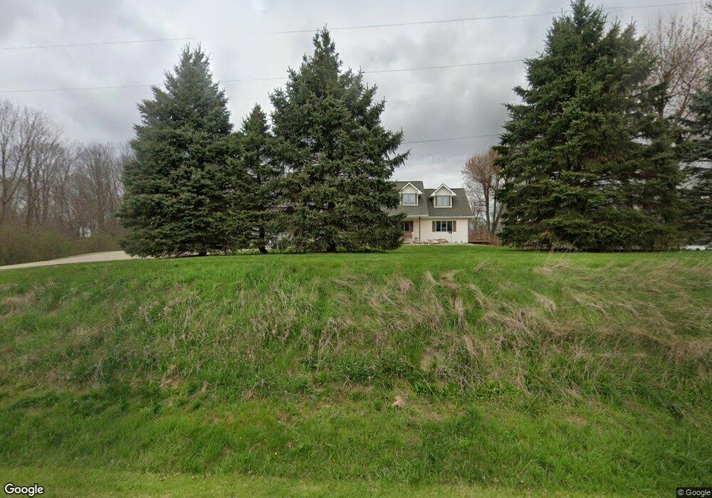
2806 W 500 N Marion, IN 46952
Estimated Value: $342,000 - $491,000
5
Beds
3
Baths
2,687
Sq Ft
$149/Sq Ft
Est. Value
About This Home
This home is located at 2806 W 500 N, Marion, IN 46952 and is currently estimated at $400,005, approximately $148 per square foot. 2806 W 500 N is a home located in Grant County with nearby schools including Converse Elementary School, Sweetser Elementary School, and Oak Hill Junior High School.
Ownership History
Date
Name
Owned For
Owner Type
Purchase Details
Closed on
Oct 2, 2017
Sold by
Pearce John M
Bought by
Ashbrooke Robert L and Ashbrooke Jaime R
Current Estimated Value
Home Financials for this Owner
Home Financials are based on the most recent Mortgage that was taken out on this home.
Original Mortgage
$216,000
Outstanding Balance
$180,421
Interest Rate
3.82%
Mortgage Type
Closed End Mortgage
Estimated Equity
$219,584
Purchase Details
Closed on
May 29, 2009
Sold by
Scales Tim and Scales Luanne
Bought by
Pearce John M and Pearce Hollis
Home Financials for this Owner
Home Financials are based on the most recent Mortgage that was taken out on this home.
Original Mortgage
$21,200
Interest Rate
4.85%
Mortgage Type
Purchase Money Mortgage
Create a Home Valuation Report for This Property
The Home Valuation Report is an in-depth analysis detailing your home's value as well as a comparison with similar homes in the area
Home Values in the Area
Average Home Value in this Area
Purchase History
| Date | Buyer | Sale Price | Title Company |
|---|---|---|---|
| Ashbrooke Robert L | -- | None Available | |
| Pearce John M | $215,000 | Insured Closing Specialists | |
| Pearce John M | -- | None Available |
Source: Public Records
Mortgage History
| Date | Status | Borrower | Loan Amount |
|---|---|---|---|
| Open | Ashbrooke Robert L | $216,000 | |
| Previous Owner | Pearce John M | $21,200 |
Source: Public Records
Tax History Compared to Growth
Tax History
| Year | Tax Paid | Tax Assessment Tax Assessment Total Assessment is a certain percentage of the fair market value that is determined by local assessors to be the total taxable value of land and additions on the property. | Land | Improvement |
|---|---|---|---|---|
| 2024 | $2,322 | $303,200 | $35,800 | $267,400 |
| 2023 | $2,179 | $256,200 | $35,800 | $220,400 |
| 2022 | $2,416 | $239,300 | $32,300 | $207,000 |
| 2021 | $2,057 | $212,700 | $32,300 | $180,400 |
| 2020 | $1,877 | $204,500 | $30,800 | $173,700 |
| 2019 | $1,859 | $209,000 | $30,800 | $178,200 |
| 2018 | $1,581 | $194,900 | $30,800 | $164,100 |
| 2017 | $1,441 | $197,800 | $30,800 | $167,000 |
| 2016 | $1,415 | $200,700 | $30,800 | $169,900 |
| 2014 | $1,331 | $196,100 | $31,700 | $164,400 |
| 2013 | $1,331 | $193,800 | $31,700 | $162,100 |
Source: Public Records
Map
Nearby Homes
- 5066 Sunset Ct
- 3576 W 505 N
- 5085 County Road 525 W
- 5055 N Wabash Rd
- 4493 N Wabash Rd
- 4616 W 505 N
- 3930 N Avalon Dr
- 3920 N Avalon Dr
- 1920 W Westholme Dr
- 4141 N River Rd
- 117 Meadow Dr
- 109 E Grant St
- 403 E Kendall St
- 2214 N Wabash Rd
- 4480 N 100 E
- 2010 W Wilno Dr
- 2376 W Kem Rd
- 1431 Fox Trail Unit 49
- 1406 N Marlin Dr
- 1614 Fox Trail Unit 1
- 5059 N Peconga Dr
- 5021 N Peconga Dr
- 2833 W Tecumseh St
- 5089 N Peconga Dr
- 5058 N Peconga Dr
- 2692 W Miami Trail
- 2646 W 500 N
- 2650 W Miami Trail
- 5140 N Peconga Dr
- 5173 N Peconga Dr
- 2630 W Miami Trail
- 2614 W 500 N
- 5178 N Peconga Dr
- 2580 W 500 N
- 5204 N Peconga Dr
- 2592 W Miami Trail
- 2585 W Miami Trail
- 5215 N Peconga Dr
- 5178 N 380 W
- 2544 W 500 N