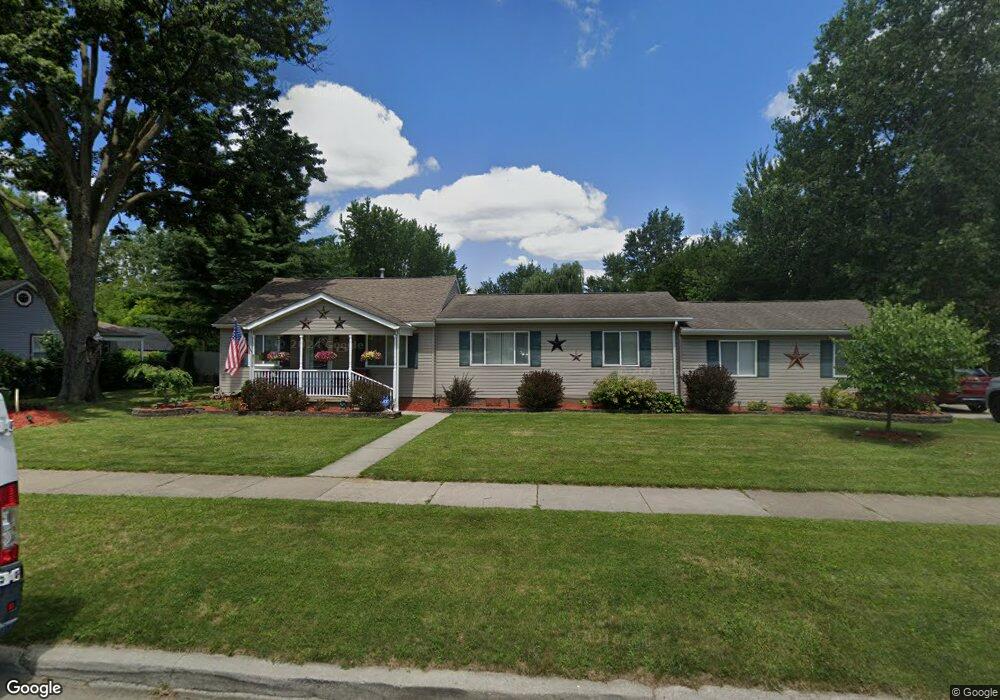
28072 Eton St Westland, MI 48186
Estimated Value: $72,000 - $180,000
--
Bed
1
Bath
1,452
Sq Ft
$102/Sq Ft
Est. Value
About This Home
This home is located at 28072 Eton St, Westland, MI 48186 and is currently estimated at $148,583, approximately $102 per square foot. 28072 Eton St is a home located in Wayne County with nearby schools including Taylor Parks Elementary School, Hoover Middle School, and Taylor High School.
Ownership History
Date
Name
Owned For
Owner Type
Purchase Details
Closed on
Jan 25, 2010
Sold by
Bale Leonard and Evans Bale Carol L
Bought by
Dickerson James
Current Estimated Value
Purchase Details
Closed on
Dec 22, 2004
Sold by
Bale Leonard and Evans Bale Carol L
Bought by
Brown Caleb
Purchase Details
Closed on
Aug 10, 1999
Sold by
First Independence Capit
Bought by
Bale Leonard Bale
Create a Home Valuation Report for This Property
The Home Valuation Report is an in-depth analysis detailing your home's value as well as a comparison with similar homes in the area
Home Values in the Area
Average Home Value in this Area
Purchase History
| Date | Buyer | Sale Price | Title Company |
|---|---|---|---|
| Dickerson James | $20,000 | None Available | |
| Brown Caleb | -- | Colonial Title Co | |
| Bale Leonard Bale | $25,000 | -- |
Source: Public Records
Tax History Compared to Growth
Tax History
| Year | Tax Paid | Tax Assessment Tax Assessment Total Assessment is a certain percentage of the fair market value that is determined by local assessors to be the total taxable value of land and additions on the property. | Land | Improvement |
|---|---|---|---|---|
| 2025 | $1,465 | $94,500 | $0 | $0 |
| 2024 | $1,465 | $93,700 | $0 | $0 |
| 2023 | $2,221 | $77,000 | $0 | $0 |
| 2022 | $3,245 | $65,100 | $0 | $0 |
| 2021 | $2,881 | $55,200 | $0 | $0 |
| 2020 | $2,746 | $43,300 | $0 | $0 |
| 2019 | $2,806 | $37,700 | $0 | $0 |
| 2018 | $1,780 | $33,200 | $0 | $0 |
| 2017 | $2,236 | $33,500 | $0 | $0 |
| 2016 | $2,852 | $34,200 | $0 | $0 |
| 2015 | $3,372 | $33,860 | $0 | $0 |
| 2013 | $3,503 | $36,170 | $0 | $0 |
| 2012 | $1,483 | $36,640 | $0 | $0 |
Source: Public Records
Map
Nearby Homes
- POWERS Powers St
- 27523 Powers St
- 4120 Ash St
- 4315 Isabelle St
- 4133 Moore St
- 4054 Moore St
- 28919 Powers St
- 4080 Isabelle St
- 3925 Spruce St
- 28951 Powers St
- 27285 Colgate St
- 29006 Eton St
- 29026 York St
- 29038 York St
- 29025 Powers St
- 28654 N Maple St Unit 131
- 29119 York St
- Vacant Spruce St
- 5926 Esther St
- 6002 Frederick St Unit 81