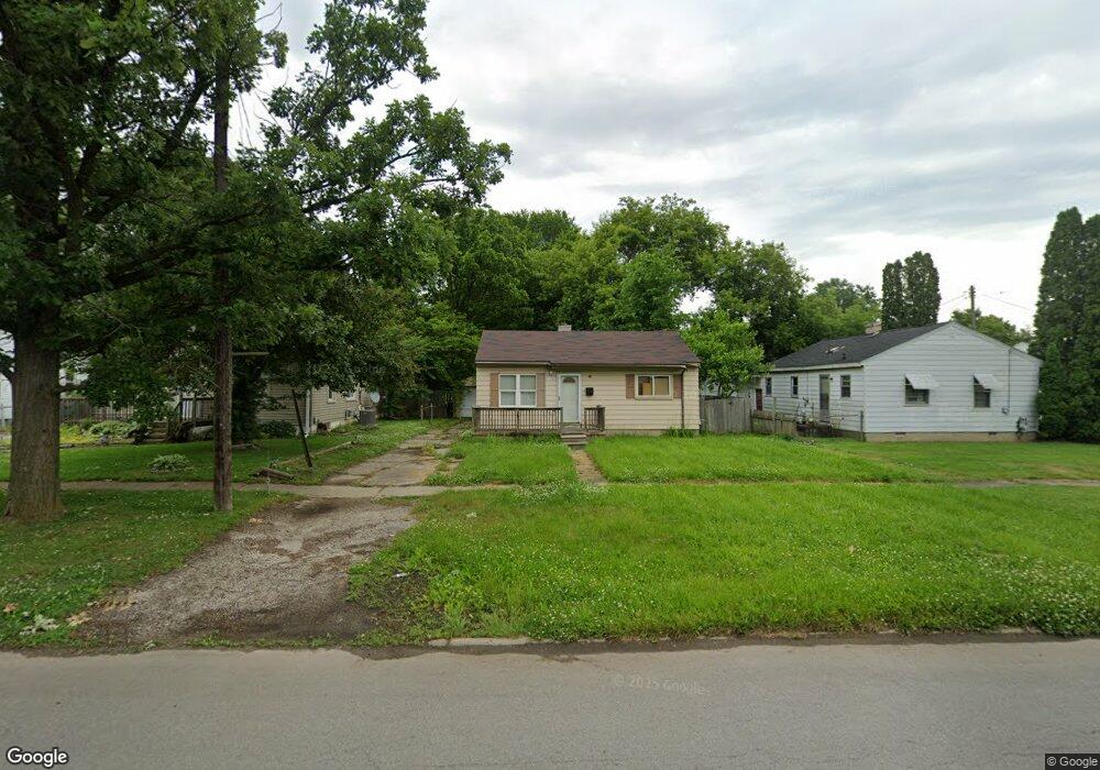
2808 Branch Rd Flint, MI 48506
Potter Longway NeighborhoodEstimated Value: $43,000 - $78,000
3
Beds
1
Bath
1,086
Sq Ft
$55/Sq Ft
Est. Value
About This Home
This home is located at 2808 Branch Rd, Flint, MI 48506 and is currently estimated at $59,988, approximately $55 per square foot. 2808 Branch Rd is a home located in Genesee County with nearby schools including Potter School, Richfield Public School Academy, and Richfield Early Learning Center.
Ownership History
Date
Name
Owned For
Owner Type
Purchase Details
Closed on
Jan 4, 2008
Sold by
Wells Fargo Bank Na
Bought by
Valu Joseph
Current Estimated Value
Purchase Details
Closed on
Feb 9, 2007
Sold by
Mortgage Electronic Registration Systems
Bought by
Wells Fargo Bank Na and Securitized Asset Backed Receivables Llc
Purchase Details
Closed on
Dec 20, 2006
Sold by
Snyder Craig A and Snyder Cherie A
Bought by
Mortgage Electronic Registration Systems
Purchase Details
Closed on
Apr 6, 2006
Sold by
Snyder Cherie Ann
Bought by
Snyder Craig Albert
Purchase Details
Closed on
Oct 15, 2004
Sold by
Miller Corrine A
Bought by
Snyder Craig A and Snyder Cherie A
Create a Home Valuation Report for This Property
The Home Valuation Report is an in-depth analysis detailing your home's value as well as a comparison with similar homes in the area
Home Values in the Area
Average Home Value in this Area
Purchase History
| Date | Buyer | Sale Price | Title Company |
|---|---|---|---|
| Valu Joseph | $16,000 | Attorneys Title Agency | |
| Wells Fargo Bank Na | -- | None Available | |
| Mortgage Electronic Registration Systems | $58,607 | None Available | |
| Snyder Craig Albert | -- | None Available | |
| Snyder Craig A | $36,000 | Metropolitan Title Company |
Source: Public Records
Tax History
| Year | Tax Paid | Tax Assessment Tax Assessment Total Assessment is a certain percentage of the fair market value that is determined by local assessors to be the total taxable value of land and additions on the property. | Land | Improvement |
|---|---|---|---|---|
| 2025 | $988 | $26,300 | $0 | $0 |
| 2024 | $919 | $23,700 | $0 | $0 |
| 2023 | $901 | $18,600 | $0 | $0 |
| 2022 | $0 | $14,600 | $0 | $0 |
| 2021 | $911 | $13,600 | $0 | $0 |
| 2020 | $842 | $11,600 | $0 | $0 |
| 2019 | $826 | $10,000 | $0 | $0 |
| 2018 | $808 | $8,400 | $0 | $0 |
| 2017 | $869 | $0 | $0 | $0 |
| 2016 | $864 | $0 | $0 | $0 |
| 2015 | -- | $0 | $0 | $0 |
| 2014 | -- | $0 | $0 | $0 |
| 2012 | -- | $12,700 | $0 | $0 |
Source: Public Records
Map
Nearby Homes
- 2719 Branch Rd
- 3018 Dakota Ave
- 2701 Branch Rd
- 3314 Dakota Ave
- 3149 Whittier Ave
- 3118 Wyoming Ave
- 3010 Wyoming Ave
- 3413 Dakota Ave
- 3210 Wyoming Ave
- 2426 Hoff St
- 3213 Holly Ave
- 3602 Dakota Ave
- 2211 Torrance St
- 3006 Agree Ave
- 2002 Branch Rd
- 3232 Dale Ave
- 2321 Levern St
- 2217 Maryland Ave
- 2426 Broadway Blvd
- 3614 Holly Ave
- 2820 Branch Rd
- 3103 Maryland Ave
- 2814 Branch Rd
- 3111 Maryland Ave
- 3115 Maryland Ave
- 3119 Maryland Ave
- 2718 Branch Rd
- 2805 Branch Rd
- 2801 Branch Rd
- 3120 Dakota Ave
- 2813 Branch Rd
- 2902 Branch Rd
- 3112 Maryland Ave
- 3116 Maryland Ave
- 3109 Dakota Ave
- 2714 Branch Rd
- 3127 Maryland Ave
- 2710 Branch Rd
- 3029 Maryland Ave
- 3126 Dakota Ave
Your Personal Tour Guide
Ask me questions while you tour the home.