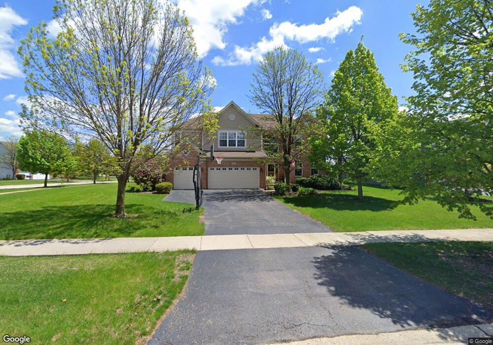
2809 Mc Duffee Cir North Aurora, IL 60542
Nelson Lake NeighborhoodEstimated Value: $569,000 - $680,000
6
Beds
4
Baths
4,073
Sq Ft
$154/Sq Ft
Est. Value
About This Home
This home is located at 2809 Mc Duffee Cir, North Aurora, IL 60542 and is currently estimated at $627,917, approximately $154 per square foot. 2809 Mc Duffee Cir is a home located in Kane County with nearby schools including Fearn Elementary School, Herget Middle School, and West Aurora High School.
Ownership History
Date
Name
Owned For
Owner Type
Purchase Details
Closed on
May 20, 2003
Sold by
Neumann Homes Inc
Bought by
Moore Philip Andrew and Moore Julie Anne
Current Estimated Value
Home Financials for this Owner
Home Financials are based on the most recent Mortgage that was taken out on this home.
Original Mortgage
$305,765
Outstanding Balance
$130,178
Interest Rate
5.51%
Mortgage Type
Purchase Money Mortgage
Estimated Equity
$497,739
Create a Home Valuation Report for This Property
The Home Valuation Report is an in-depth analysis detailing your home's value as well as a comparison with similar homes in the area
Home Values in the Area
Average Home Value in this Area
Purchase History
| Date | Buyer | Sale Price | Title Company |
|---|---|---|---|
| Moore Philip Andrew | $382,500 | Chicago Title Insurance Comp |
Source: Public Records
Mortgage History
| Date | Status | Borrower | Loan Amount |
|---|---|---|---|
| Open | Moore Philip Andrew | $305,765 | |
| Closed | Moore Philip Andrew | $38,200 |
Source: Public Records
Tax History Compared to Growth
Tax History
| Year | Tax Paid | Tax Assessment Tax Assessment Total Assessment is a certain percentage of the fair market value that is determined by local assessors to be the total taxable value of land and additions on the property. | Land | Improvement |
|---|---|---|---|---|
| 2024 | $13,321 | $181,591 | $12,735 | $168,856 |
| 2023 | $11,167 | $163,891 | $11,494 | $152,397 |
| 2022 | $12,159 | $171,526 | $10,549 | $160,977 |
| 2021 | $11,944 | $164,171 | $10,097 | $154,074 |
| 2020 | $11,856 | $160,323 | $9,860 | $150,463 |
| 2019 | $12,422 | $140,076 | $9,715 | $130,361 |
| 2018 | $12,247 | $133,975 | $9,715 | $124,260 |
| 2017 | $12,448 | $132,452 | $9,605 | $122,847 |
| 2016 | $11,654 | $120,975 | $9,352 | $111,623 |
| 2015 | -- | $111,074 | $8,987 | $102,087 |
| 2014 | -- | $113,703 | $10,000 | $103,703 |
| 2013 | -- | $113,703 | $10,000 | $103,703 |
Source: Public Records
Map
Nearby Homes
- 2772 Berman Rd Unit 1A
- 483 Glover Dr
- 512 Bennett Dr
- 2045 Bartram Rd
- 965 Carmen Rd
- 921 N Deerpath Rd
- 868 Fair Meadow Ct
- 876 Fair Meadow Ct
- 916 Fair Meadow St
- 867 Fair Meadow Ct
- 875 Fair Meadow Ct
- 909 Fair Meadow St
- 917 Fair Meadow St
- Maxfield Plan at Autumn Ridge
- Morgan Plan at Autumn Ridge
- Newbury Plan at Autumn Ridge
- Quinn Plan at Autumn Ridge
- Paxton Plan at Autumn Ridge
- Leyden Plan at Autumn Ridge
- 1799 Breton Ave
- 2801 Mc Duffee Cir
- 2836 Berman Rd Unit 1A
- 2857 Mc Duffee Cir
- 2793 Mc Duffee Cir Unit 1A
- 2828 Berman Rd
- 2845 Berman Rd Unit 1A
- 2840 Mc Duffee Cir Unit 1A
- 2785 Mc Duffee Cir Unit 1A
- 2865 Mc Duffee Cir
- 2837 Berman Rd Unit 1A
- 2832 Mc Duffee Cir Unit 1A
- 2848 Mc Duffee Cir
- 2824 Mc Duffee Cir
- 2820 Berman Rd Unit 1A
- 2829 Berman Rd
- 2777 Mc Duffee Cir Unit 1A
- 2873 Mc Duffee Cir Unit 1A
- 2816 Mc Duffee Cir Unit 1A
- 2864 Mc Duffee Cir Unit 1A
- 2821 Berman Rd Unit 1A