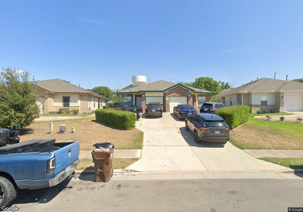
2809 Southampton Way Unit B Round Rock, TX 78664
Forest Creek NeighborhoodEstimated Value: $291,315 - $552,000
--
Bed
4
Baths
1,134
Sq Ft
$372/Sq Ft
Est. Value
About This Home
This home is located at 2809 Southampton Way Unit B, Round Rock, TX 78664 and is currently estimated at $421,658, approximately $371 per square foot. 2809 Southampton Way Unit B is a home located in Williamson County with nearby schools including Gattis Elementary School, Ridgeview Middle School, and Cedar Ridge High School.
Ownership History
Date
Name
Owned For
Owner Type
Purchase Details
Closed on
Jan 30, 2013
Sold by
Nguyen Lien Ngoc Mai
Bought by
Tra Bao Michael
Current Estimated Value
Purchase Details
Closed on
Dec 27, 2011
Sold by
Sepich Family Limited Partnership
Bought by
Bui Dinh K and Nguyen Lien Ngoc Mai
Purchase Details
Closed on
Mar 10, 2005
Sold by
Martin Timothy J
Bought by
Sepich Family Lp
Create a Home Valuation Report for This Property
The Home Valuation Report is an in-depth analysis detailing your home's value as well as a comparison with similar homes in the area
Home Values in the Area
Average Home Value in this Area
Purchase History
| Date | Buyer | Sale Price | Title Company |
|---|---|---|---|
| Tra Bao Michael | -- | None Available | |
| Bui Dinh K | -- | Independence Title Company | |
| Sepich Family Lp | -- | Alamo Title Company |
Source: Public Records
Tax History Compared to Growth
Tax History
| Year | Tax Paid | Tax Assessment Tax Assessment Total Assessment is a certain percentage of the fair market value that is determined by local assessors to be the total taxable value of land and additions on the property. | Land | Improvement |
|---|---|---|---|---|
| 2025 | $5,122 | $274,797 | $64,000 | $210,797 |
| 2024 | $5,122 | $289,174 | $110,500 | $178,674 |
| 2023 | $4,955 | $282,502 | $80,000 | $202,502 |
| 2022 | $5,371 | $283,235 | $60,000 | $223,235 |
| 2021 | $4,315 | $192,232 | $34,000 | $158,232 |
| 2020 | $3,879 | $171,837 | $31,761 | $140,076 |
| 2019 | $3,837 | $166,181 | $32,100 | $134,081 |
| 2018 | $3,386 | $146,659 | $32,100 | $114,559 |
| 2017 | $3,192 | $135,488 | $30,000 | $105,488 |
| 2016 | $2,971 | $126,091 | $30,000 | $96,091 |
| 2015 | $2,518 | $118,092 | $20,000 | $98,092 |
| 2014 | $2,518 | $107,017 | $0 | $0 |
Source: Public Records
Map
Nearby Homes
- 3225 Elizabeth Anne Ln
- 2727 High Point Dr
- 2801 Adelen Ln
- 2880 Donnell Dr Unit 503
- 2880 Donnell Dr Unit 702
- 2880 Donnell Dr Unit 2003
- 2639 Tandi Trail
- 2703 Vinson Ct
- 3403 Kelsey Cove
- 2508 Eastwood Ln
- Lavaca Plan at Center 45
- 18909 Schultz Ln
- 18909 Schultz Ln Unit 1102
- Frio Plan at Center 45
- Pecos Plan at Center 45
- Aspen Plan at Center 45
- 18909 Schultz Ln Unit 1002
- Comal Plan at Center 45
- 3409 Shiraz Loop
- 228 Timothy John Dr
- 2809 Southampton Way Unit A
- 2807 Southampton Way Unit B
- 2807 Southampton Way Unit A
- 2807 Southampton Way
- 2811 Southampton Way Unit B
- 2811 Southampton Way Unit A
- 2805 Southampton Way
- 2805 Southampton Way Unit B
- 2805 Southampton Way Unit A
- 2909 Flower Hill Dr
- 2911 Flower Hill Dr
- 2907 Flower Hill Dr
- 2913 Flower Hill Dr
- 2813 Southampton Way Unit B
- 2813 Southampton Way Unit A
- 2813 Southampton Way
- 2905 Flower Hill Dr
- 2812 B Southampton
- 2812 Southampton Way Unit B
- 2812 Southampton Way Unit A