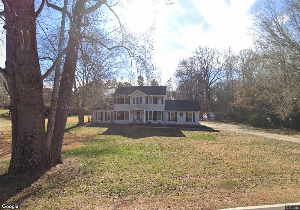
281 Big Indian Loop Mooresville, NC 28117
Estimated Value: $426,389 - $586,000
3
Beds
3
Baths
2,012
Sq Ft
$263/Sq Ft
Est. Value
About This Home
This home is located at 281 Big Indian Loop, Mooresville, NC 28117 and is currently estimated at $528,347, approximately $262 per square foot. 281 Big Indian Loop is a home located in Iredell County with nearby schools including Lakeshore Elementary School, Lakeshore Middle School, and Lake Norman High School.
Ownership History
Date
Name
Owned For
Owner Type
Purchase Details
Closed on
Jul 17, 1998
Sold by
Traynor Kevin M and Traynor Marion
Bought by
Carr Randy W and Lane Jackie B
Current Estimated Value
Home Financials for this Owner
Home Financials are based on the most recent Mortgage that was taken out on this home.
Original Mortgage
$180,400
Outstanding Balance
$34,942
Interest Rate
7%
Estimated Equity
$493,405
Purchase Details
Closed on
Aug 1, 1988
Purchase Details
Closed on
Mar 1, 1988
Purchase Details
Closed on
Nov 1, 1987
Create a Home Valuation Report for This Property
The Home Valuation Report is an in-depth analysis detailing your home's value as well as a comparison with similar homes in the area
Home Values in the Area
Average Home Value in this Area
Purchase History
| Date | Buyer | Sale Price | Title Company |
|---|---|---|---|
| Carr Randy W | $190,000 | -- | |
| -- | -- | -- | |
| -- | -- | -- | |
| -- | -- | -- |
Source: Public Records
Mortgage History
| Date | Status | Borrower | Loan Amount |
|---|---|---|---|
| Open | Carr Randy W | $180,400 |
Source: Public Records
Tax History
| Year | Tax Paid | Tax Assessment Tax Assessment Total Assessment is a certain percentage of the fair market value that is determined by local assessors to be the total taxable value of land and additions on the property. | Land | Improvement |
|---|---|---|---|---|
| 2025 | $2,153 | $354,750 | $56,250 | $298,500 |
| 2024 | $2,153 | $354,750 | $56,250 | $298,500 |
| 2023 | $2,153 | $354,750 | $56,250 | $298,500 |
| 2022 | $1,445 | $220,670 | $48,750 | $171,920 |
| 2021 | $1,441 | $220,670 | $48,750 | $171,920 |
| 2020 | $1,441 | $220,670 | $48,750 | $171,920 |
| 2019 | $1,375 | $220,670 | $48,750 | $171,920 |
| 2018 | $1,328 | $213,620 | $54,000 | $159,620 |
| 2017 | $1,328 | $213,620 | $54,000 | $159,620 |
| 2016 | $1,328 | $213,620 | $54,000 | $159,620 |
| 2015 | $1,328 | $213,620 | $54,000 | $159,620 |
| 2014 | $1,351 | $234,110 | $63,000 | $171,110 |
Source: Public Records
Map
Nearby Homes
- 123 Palos Verde Dr
- 127 Palos Verde Dr
- 147 Castle Dr
- 110 Hunts Landing Dr
- 117 Hunts Landing Dr
- 103 Spartina Ct
- 162 W Maranta Rd
- 108 Fransher Ln
- 112 Fransher Ln
- 272 Glencoe Ln
- 130 Canoe Pole Ln
- 150 Coronilla Rd
- 108 Heron Cove Loop Unit 62
- 128 Comata Rd
- 000 Bluefield Rd
- 123 Comata Rd
- 158 Eagles Landing Dr
- 149 Little Indian Loop
- 145 Walmsley Place
- 200 Ervin Rd Unit Caldwell
- 289 Big Indian Loop
- 104 Cherokee Dr
- 114 Cherokee Dr
- 286 Big Indian Loop
- 8 Palos Verde Dr
- 00 Palos Verde Dr
- 16 Palos Verde Dr
- 120 Cherokee Dr
- 106 Palos Verde Dr
- 295 Big Indian Loop
- 299 Big Indian Loop
- 124 Cherokee Dr
- 107 Cherokee Dr
- 105 Palos Verde Dr
- 11 Palos Verde Dr Unit 11
- 116 Palos Verde Dr Unit 15
- 116 Palos Verde Dr
- 280 Big Indian Loop
- 120 Palos Verde Dr
- 115 Cherokee Dr
Your Personal Tour Guide
Ask me questions while you tour the home.