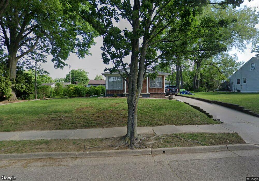
281 E Boxwood Ave Akron, OH 44301
Firestone Park NeighborhoodEstimated Value: $103,840 - $116,000
Studio
--
Bath
--
Sq Ft
4,008
Sq Ft Lot
About This Home
This home is located at 281 E Boxwood Ave, Akron, OH 44301 and is currently estimated at $109,920. 281 E Boxwood Ave is a home located in Summit County with nearby schools including Kenmore Garfield Community Learning Center, Main Preparatory Academy, and Eagle Elementary.
Ownership History
Date
Name
Owned For
Owner Type
Purchase Details
Closed on
Nov 3, 2020
Sold by
Harry Nichols
Bought by
Nichols Harry
Current Estimated Value
Purchase Details
Closed on
May 23, 2002
Sold by
Nichols Doris I
Bought by
Nichols Harry
Purchase Details
Closed on
Mar 1, 2000
Sold by
Nichols Jean
Bought by
Nichols Doris I
Create a Home Valuation Report for This Property
The Home Valuation Report is an in-depth analysis detailing your home's value as well as a comparison with similar homes in the area
Home Values in the Area
Average Home Value in this Area
Purchase History
| Date | Buyer | Sale Price | Title Company |
|---|---|---|---|
| Nichols Harry | -- | Flasck Estelle D | |
| Nichols Harry | -- | -- | |
| Nichols Doris I | -- | -- |
Source: Public Records
Tax History
| Year | Tax Paid | Tax Assessment Tax Assessment Total Assessment is a certain percentage of the fair market value that is determined by local assessors to be the total taxable value of land and additions on the property. | Land | Improvement |
|---|---|---|---|---|
| 2025 | $317 | $4,138 | $3,693 | $445 |
| 2024 | $317 | $4,138 | $3,693 | $445 |
| 2023 | $317 | $4,138 | $3,693 | $445 |
| 2022 | $308 | $3,119 | $2,674 | $445 |
| 2021 | $308 | $3,119 | $2,674 | $445 |
| 2020 | $305 | $3,120 | $2,670 | $450 |
| 2019 | $335 | $3,240 | $2,670 | $570 |
| 2018 | $332 | $3,240 | $2,670 | $570 |
| 2017 | $336 | $3,240 | $2,670 | $570 |
| 2016 | $336 | $3,240 | $2,670 | $570 |
| 2015 | $336 | $3,240 | $2,670 | $570 |
| 2014 | $334 | $3,240 | $2,670 | $570 |
| 2013 | $322 | $3,140 | $2,670 | $470 |
Source: Public Records
Map
Nearby Homes
- 1842 Thornapple Ave
- 231 E Dresden Ave
- 1878 Carter Ave Unit 1880
- 1905 Carter Ave Unit 1907
- 248 E Catawba Ave
- 367 Wayne Ave
- 244 E Catawba Ave
- 106 Selden Ave
- 502 E Woodsdale Ave
- 2069 Penguin Ave
- 1597 Glenmount Ave
- 457 S Firestone Blvd
- 2146 Stonehenge Cir
- 1726 Coventry St
- 37 & 39 W Woodsdale Ave
- 2162 Thornbury Ln
- 1612 Oakwood Ave
- 30 Youtz Ave
- 178 Mission Dr
- 1595 Redwood Ave
- 281 E Boxwood Ave
- 1967 Thornapple Ave
- 1961 Thornapple Ave
- 280 E Ralston Ave
- 280 E Ralston Ave
- 1957 Thornapple Ave
- 286 E Ralston Ave
- 289 E Boxwood Ave
- 270 E Ralston Ave
- 294 E Ralston Ave
- 300 E Ralston Ave
- 303 E Boxwood Ave
- 271 E Ralston Ave
- 1968 Thornapple Ave
- 279 E Ralston Ave
- 1962 Thornapple Ave
- 285 E Ralston Ave
- 287 E Waterloo Rd
- 1952 Thornapple Ave
- 252 E Boxwood Ave
Your Personal Tour Guide
Ask me questions while you tour the home.