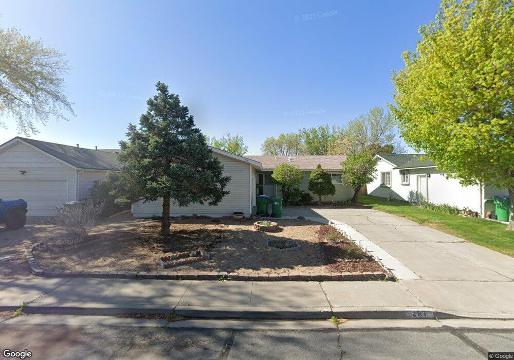
281 Elges Way Sparks, NV 89431
McCarran Boulevard-Probasco NeighborhoodEstimated Value: $416,678 - $456,000
3
Beds
2
Baths
1,333
Sq Ft
$325/Sq Ft
Est. Value
About This Home
This home is located at 281 Elges Way, Sparks, NV 89431 and is currently estimated at $433,170, approximately $324 per square foot. 281 Elges Way is a home located in Washoe County with nearby schools including Lena Juniper Elementary School, Lou Mendive Middle School, and Edward C Reed High School.
Ownership History
Date
Name
Owned For
Owner Type
Purchase Details
Closed on
Aug 4, 2004
Sold by
Rinaldi David A and Rinaldi Rosemary
Bought by
Rhuys Caroline A
Current Estimated Value
Home Financials for this Owner
Home Financials are based on the most recent Mortgage that was taken out on this home.
Original Mortgage
$156,000
Outstanding Balance
$78,230
Interest Rate
6.17%
Mortgage Type
Unknown
Estimated Equity
$354,940
Purchase Details
Closed on
Jun 2, 1999
Sold by
Rinaldi David A and Rinaldi Rosemary
Bought by
Rinaldi David A and Rinaldi Rosemary
Purchase Details
Closed on
Dec 11, 1997
Sold by
Morros Connie M and Altman Connie M
Bought by
Rinaldi David A and Rinaldi Rosemary
Home Financials for this Owner
Home Financials are based on the most recent Mortgage that was taken out on this home.
Original Mortgage
$85,400
Interest Rate
7.19%
Create a Home Valuation Report for This Property
The Home Valuation Report is an in-depth analysis detailing your home's value as well as a comparison with similar homes in the area
Home Values in the Area
Average Home Value in this Area
Purchase History
| Date | Buyer | Sale Price | Title Company |
|---|---|---|---|
| Rhuys Caroline A | $216,000 | Stewart Title Of Northern Nv | |
| Rinaldi David A | -- | -- | |
| Rinaldi David A | $122,000 | First American Title Co |
Source: Public Records
Mortgage History
| Date | Status | Borrower | Loan Amount |
|---|---|---|---|
| Open | Rhuys Caroline A | $156,000 | |
| Previous Owner | Rinaldi David A | $85,400 |
Source: Public Records
Tax History Compared to Growth
Tax History
| Year | Tax Paid | Tax Assessment Tax Assessment Total Assessment is a certain percentage of the fair market value that is determined by local assessors to be the total taxable value of land and additions on the property. | Land | Improvement |
|---|---|---|---|---|
| 2025 | $1,140 | $57,377 | $36,715 | $20,662 |
| 2024 | $1,107 | $55,115 | $34,755 | $20,360 |
| 2023 | $827 | $53,783 | $34,930 | $18,853 |
| 2022 | $1,075 | $43,816 | $28,455 | $15,361 |
| 2021 | $1,044 | $34,621 | $19,635 | $14,986 |
| 2020 | $1,012 | $33,438 | $17,850 | $15,588 |
| 2019 | $982 | $34,328 | $18,725 | $15,603 |
| 2018 | $954 | $29,295 | $13,545 | $15,750 |
| 2017 | $926 | $28,324 | $12,075 | $16,249 |
| 2016 | $903 | $28,624 | $11,550 | $17,074 |
| 2015 | $901 | $26,915 | $9,415 | $17,500 |
| 2014 | $875 | $25,257 | $7,980 | $17,277 |
| 2013 | -- | $23,412 | $5,985 | $17,427 |
Source: Public Records
Map
Nearby Homes
- 3245 Elaine Way
- 3465 Dawn Cir
- 465 Lenwood Dr
- 119 Devere Way
- 120 E Lenwood Dr
- 3545 4th St
- 780 Emerson Way
- 3607 Keogh Dr
- 3595 Rocky Ridge Ct
- 10 Sheridan Way
- 2865 Patrice Dr
- 3071 Meadowlands Dr
- 5650 Wedekind Rd
- 3104 Sandy St
- 3332 Shari Way
- 3252 Holman Way
- 3200 Bristle Branch Dr
- 3198 Bristle Branch Dr
- 3188 Bristle Branch Dr
- 3167 Bristle Branch Dr
- 243 Elges Way
- 303 Elges Way
- 282 Granada Dr
- 220 Granada Dr
- 300 Granada Dr
- 313 Elges Way
- 215 Elges Way
- 292 Elges Way
- 310 Granada Dr
- 198 Granada Dr
- 250 Elges Way
- 312 Elges Way
- 177 Elges Way
- 220 Elges Way
- 333 Elges Way
- 322 Elges Way Unit 6B
- 330 Granada Dr
- 154 Granada Dr
- 190 Elges Way
- 123 Elges Way Unit 6B