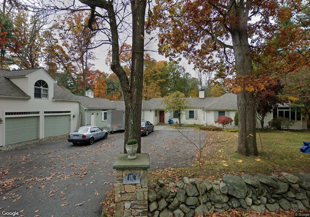
281 Goodmans Hill Rd Sudbury, MA 01776
Estimated Value: $1,497,000 - $1,696,000
4
Beds
4
Baths
4,995
Sq Ft
$317/Sq Ft
Est. Value
About This Home
This home is located at 281 Goodmans Hill Rd, Sudbury, MA 01776 and is currently estimated at $1,583,893, approximately $317 per square foot. 281 Goodmans Hill Rd is a home located in Middlesex County with nearby schools including Peter Noyes Elementary School, Ephraim Curtis Middle School, and Lincoln-Sudbury Regional High School.
Ownership History
Date
Name
Owned For
Owner Type
Purchase Details
Closed on
Nov 29, 2007
Sold by
Eisel Maria and Eisel Robert A
Bought by
Boursiquot-King Anne M and King David S
Current Estimated Value
Home Financials for this Owner
Home Financials are based on the most recent Mortgage that was taken out on this home.
Original Mortgage
$650,000
Outstanding Balance
$415,236
Interest Rate
6.48%
Mortgage Type
Purchase Money Mortgage
Estimated Equity
$1,168,657
Create a Home Valuation Report for This Property
The Home Valuation Report is an in-depth analysis detailing your home's value as well as a comparison with similar homes in the area
Home Values in the Area
Average Home Value in this Area
Purchase History
| Date | Buyer | Sale Price | Title Company |
|---|---|---|---|
| Boursiquot-King Anne M | $845,000 | -- |
Source: Public Records
Mortgage History
| Date | Status | Borrower | Loan Amount |
|---|---|---|---|
| Open | Boursiquot-King Anne M | $650,000 |
Source: Public Records
Tax History Compared to Growth
Tax History
| Year | Tax Paid | Tax Assessment Tax Assessment Total Assessment is a certain percentage of the fair market value that is determined by local assessors to be the total taxable value of land and additions on the property. | Land | Improvement |
|---|---|---|---|---|
| 2025 | $18,300 | $1,250,000 | $433,200 | $816,800 |
| 2024 | $17,662 | $1,208,900 | $420,600 | $788,300 |
| 2023 | $17,380 | $1,102,100 | $389,400 | $712,700 |
| 2022 | $15,653 | $867,200 | $357,400 | $509,800 |
| 2021 | $14,900 | $791,300 | $357,400 | $433,900 |
| 2020 | $14,599 | $791,300 | $357,400 | $433,900 |
| 2019 | $14,172 | $791,300 | $357,400 | $433,900 |
| 2018 | $14,613 | $815,000 | $381,100 | $433,900 |
| 2017 | $14,128 | $796,400 | $362,500 | $433,900 |
| 2016 | $13,701 | $769,700 | $348,700 | $421,000 |
| 2015 | $13,158 | $747,600 | $335,300 | $412,300 |
| 2014 | $13,146 | $729,100 | $325,400 | $403,700 |
Source: Public Records
Map
Nearby Homes
- 268 Old Sudbury Rd
- 7 Nashoba Rd
- 270 Old Lancaster Rd
- 377 Concord Rd
- 20 Kato Dr
- 4 Kato Summit
- 427 Concord Rd
- 10 Bradley Place
- 210 Plympton Rd
- 447 Peakham Rd
- 23 Massasoit Ave
- 24 Goodnow Rd
- 89 Bridle Path
- 40 Tall Pine Dr Unit 12
- 1011 Boston Post Rd
- 271 Landham Rd
- 16 Meadowbrook Cir
- 14 Tanbark Rd
- 0 Robbins Rd
- 7 Adams Rd
- 273 Goodmans Hill Rd
- 5 Bostonian Way Unit Lot 1
- 280 Goodmans Hill Rd
- 6 Bostonian Way
- 286 Goodmans Hill Rd
- 295 Goodmans Hill Rd
- 11 Antique Cir
- 267 Goodmans Hill Rd
- 3 Olde Bostonian Way
- 2 Bostonian Way Unit Lot 2
- 2 Bostonian Way
- 2 Bostonian Way
- 12 Antique Cir
- 304 Goodmans Hill Rd
- 261 Goodmans Hill Rd
- 19 Brewster Rd
- 252 Concord Rd
- 236 Concord Rd
- 31 Plantation Cir
- 16 Brewster Rd