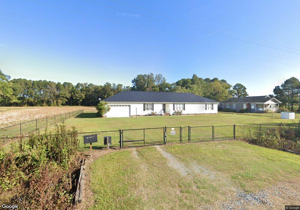
281 King Rd Clinton, NC 28328
Estimated Value: $285,000 - $429,336
3
Beds
2
Baths
2,550
Sq Ft
$135/Sq Ft
Est. Value
About This Home
This home is located at 281 King Rd, Clinton, NC 28328 and is currently estimated at $344,334, approximately $135 per square foot. 281 King Rd is a home located in Sampson County with nearby schools including Hargrove Elementary School, Hobbton Middle School, and Hobbton High School.
Ownership History
Date
Name
Owned For
Owner Type
Purchase Details
Closed on
Apr 5, 2005
Sold by
Raynor Rayford and Raynor Doris P
Bought by
Raynor Edward Aron and Thornton Geneva An
Current Estimated Value
Create a Home Valuation Report for This Property
The Home Valuation Report is an in-depth analysis detailing your home's value as well as a comparison with similar homes in the area
Home Values in the Area
Average Home Value in this Area
Purchase History
| Date | Buyer | Sale Price | Title Company |
|---|---|---|---|
| Raynor Edward Aron | $25,000 | -- |
Source: Public Records
Tax History Compared to Growth
Tax History
| Year | Tax Paid | Tax Assessment Tax Assessment Total Assessment is a certain percentage of the fair market value that is determined by local assessors to be the total taxable value of land and additions on the property. | Land | Improvement |
|---|---|---|---|---|
| 2025 | $2,393 | $361,980 | $31,171 | $330,809 |
| 2024 | $2,155 | $361,980 | $31,171 | $330,809 |
| 2023 | $1,814 | $247,648 | $27,105 | $220,543 |
| 2022 | $1,814 | $247,648 | $27,105 | $220,543 |
| 2021 | $1,803 | $246,448 | $27,105 | $219,343 |
| 2020 | $1,803 | $246,448 | $27,105 | $219,343 |
| 2019 | $1,803 | $246,448 | $0 | $0 |
| 2018 | $1,656 | $230,025 | $0 | $0 |
| 2017 | $2,059 | $230,025 | $0 | $0 |
| 2016 | $2,070 | $230,025 | $0 | $0 |
| 2015 | $2,070 | $230,025 | $0 | $0 |
| 2014 | $2,070 | $230,025 | $0 | $0 |
Source: Public Records
Map
Nearby Homes
- 178 Westbrook Rd
- 3014 Basstown Rd
- 243 Sandhole Rd
- 1399 Basstown Rd
- 1 Basstown Rd
- Lot 5 Crumpler Lake Ln
- 21 Cedar View Ln
- 1429 Isaac Weeks Rd
- 0 Hobbton Hwy
- 87 Cedar Lake Ln
- 90 Miry Creek Ln
- 30 Northgate Ln
- 118 Northgate Ln
- 104 Sunny Acres Ln
- 101 Sunny Acres Ln
- 105 Sunny Acres Ln
- 103 Sunny Acres Ln
- 706 Walking Stick Trail
- 504 Dark Horse Ln
- 1012 Raleigh Rd