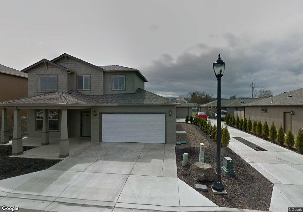
281 Mac Ct Central Point, OR 97502
Estimated Value: $440,000 - $515,000
4
Beds
4
Baths
2,331
Sq Ft
$203/Sq Ft
Est. Value
About This Home
This home is located at 281 Mac Ct, Central Point, OR 97502 and is currently estimated at $473,315, approximately $203 per square foot. 281 Mac Ct is a home with nearby schools including Richardson Elementary School, Scenic Middle School, and Crater High School.
Ownership History
Date
Name
Owned For
Owner Type
Purchase Details
Closed on
Oct 9, 2020
Sold by
Newport Peter and Knight Kelly
Bought by
Brown Wendi L and Brown Debra J
Current Estimated Value
Home Financials for this Owner
Home Financials are based on the most recent Mortgage that was taken out on this home.
Original Mortgage
$262,500
Interest Rate
2.8%
Mortgage Type
New Conventional
Purchase Details
Closed on
Sep 9, 2009
Sold by
Montero L Ann
Bought by
Stone Craig and Stone Deborah
Create a Home Valuation Report for This Property
The Home Valuation Report is an in-depth analysis detailing your home's value as well as a comparison with similar homes in the area
Purchase History
| Date | Buyer | Sale Price | Title Company |
|---|---|---|---|
| Brown Wendi L | $350,000 | First American | |
| Stone Craig | $134,630 | First American |
Source: Public Records
Mortgage History
| Date | Status | Borrower | Loan Amount |
|---|---|---|---|
| Previous Owner | Brown Wendi L | $262,500 |
Source: Public Records
Tax History
| Year | Tax Paid | Tax Assessment Tax Assessment Total Assessment is a certain percentage of the fair market value that is determined by local assessors to be the total taxable value of land and additions on the property. | Land | Improvement |
|---|---|---|---|---|
| 2026 | $5,625 | $333,580 | $131,000 | $202,580 |
| 2025 | $5,625 | $330,010 | $65,390 | $264,620 |
| 2024 | $5,487 | $320,400 | $63,490 | $256,910 |
| 2023 | $5,310 | $311,070 | $61,640 | $249,430 |
| 2022 | $5,186 | $311,070 | $61,640 | $249,430 |
| 2021 | $5,038 | $302,010 | $59,850 | $242,160 |
| 2020 | $4,891 | $293,220 | $58,100 | $235,120 |
| 2019 | $4,770 | $276,390 | $54,760 | $221,630 |
| 2018 | $4,625 | $268,340 | $53,160 | $215,180 |
| 2017 | $4,509 | $268,340 | $53,160 | $215,180 |
| 2016 | $4,377 | $252,950 | $50,120 | $202,830 |
| 2015 | $4,194 | $252,950 | $50,120 | $202,830 |
| 2014 | $4,087 | $238,440 | $47,250 | $191,190 |
Source: Public Records
Map
Nearby Homes
- 1189 Lindsey Ct
- 436 Cheney Loop
- 827 Isherwood Dr
- 114 Cedar St
- 755 S 4th St
- 887 Silver Fox Dr
- 185 Logan Ave
- 871 Holley Way
- 895 Holley Way
- 220 S 3rd St
- 350 Alder St
- 209 Corcoran Ln
- 349 W Pine St
- 736 Hemlock Ave
- 555 Freeman Rd Unit 73
- 555 Freeman Rd Unit 254
- 555 Freeman Rd Unit 105
- 555 Freeman Rd Unit 209
- 3364 Bursell Rd
- 3358 Bursell Rd
- 285 Mac Ct
- 277 Mac Ct
- 289 Mac Ct
- 1188 Lindsey Ct
- 1190 Lindsey Ct
- 1186 Lindsey Ct
- 3503 Chicory Ln
- 1184 Lindsey Ct
- 293 Mac Ct
- 3505 Chicory Ln
- 3479 Chicory Ln
- 1180 Lindsey Ct
- 1187 Lindsey Ct
- 297 Mac Ct
- 3470 Chicory Ln
- 1240 Rochelle Ct
- 1185 Lindsey Ct
- 485 Cheney Loop Unit 8
- 485 Cheney Loop
- 1230 Rochelle Ct
Your Personal Tour Guide
Ask me questions while you tour the home.