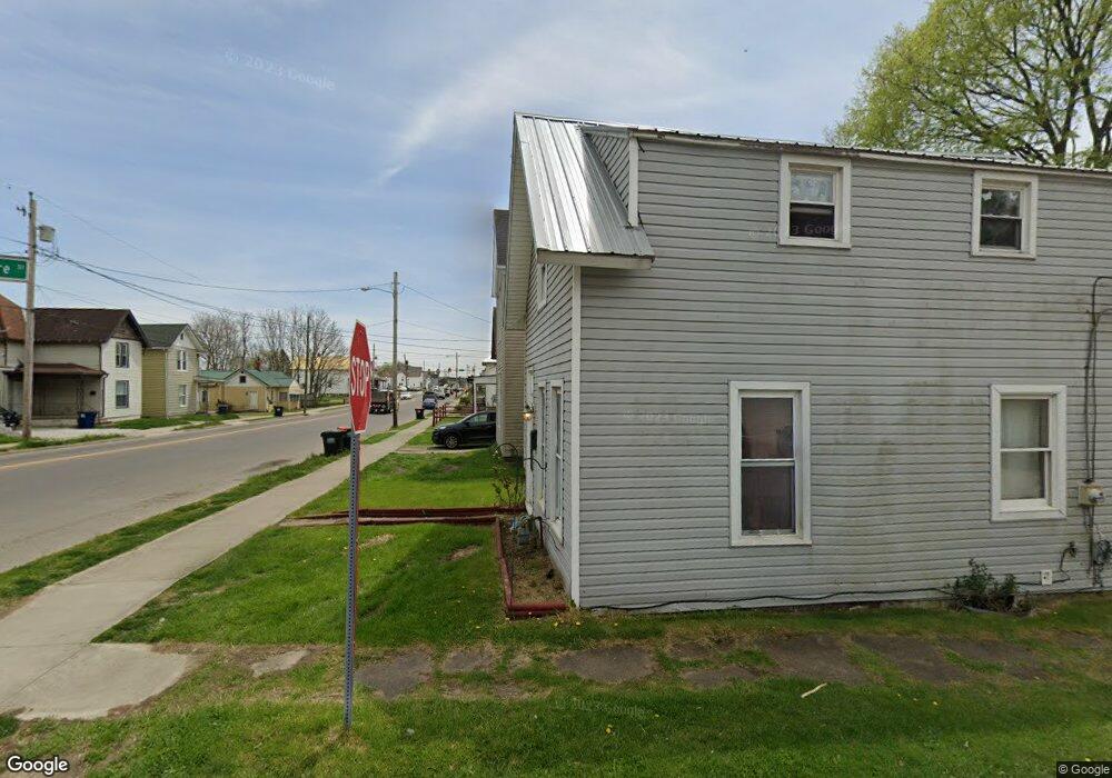
281 Mount Vernon Rd Newark, OH 43055
Estimated Value: $112,534 - $163,000
2
Beds
1
Bath
1,183
Sq Ft
$117/Sq Ft
Est. Value
About This Home
This home is located at 281 Mount Vernon Rd, Newark, OH 43055 and is currently estimated at $138,134, approximately $116 per square foot. 281 Mount Vernon Rd is a home located in Licking County with nearby schools including John Clem Elementary School, Liberty Middle School, and Newark High School.
Ownership History
Date
Name
Owned For
Owner Type
Purchase Details
Closed on
Oct 21, 2004
Sold by
Bank One Na
Bought by
Brown Dennis R
Current Estimated Value
Purchase Details
Closed on
Aug 17, 2004
Sold by
Mason Paul D and Mason Petrina M
Bought by
Bank One Na
Purchase Details
Closed on
Jan 2, 2001
Sold by
Strear James A
Bought by
Mason Paul D and Mason Petrina M
Home Financials for this Owner
Home Financials are based on the most recent Mortgage that was taken out on this home.
Original Mortgage
$42,000
Interest Rate
7.8%
Mortgage Type
New Conventional
Create a Home Valuation Report for This Property
The Home Valuation Report is an in-depth analysis detailing your home's value as well as a comparison with similar homes in the area
Home Values in the Area
Average Home Value in this Area
Purchase History
| Date | Buyer | Sale Price | Title Company |
|---|---|---|---|
| Brown Dennis R | $16,500 | Resource Title Agency Inc | |
| Bank One Na | $11,334 | -- | |
| Mason Paul D | $52,500 | -- |
Source: Public Records
Mortgage History
| Date | Status | Borrower | Loan Amount |
|---|---|---|---|
| Previous Owner | Mason Paul D | $42,000 |
Source: Public Records
Tax History
| Year | Tax Paid | Tax Assessment Tax Assessment Total Assessment is a certain percentage of the fair market value that is determined by local assessors to be the total taxable value of land and additions on the property. | Land | Improvement |
|---|---|---|---|---|
| 2024 | $907 | $24,680 | $7,630 | $17,050 |
| 2023 | $1,043 | $28,460 | $9,000 | $19,460 |
| 2022 | $642 | $15,510 | $4,590 | $10,920 |
| 2021 | $673 | $15,510 | $4,590 | $10,920 |
| 2020 | $688 | $15,510 | $4,590 | $10,920 |
| 2019 | $564 | $12,220 | $3,820 | $8,400 |
| 2018 | $565 | $0 | $0 | $0 |
| 2017 | $567 | $0 | $0 | $0 |
| 2016 | $581 | $0 | $0 | $0 |
| 2015 | $594 | $0 | $0 | $0 |
| 2014 | $740 | $0 | $0 | $0 |
| 2013 | $595 | $0 | $0 | $0 |
Source: Public Records
Map
Nearby Homes
- 69 Wallace St
- 99 Hoover St
- 242 Hudson Ave
- 12 E Saint Clair St
- 311 Clinton St
- 191 Elmwood Ave
- 27 W North St
- 122 W Shields St
- 210 Buckingham St
- 355 Eddy St
- 441 Mount Vernon Rd
- 236 N 10th St
- 24 Elizabeth St
- 218 Granville St
- 185 N 10th St
- 567 Kibler Ave
- 293 Merchant St
- 361 Granville St
- 8 N 8th St
- 54 E Stevens St
- 277 Mount Vernon Rd
- 275 Mount Vernon Rd
- 52 Commodore St
- 55 Commodore St
- 295 Mount Vernon Rd
- 271 Mount Vernon Rd
- 297 Mount Vernon Rd
- 286 Mount Vernon Rd
- 290 Mount Vernon Rd
- 290 Mount Vernon Rd Unit 292
- 286 Mt Vernon Rd
- 59 Commodore St
- 282 Mount Vernon Rd
- 301 Mount Vernon Rd
- 269 Mount Vernon Rd
- 294 Mount Vernon Rd
- 65 Commodore St
- 274 Mount Vernon Rd
- 298 Mount Vernon Rd
- 272 Mount Vernon Rd
Your Personal Tour Guide
Ask me questions while you tour the home.