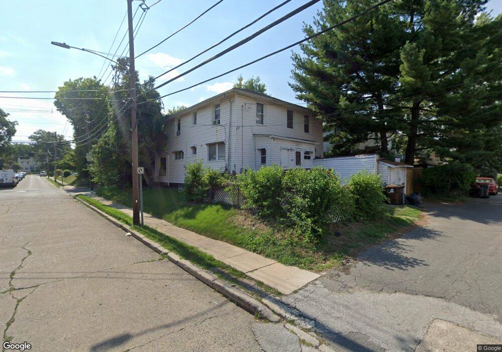
281 N Maple Ave Lansdowne, PA 19050
Estimated Value: $278,541 - $416,000
4
Beds
2
Baths
2,105
Sq Ft
$161/Sq Ft
Est. Value
About This Home
This home is located at 281 N Maple Ave, Lansdowne, PA 19050 and is currently estimated at $339,635, approximately $161 per square foot. 281 N Maple Ave is a home located in Delaware County with nearby schools including East Lansdowne Elementary School, Penn Wood Middle School, and Penn Wood High School - Cypress Street Campus.
Ownership History
Date
Name
Owned For
Owner Type
Purchase Details
Closed on
Feb 4, 2003
Sold by
Cohen Debbie
Bought by
Milord Ivana
Current Estimated Value
Home Financials for this Owner
Home Financials are based on the most recent Mortgage that was taken out on this home.
Original Mortgage
$93,750
Outstanding Balance
$40,268
Interest Rate
5.99%
Mortgage Type
Stand Alone First
Estimated Equity
$299,367
Purchase Details
Closed on
Nov 7, 2002
Sold by
Rendler Margaret B
Bought by
Cohen Debbie
Create a Home Valuation Report for This Property
The Home Valuation Report is an in-depth analysis detailing your home's value as well as a comparison with similar homes in the area
Home Values in the Area
Average Home Value in this Area
Purchase History
| Date | Buyer | Sale Price | Title Company |
|---|---|---|---|
| Milord Ivana | $125,000 | Fidelity Natl Title Ins Co O | |
| Cohen Debbie | $90,000 | -- |
Source: Public Records
Mortgage History
| Date | Status | Borrower | Loan Amount |
|---|---|---|---|
| Open | Milord Ivana | $93,750 |
Source: Public Records
Tax History
| Year | Tax Paid | Tax Assessment Tax Assessment Total Assessment is a certain percentage of the fair market value that is determined by local assessors to be the total taxable value of land and additions on the property. | Land | Improvement |
|---|---|---|---|---|
| 2025 | $5,584 | $135,630 | $33,710 | $101,920 |
| 2024 | $5,584 | $135,630 | $33,710 | $101,920 |
| 2023 | $5,324 | $135,630 | $33,710 | $101,920 |
| 2022 | $5,219 | $135,630 | $33,710 | $101,920 |
| 2021 | $7,838 | $135,630 | $33,710 | $101,920 |
| 2020 | $4,875 | $76,920 | $20,530 | $56,390 |
| 2019 | $1,753 | $76,920 | $20,530 | $56,390 |
| 2018 | $4,875 | $76,920 | $0 | $0 |
| 2017 | $1,749 | $76,920 | $0 | $0 |
| 2016 | $422 | $76,920 | $0 | $0 |
| 2015 | $431 | $76,920 | $0 | $0 |
| 2014 | $422 | $76,920 | $0 | $0 |
Source: Public Records
Map
Nearby Homes
- 291 N Wycombe Ave
- 247 Coverly Rd
- 243 Coverly Rd
- 212 N Maple Ave
- 7303 Sherbrook Blvd
- 91 Lamport Rd
- 7273 Guilford Rd
- 210 Wabash Ave
- 360 Huntley Rd
- 291 Jackson Ave
- 7265 Calvin Rd
- 7261 Calvin Rd
- 178 N Union Ave
- 0 Hirst Ave
- 217 E Greenwood Ave
- 319 Avon Rd
- 346 Long Ln
- 7283 Bradford Rd
- 432 Grace Rd
- 7218 Radbourne Rd
- 285 N Maple Ave
- 289 N Maple Ave
- 280 N Wycombe Ave
- 280 N Wycombe Ave
- 280 N Wycombe Ave Unit 1
- 280 N Wycombe Ave Unit 2
- 284 N Wycombe Ave
- 288 N Wycombe Ave
- 293 N Maple Ave
- 184 Midway Ave
- 275 N Wycombe Ave
- 182 Midway Ave
- 280 N Maple Ave
- 260 N Wycombe Ave
- 180 Midway Ave
- 292 N Wycombe Ave
- 292 N Wycombe Ave Unit 2
- 292 N Wycombe Ave
- 178 Midway Ave
- 286 N Maple Ave
Your Personal Tour Guide
Ask me questions while you tour the home.