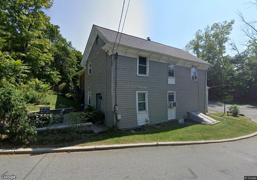
281 Potterstown Rd Lebanon, NJ 08833
Readington NeighborhoodEstimated Value: $647,000 - $869,000
3
Beds
2
Baths
4,920
Sq Ft
$158/Sq Ft
Est. Value
About This Home
This home is located at 281 Potterstown Rd, Lebanon, NJ 08833 and is currently estimated at $775,998, approximately $157 per square foot. 281 Potterstown Rd is a home located in Hunterdon County with nearby schools including Hunterdon Central Regional High School District and Whitehouse Preparatory School.
Ownership History
Date
Name
Owned For
Owner Type
Purchase Details
Closed on
Dec 9, 2010
Sold by
Kayhart Brian R
Bought by
Potterstown Llc
Current Estimated Value
Home Financials for this Owner
Home Financials are based on the most recent Mortgage that was taken out on this home.
Original Mortgage
$198,750
Outstanding Balance
$131,377
Interest Rate
4.23%
Mortgage Type
Purchase Money Mortgage
Estimated Equity
$644,621
Purchase Details
Closed on
Mar 28, 1989
Sold by
Barna Michael J and Et Als Leonore H
Bought by
Bartlett Catherine H and Bartlett Matthew T
Create a Home Valuation Report for This Property
The Home Valuation Report is an in-depth analysis detailing your home's value as well as a comparison with similar homes in the area
Home Values in the Area
Average Home Value in this Area
Purchase History
| Date | Buyer | Sale Price | Title Company |
|---|---|---|---|
| Potterstown Llc | $265,000 | None Available | |
| Bartlett Catherine H | -- | -- |
Source: Public Records
Mortgage History
| Date | Status | Borrower | Loan Amount |
|---|---|---|---|
| Open | Potterstown Llc | $198,750 |
Source: Public Records
Tax History Compared to Growth
Tax History
| Year | Tax Paid | Tax Assessment Tax Assessment Total Assessment is a certain percentage of the fair market value that is determined by local assessors to be the total taxable value of land and additions on the property. | Land | Improvement |
|---|---|---|---|---|
| 2025 | $13,876 | $529,400 | $79,700 | $449,700 |
| 2024 | $13,759 | $529,400 | $79,700 | $449,700 |
| 2023 | $13,759 | $529,400 | $79,700 | $449,700 |
| 2022 | $13,404 | $529,400 | $79,700 | $449,700 |
| 2021 | $8,651 | $529,400 | $79,700 | $449,700 |
| 2020 | $10,455 | $343,800 | $150,700 | $193,100 |
| 2019 | $8,403 | $281,700 | $150,700 | $131,000 |
| 2018 | $8,271 | $281,700 | $150,700 | $131,000 |
| 2017 | $8,079 | $281,700 | $150,700 | $131,000 |
| 2016 | $7,888 | $281,700 | $150,700 | $131,000 |
| 2015 | $7,761 | $281,700 | $150,700 | $131,000 |
| 2014 | $7,194 | $264,400 | $134,200 | $130,200 |
Source: Public Records
Map
Nearby Homes
- 2 Wayside Ln
- 417 Mountain Rd
- 10 Concord Rd
- 474 Us Highway 22 and 3
- 474 U S 22
- 474 Rt 22
- 1121 Route 22 E
- 7 Welsh Rd
- 49 Blossom Hill Rd
- 156 Main St
- 4 Orchid Place
- 26 Hunters Cir
- 13 Jennifer Ct
- 35 Hunters Cir
- 1 Gerald Ct
- 9 Daniel Ct
- 25 Ramsey Rd
- 1305 S Branch Dr Unit 11C
- 111 S Branch Dr Unit 5F
- 1402 S Branch Dr Unit 20E
- 276 Potterstown Rd
- 11 Potterstown Rd
- 9 Potterstown Rd
- 512 Potterstown Rd
- 3 Potterstown Rd
- 3 Potterstown Rd
- 5 Potterstown Rd
- 510 Us Highway 22
- 13 Potterstown Rd
- 271 Potterstown Rd
- 281 Us Highway 22
- 1001 Route 22
- 15 Potterstown Rd
- 1006 U S 22 Unit 1
- 17 Potterstown Rd
- 268 Potterstown Rd
- 506 Rt 22
- 265 Aray Dr
- 266 Aray Dr
- 17 Wayside Ln