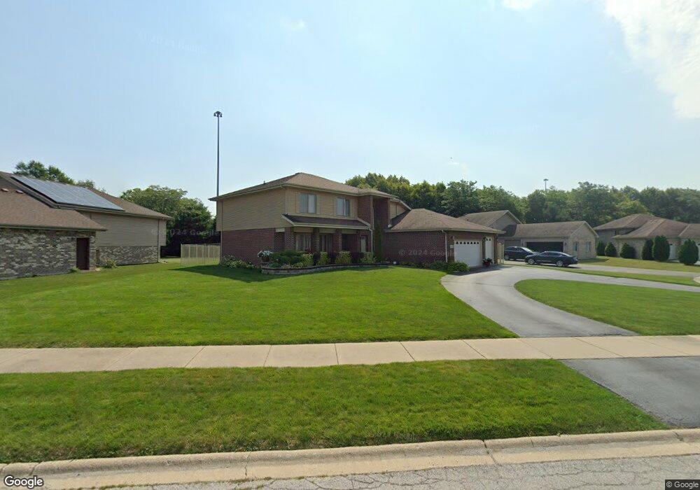
281 Providence Dr Matteson, IL 60443
West Matteson NeighborhoodEstimated Value: $413,000 - $461,000
About This Home
This home is located at 281 Providence Dr, Matteson, IL 60443 and is currently estimated at $437,935, approximately $146 per square foot. 281 Providence Dr is a home located in Cook County with nearby schools including Colin Powell Middle School.
Ownership History
We collect this data history from publicly available records. To have your information removed, we recommend requesting removal directly through your county’s website.
Purchase Details
Home Financials for this Owner
Home Financials are based on the most recent Mortgage that was taken out on this home.Home Values in the Area
Average Home Value in this Area
Purchase History
We collect this data history from publicly available records. To have your information removed, we recommend requesting removal directly through your county’s website.
| Date | Buyer | Sale Price | Title Company |
|---|---|---|---|
| $316,000 | -- |
Mortgage History
We collect this data history from publicly available records. To have your information removed, we recommend requesting removal directly through your county’s website.
| Date | Status | Borrower | Loan Amount |
|---|---|---|---|
| Open | $283,995 |
Tax History
We collect this data history from publicly available records. To have your information removed, we recommend requesting removal directly through your county’s website.
| Year | Tax Paid | Tax Assessment Tax Assessment Total Assessment is a certain percentage of the fair market value that is determined by local assessors to be the total taxable value of land and additions on the property. | Land | Improvement |
|---|---|---|---|---|
| 2025 | $12,490 | $36,100 | $7,855 | $28,245 |
| 2024 | $12,490 | $36,100 | $7,855 | $28,245 |
| 2023 | $8,822 | $36,100 | $7,855 | $28,245 |
| 2022 | $8,822 | $22,636 | $6,784 | $15,852 |
| 2021 | $8,992 | $22,634 | $6,783 | $15,851 |
| 2020 | $8,904 | $22,634 | $6,783 | $15,851 |
| 2019 | $8,697 | $22,090 | $6,069 | $16,021 |
| 2018 | $8,564 | $22,090 | $6,069 | $16,021 |
| 2017 | $8,384 | $22,090 | $6,069 | $16,021 |
| 2016 | $10,879 | $23,519 | $5,355 | $18,164 |
| 2015 | $10,618 | $23,519 | $5,355 | $18,164 |
| 2014 | $10,357 | $23,519 | $5,355 | $18,164 |
| 2013 | $11,035 | $26,616 | $5,355 | $21,261 |
Map
- 301 Providence Dr
- 5171 Monroe St
- 222 Owen St
- 5105 Monroe St
- 117 Bowman St
- 161 Briarwood Ct Unit 2131
- 130 Central Ave Unit 1194
- 5620 Feathercreek Rd
- 137 Lawrence Ln
- 651 Central Ave
- 156 Cloverleaf Rd
- 5733 Woodgate Dr
- 848 Notre Dame Dr
- 5631 Colgate Ln
- 818 Princeton Ave
- 937 Notre Dame Dr
- 151 Oriole Rd
- 115 Oriole Rd
- 123 Oriole Rd
- 920 Central Ave
- 271 Providence Dr
- 291 Providence Dr
- 261 Providence Dr
- 280 Providence Dr
- 270 Providence Dr
- 290 Providence Dr
- 260 Providence Dr
- 311 Providence Dr
- 300 Providence Dr
- 251 Providence Dr
- 310 Providence Dr
- 241 Providence Dr
- 281 Maryview Pkwy
- 271 Maryview Pkwy
- 321 Providence Dr
- 291 Maryview Pkwy
- 5280 Hope Place
- 261 Maryview Pkwy
- 301 Maryview Pkwy
- 331 Providence Dr
Ask me questions while you tour the home.