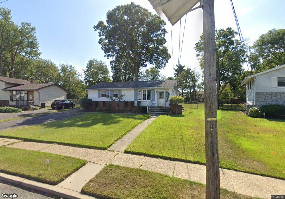
281 Somerset Rd Woodbury, NJ 08096
Deptford Township NeighborhoodEstimated Value: $309,378 - $338,000
--
Bed
--
Bath
1,280
Sq Ft
$250/Sq Ft
Est. Value
About This Home
This home is located at 281 Somerset Rd, Woodbury, NJ 08096 and is currently estimated at $319,845, approximately $249 per square foot. 281 Somerset Rd is a home located in Gloucester County with nearby schools including Deptford Township High School and Holy Angels Catholic School.
Ownership History
Date
Name
Owned For
Owner Type
Purchase Details
Closed on
May 13, 2002
Sold by
Platt Robin T and State Of New Jersey
Bought by
Fremont Investment & Loan
Current Estimated Value
Purchase Details
Closed on
May 28, 1999
Sold by
Blasker Herbert and Blasker Rosemarie
Bought by
Platt Robin T
Home Financials for this Owner
Home Financials are based on the most recent Mortgage that was taken out on this home.
Original Mortgage
$35,000
Interest Rate
6.85%
Purchase Details
Closed on
Aug 15, 1995
Sold by
Gawason Walter
Bought by
Blasker Herbert and Blasker Rosemarie
Purchase Details
Closed on
Sep 14, 1994
Sold by
Gawason Walter and Gawason Anna Z
Bought by
Gawason Walter
Create a Home Valuation Report for This Property
The Home Valuation Report is an in-depth analysis detailing your home's value as well as a comparison with similar homes in the area
Home Values in the Area
Average Home Value in this Area
Purchase History
| Date | Buyer | Sale Price | Title Company |
|---|---|---|---|
| Fremont Investment & Loan | $37,616 | -- | |
| Platt Robin T | $90,250 | Group 21 Title Agency | |
| Blasker Herbert | $89,900 | American Title Abstract | |
| Gawason Walter | -- | -- |
Source: Public Records
Mortgage History
| Date | Status | Borrower | Loan Amount |
|---|---|---|---|
| Previous Owner | Platt Robin T | $35,000 |
Source: Public Records
Tax History Compared to Growth
Tax History
| Year | Tax Paid | Tax Assessment Tax Assessment Total Assessment is a certain percentage of the fair market value that is determined by local assessors to be the total taxable value of land and additions on the property. | Land | Improvement |
|---|---|---|---|---|
| 2025 | $5,578 | $155,600 | $45,300 | $110,300 |
| 2024 | $5,399 | $155,600 | $45,300 | $110,300 |
| 2023 | $5,399 | $155,600 | $45,300 | $110,300 |
| 2022 | $5,360 | $155,600 | $45,300 | $110,300 |
| 2021 | $5,284 | $155,600 | $45,300 | $110,300 |
| 2020 | $5,223 | $155,600 | $45,300 | $110,300 |
| 2019 | $5,124 | $155,600 | $45,300 | $110,300 |
| 2018 | $5,009 | $155,600 | $45,300 | $110,300 |
| 2017 | $4,875 | $155,600 | $45,300 | $110,300 |
| 2016 | $4,775 | $155,600 | $45,300 | $110,300 |
| 2015 | $4,628 | $155,600 | $45,300 | $110,300 |
| 2014 | $4,508 | $155,600 | $45,300 | $110,300 |
Source: Public Records
Map
Nearby Homes
- 1573 Delsea Dr
- 1002 Cumberland Ave
- 1106 Cumberland Ave
- 951 New Jersey Ave
- 924 Virginia Ave
- 14 Laurel Ct
- 106 Shelly Ln
- 1672 Cooper St
- 1209 Cooper St
- 1879 Delsea Dr
- 1232 Cooper St
- 133 Hampshire Dr
- 807 Buffalo Ct
- BL 129 LT 8 10-20 Buffalo Ct
- 230 Hampshire Dr
- 418 Dogwood Dr
- 129 Williams Ave
- 314 Dogwood Dr
- 453 Dogwood Dr
- 1040 Lexington Dr
- 279 Somerset Rd
- 283 Somerset Rd
- 1030 Byrd Dr
- 277 Somerset Rd
- 1048 Byrd Dr
- 285 Somerset Rd
- 1026 Byrd Dr
- 282 Somerset Rd
- 278 Somerset Rd
- 275 Somerset Rd
- 1060 Byrd Dr
- 286 Somerset Rd
- 287 Somerset Rd
- 276 Somerset Rd
- 273 Somerset Rd
- 288 Somerset Rd
- 1531 Delsea Dr
- 1070 Byrd Dr
- 289 Somerset Rd
- 274 Somerset Rd