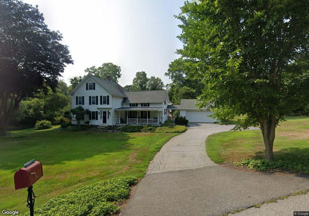
281 W Main St Niantic, CT 06357
Estimated Value: $552,686 - $916,000
3
Beds
2
Baths
2,552
Sq Ft
$255/Sq Ft
Est. Value
About This Home
This home is located at 281 W Main St, Niantic, CT 06357 and is currently estimated at $650,422, approximately $254 per square foot. 281 W Main St is a home located in New London County with nearby schools including East Lyme Middle School, East Lyme High School, and The Light House Voc-Ed Center.
Ownership History
Date
Name
Owned For
Owner Type
Purchase Details
Closed on
Jun 20, 2014
Sold by
Mazzulli Armand and Mazzulli Linnea B
Bought by
Mazzilli Ft
Current Estimated Value
Purchase Details
Closed on
Jul 21, 1969
Bought by
Mazzulli Armand
Create a Home Valuation Report for This Property
The Home Valuation Report is an in-depth analysis detailing your home's value as well as a comparison with similar homes in the area
Home Values in the Area
Average Home Value in this Area
Purchase History
| Date | Buyer | Sale Price | Title Company |
|---|---|---|---|
| Mazzilli Ft | -- | -- | |
| Mazzulli Armand | -- | -- | |
| Mazzilli Ft | -- | -- |
Source: Public Records
Mortgage History
| Date | Status | Borrower | Loan Amount |
|---|---|---|---|
| Previous Owner | Mazzulli Armand | $66,000 | |
| Previous Owner | Mazzulli Armand | $65,369 |
Source: Public Records
Tax History Compared to Growth
Tax History
| Year | Tax Paid | Tax Assessment Tax Assessment Total Assessment is a certain percentage of the fair market value that is determined by local assessors to be the total taxable value of land and additions on the property. | Land | Improvement |
|---|---|---|---|---|
| 2025 | $7,200 | $257,040 | $65,450 | $191,590 |
| 2024 | $6,773 | $257,040 | $65,450 | $191,590 |
| 2023 | $6,395 | $257,040 | $65,450 | $191,590 |
| 2022 | $6,128 | $257,040 | $65,450 | $191,590 |
| 2021 | $5,670 | $198,870 | $75,530 | $123,340 |
| 2020 | $5,640 | $198,870 | $75,530 | $123,340 |
| 2019 | $5,606 | $198,870 | $75,530 | $123,340 |
| 2018 | $5,439 | $198,870 | $75,530 | $123,340 |
| 2017 | $5,202 | $198,870 | $75,530 | $123,340 |
| 2016 | $4,788 | $188,790 | $65,450 | $123,340 |
| 2015 | $4,665 | $188,790 | $65,450 | $123,340 |
| 2014 | $4,537 | $188,790 | $65,450 | $123,340 |
Source: Public Records
Map
Nearby Homes
- 4 Jean Dr
- 2 Riverdale Landing
- 22 Riverdale Landing
- 14 Colton Rd
- 15 Freedom Way Unit 92
- 188 4 Mile River Rd
- 15 Short Hills Rd
- 40 Spinnaker Dr
- 18 Twin Valley Rd
- 3 Twin Valley Rd
- 16 Twin Valley Rd
- Waramaug Plan at Riverside Reserve
- Highland Plan at Riverside Reserve
- Hayward Plan at Riverside Reserve
- Ashford Plan at Riverside Reserve
- Lillinonah Plan at Riverside Reserve
- 245 Giants Neck Rd
- 13 Victoria Ln
- 15 Griswold Rd
- 23 Over Brook Rd
- 283 W Main St
- 279 W Main St
- 289 W Main St
- 277 W Main St
- 21 Four Mile River Rd
- 11 Four Mile River Rd
- 21 4 Mile River Rd
- 23 Four Mile River Rd
- 7 Four Mile River Rd
- 18 Four Mile River Rd
- 5 Four Mile River Rd
- 20 Four Mile River Rd
- 275 W Main St
- 29 Four Mile River Rd
- 29 4 Mile River Rd
- 16 Four Mile River Rd
- 3 Four Mile River Rd
- 3 4 Mile River Rd
- 22 Four Mile River Rd
- 6 4 Mile River Rd