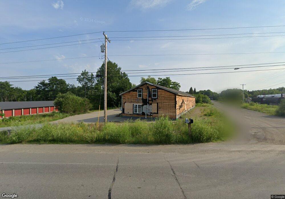
281 Western Ave Hampden, ME 04444
--
Bed
--
Bath
6,112
Sq Ft
0.72
Acres
About This Home
This home is located at 281 Western Ave, Hampden, ME 04444. 281 Western Ave is a home located in Penobscot County.
Ownership History
Date
Name
Owned For
Owner Type
Purchase Details
Closed on
Mar 27, 2020
Sold by
Holden Llc
Bought by
Freedom Rentals Llc
Home Financials for this Owner
Home Financials are based on the most recent Mortgage that was taken out on this home.
Original Mortgage
$140,000
Outstanding Balance
$124,023
Interest Rate
3.4%
Mortgage Type
New Conventional
Purchase Details
Closed on
Jan 29, 2007
Sold by
Whitcomb Dennis M and Theriault David M
Bought by
Holden Llc
Home Financials for this Owner
Home Financials are based on the most recent Mortgage that was taken out on this home.
Original Mortgage
$250,000
Interest Rate
6.15%
Mortgage Type
Commercial
Create a Home Valuation Report for This Property
The Home Valuation Report is an in-depth analysis detailing your home's value as well as a comparison with similar homes in the area
Home Values in the Area
Average Home Value in this Area
Purchase History
| Date | Buyer | Sale Price | Title Company |
|---|---|---|---|
| Freedom Rentals Llc | -- | None Available | |
| Freedom Rentals Llc | -- | None Available | |
| Holden Llc | -- | -- |
Source: Public Records
Mortgage History
| Date | Status | Borrower | Loan Amount |
|---|---|---|---|
| Open | Freedom Rentals Llc | $140,000 | |
| Closed | Freedom Rentals Llc | $140,000 | |
| Previous Owner | Holden Llc | $70,000 | |
| Previous Owner | Holden Llc | $250,000 |
Source: Public Records
Tax History Compared to Growth
Tax History
| Year | Tax Paid | Tax Assessment Tax Assessment Total Assessment is a certain percentage of the fair market value that is determined by local assessors to be the total taxable value of land and additions on the property. | Land | Improvement |
|---|---|---|---|---|
| 2024 | $5,415 | $346,000 | $43,000 | $303,000 |
| 2023 | $5,477 | $284,500 | $35,400 | $249,100 |
| 2022 | $4,908 | $237,100 | $29,500 | $207,600 |
| 2021 | $4,908 | $237,100 | $29,500 | $207,600 |
| 2020 | $4,837 | $237,100 | $29,500 | $207,600 |
| 2019 | $4,812 | $235,900 | $28,600 | $207,300 |
| 2018 | $4,624 | $235,900 | $28,600 | $207,300 |
| 2017 | $4,341 | $235,900 | $28,600 | $207,300 |
| 2016 | $4,295 | $236,000 | $29,000 | $207,000 |
| 2015 | $4,130 | $236,000 | $29,000 | $207,000 |
| 2014 | $4,128 | $235,900 | $28,600 | $207,300 |
| 2013 | $2,749 | $165,100 | $28,600 | $136,500 |
Source: Public Records
Map
Nearby Homes
- 327 Western Ave
- 0 Western Ave Unit 21258039
- 135 Mayo Rd Unit G
- 128 Mayo Rd Unit D
- 45 Hughes Blvd
- 0 Constitution
- 73 Papermill Rd
- 59 Patterson Rd
- 594 Western Ave
- 31 Jays Way
- 9 Patterson Rd
- 69 Cottage St
- 24 Coldbrook Rd
- 25 Summer St
- 20 Coldbrook Rd
- 12 Rowell Rd
- 41 Stoneybrook Rd
- 45 Stearns Farm Rd
- 34 Stoneybrook Rd
- 1 Honey Hill Ln
- 285 Western Ave
- 271 Western Ave
- 274 Western Ave
- 288 Western Ave
- 262 Western Ave
- 299 Western Ave
- 261 Western Ave
- 303 Western Ave
- 278 Western
- 199 Mayo Rd
- 302 Western Ave
- 208 Mayo Rd
- 191 Mayo Rd
- 315 Western Ave
- 194 Mayo Rd
- 283 Western Ave
- 188 Mayo Rd
- 40 Country Meadow Dr
- 319 Western Ave Lot #1
- 39 Country Meadow Dr