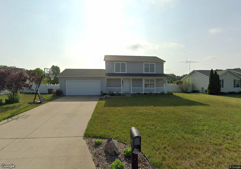
281 Zak Rd Plainwell, MI 49080
Estimated Value: $305,000 - $332,000
3
Beds
3
Baths
1,664
Sq Ft
$191/Sq Ft
Est. Value
About This Home
This home is located at 281 Zak Rd, Plainwell, MI 49080 and is currently estimated at $318,199, approximately $191 per square foot. 281 Zak Rd is a home located in Allegan County with nearby schools including Otsego High School, Otsego Christian Academy, and St. Margaret School.
Ownership History
Date
Name
Owned For
Owner Type
Purchase Details
Closed on
Mar 10, 2020
Sold by
Roeske David L and Roeske Ashley M
Bought by
Roeske David L and Roeske Ashley M
Current Estimated Value
Purchase Details
Closed on
Dec 12, 2005
Sold by
Thomas Termeer Builders Inc
Bought by
Roeske David L and Roeske Ashley M
Home Financials for this Owner
Home Financials are based on the most recent Mortgage that was taken out on this home.
Original Mortgage
$168,367
Outstanding Balance
$94,594
Interest Rate
6.36%
Mortgage Type
New Conventional
Estimated Equity
$223,605
Create a Home Valuation Report for This Property
The Home Valuation Report is an in-depth analysis detailing your home's value as well as a comparison with similar homes in the area
Home Values in the Area
Average Home Value in this Area
Purchase History
| Date | Buyer | Sale Price | Title Company |
|---|---|---|---|
| Roeske David L | -- | None Available | |
| Roeske David L | $165,000 | Devon Title Agency | |
| Thomas Termeer Builders Inc | -- | Devon Title Agency |
Source: Public Records
Mortgage History
| Date | Status | Borrower | Loan Amount |
|---|---|---|---|
| Open | Thomas Termeer Builders Inc | $168,367 |
Source: Public Records
Tax History
| Year | Tax Paid | Tax Assessment Tax Assessment Total Assessment is a certain percentage of the fair market value that is determined by local assessors to be the total taxable value of land and additions on the property. | Land | Improvement |
|---|---|---|---|---|
| 2025 | $3,111 | $155,300 | $9,900 | $145,400 |
| 2024 | $2,594 | $151,900 | $7,000 | $144,900 |
| 2023 | $2,640 | $133,000 | $7,000 | $126,000 |
| 2022 | $2,594 | $113,900 | $6,800 | $107,100 |
| 2021 | $2,453 | $106,200 | $5,400 | $100,800 |
| 2020 | $2,421 | $103,200 | $5,100 | $98,100 |
| 2019 | $2,344 | $97,000 | $4,200 | $92,800 |
| 2018 | $2,299 | $92,000 | $4,200 | $87,800 |
| 2017 | $0 | $86,800 | $4,200 | $82,600 |
| 2016 | $0 | $71,000 | $4,200 | $66,800 |
| 2015 | -- | $71,000 | $4,200 | $66,800 |
| 2014 | $2,176 | $76,900 | $4,300 | $72,600 |
| 2013 | $2,176 | $69,400 | $5,400 | $64,000 |
Source: Public Records
Map
Nearby Homes
- 323 13th St
- 1224 102nd Ave
- 1170 W Bridge St
- 355 12th St
- 909 Barton St
- 802 Kay St
- 551 W Bridge St
- 426 W Bridge St
- 704 Bayberry Ln
- 1056 Elmwood St
- V/L Bronson Ave
- 805 Irving St
- 140 W 1st Ave
- 1057 S Stoneridge Dr
- 354 E Allegan St
- Integrity 1880 Plan at Southpointe Trails
- Integrity 1910 Plan at Southpointe Trails
- Integrity 1250 Plan at Southpointe Trails
- Integrity 1750 Plan at Southpointe Trails
- Integrity 2000 Plan at Southpointe Trails