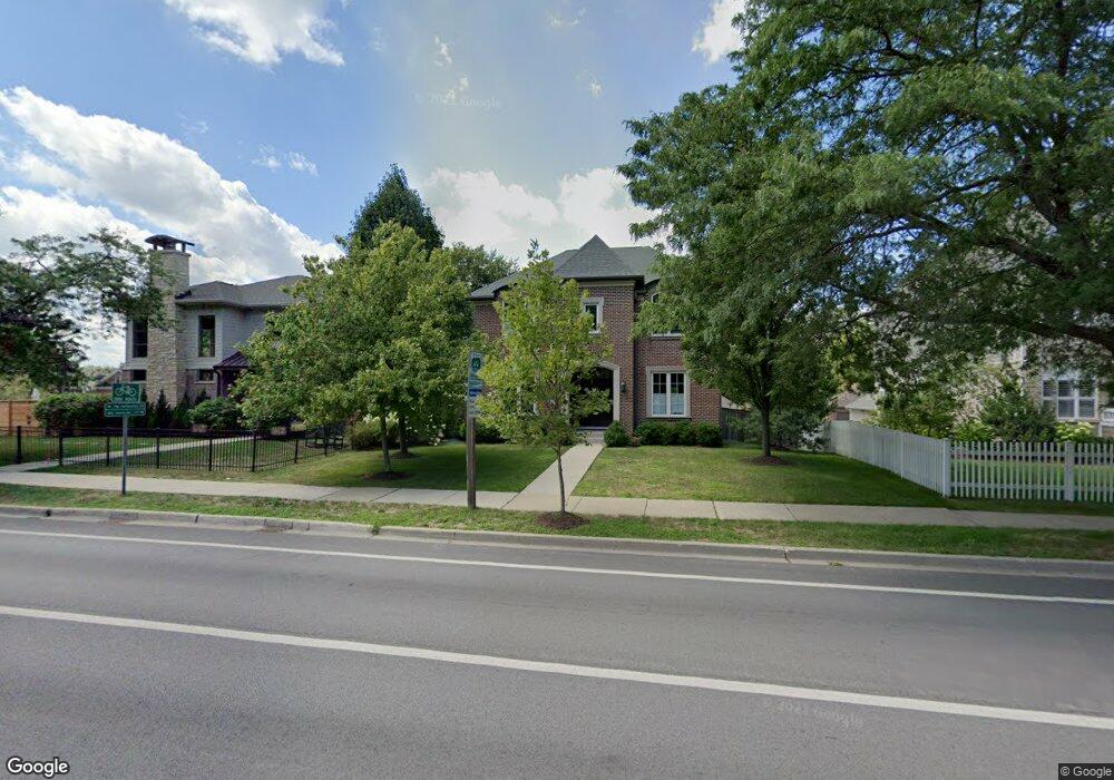
2810 Sheridan Rd Evanston, IL 60201
Central Street NeighborhoodEstimated Value: $1,433,000 - $1,860,000
About This Home
This home is located at 2810 Sheridan Rd, Evanston, IL 60201 and is currently estimated at $1,724,591, approximately $568 per square foot. 2810 Sheridan Rd is a home located in Cook County with nearby schools including Orrington Elementary School, Haven Middle School, and Evanston Township High School.
Ownership History
We collect this data history from publicly available records. To have your information removed, we recommend requesting removal directly through your county’s website.
Purchase Details
Home Financials for this Owner
Home Financials are based on the most recent Mortgage that was taken out on this home.Home Values in the Area
Average Home Value in this Area
Purchase History
We collect this data history from publicly available records. To have your information removed, we recommend requesting removal directly through your county’s website.
| Date | Buyer | Sale Price | Title Company |
|---|---|---|---|
| $1,042,000 | Cti |
Mortgage History
We collect this data history from publicly available records. To have your information removed, we recommend requesting removal directly through your county’s website.
| Date | Status | Borrower | Loan Amount |
|---|---|---|---|
| Closed | $833,348 |
Tax History
We collect this data history from publicly available records. To have your information removed, we recommend requesting removal directly through your county’s website.
| Year | Tax Paid | Tax Assessment Tax Assessment Total Assessment is a certain percentage of the fair market value that is determined by local assessors to be the total taxable value of land and additions on the property. | Land | Improvement |
|---|---|---|---|---|
| 2025 | $28,386 | $163,000 | $24,736 | $138,264 |
| 2024 | $28,386 | $119,529 | $21,258 | $98,271 |
| 2023 | $27,201 | $119,529 | $21,258 | $98,271 |
| 2022 | $27,201 | $119,529 | $21,258 | $98,271 |
| 2021 | $24,536 | $94,956 | $13,914 | $81,042 |
| 2020 | $24,264 | $94,956 | $13,914 | $81,042 |
| 2019 | $23,770 | $104,005 | $13,914 | $90,091 |
| 2018 | $21,716 | $82,032 | $11,595 | $70,437 |
| 2017 | $21,160 | $82,032 | $11,595 | $70,437 |
| 2016 | $20,289 | $82,032 | $11,595 | $70,437 |
| 2015 | $21,589 | $82,448 | $9,855 | $72,593 |
| 2014 | $21,376 | $82,448 | $9,855 | $72,593 |
| 2013 | $20,866 | $82,448 | $9,855 | $72,593 |
Map
- 2751 Girard Ave
- 712 Ingleside Place
- 2766 Asbury Ave
- 349 Gregory Ave
- 1218 Central St Unit 3S
- 1210 Central St Unit 3N
- 414 Laurel Ave
- 2254 Sherman Ave Unit 2
- 526 Linden Ave
- 2246 Sherman Ave Unit 1
- 734 Noyes St Unit O2
- 724 Noyes St Unit F2
- 2515 Prairie Ave Unit 1E
- 1933 Harrison St Unit 3B
- 725 Simpson St Unit 3
- 1010 Sheridan Rd
- 2033 Sherman Ave Unit 507
- 1906 Lincoln St Unit C
- 2108 Wesley Ave
- 1920 Lincoln St Unit 3S
- 2808 Sheridan Place
- 2806 Sheridan Rd
- 2812 Sheridan Rd
- 2802 Sheridan Rd
- 2811 Garrison Ave
- 2815 Garrison Ave
- 2809 Garrison Ave
- 2819 Garrison Ave
- 2805 Garrison Ave
- 2801 Sheridan Rd
- 100 Garrison Ave
- 123 Sheridan Rd
- 2823 Sheridan Rd
- 915 Isabella St
- 2815 Sheridan Rd
- 104 Garrison Ave
- 108 Garrison Ave
- 900 Isabella St
- 2783 Sheridan Rd
- 110 Garrison Ave
Ask me questions while you tour the home.