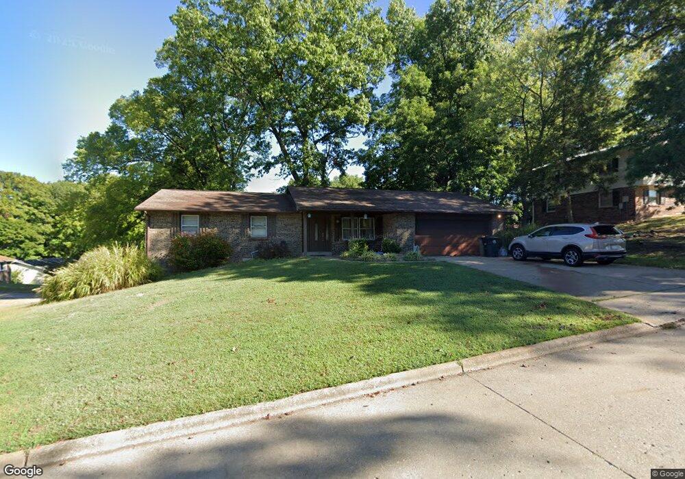
2810 Thomas Dr Cape Girardeau, MO 63701
Estimated Value: $241,000 - $268,000
3
Beds
3
Baths
1,569
Sq Ft
$159/Sq Ft
Est. Value
About This Home
This home is located at 2810 Thomas Dr, Cape Girardeau, MO 63701 and is currently estimated at $249,770, approximately $159 per square foot. 2810 Thomas Dr is a home with nearby schools including Clippard Elementary School, Central Middle School, and Central Junior High School.
Ownership History
Date
Name
Owned For
Owner Type
Purchase Details
Closed on
Nov 29, 2021
Sold by
Cauble Dustin Michael and Cauble Lindsay
Bought by
English Bryan and English Sarah
Current Estimated Value
Home Financials for this Owner
Home Financials are based on the most recent Mortgage that was taken out on this home.
Original Mortgage
$160,000
Outstanding Balance
$147,217
Interest Rate
3.14%
Mortgage Type
New Conventional
Estimated Equity
$102,553
Purchase Details
Closed on
Jul 29, 2021
Sold by
Randol Gregory Wayne and Randol Marilyn
Bought by
Cauble Dustin Michael and Rusher Michael
Home Financials for this Owner
Home Financials are based on the most recent Mortgage that was taken out on this home.
Original Mortgage
$200,000
Interest Rate
2.9%
Mortgage Type
New Conventional
Create a Home Valuation Report for This Property
The Home Valuation Report is an in-depth analysis detailing your home's value as well as a comparison with similar homes in the area
Home Values in the Area
Average Home Value in this Area
Purchase History
| Date | Buyer | Sale Price | Title Company |
|---|---|---|---|
| English Bryan | -- | None Available | |
| Cauble Dustin Michael | -- | None Available |
Source: Public Records
Mortgage History
| Date | Status | Borrower | Loan Amount |
|---|---|---|---|
| Open | English Bryan | $160,000 | |
| Previous Owner | Cauble Dustin Michael | $200,000 |
Source: Public Records
Tax History Compared to Growth
Tax History
| Year | Tax Paid | Tax Assessment Tax Assessment Total Assessment is a certain percentage of the fair market value that is determined by local assessors to be the total taxable value of land and additions on the property. | Land | Improvement |
|---|---|---|---|---|
| 2025 | $16 | $31,820 | $2,650 | $29,170 |
| 2024 | $16 | $30,300 | $2,520 | $27,780 |
| 2023 | $1,575 | $30,300 | $2,520 | $27,780 |
| 2022 | $1,452 | $27,930 | $2,320 | $25,610 |
| 2021 | $1,452 | $27,930 | $2,320 | $25,610 |
| 2020 | $1,456 | $27,930 | $2,320 | $25,610 |
| 2019 | $1,454 | $27,930 | $0 | $0 |
| 2018 | $1,451 | $27,930 | $0 | $0 |
| 2017 | $1,455 | $27,930 | $0 | $0 |
| 2016 | $1,449 | $27,930 | $0 | $0 |
| 2015 | $1,450 | $27,930 | $0 | $0 |
| 2014 | $1,458 | $27,930 | $0 | $0 |
Source: Public Records
Map
Nearby Homes
- 1107 Dorothy St
- 1070 Dorothy St
- 835 Lochinvar Ln
- 1246 Marilyn Dr
- 1000 N Mount Auburn Rd
- 3269 Hopper Rd
- 3002 Melrose Ave
- 1705 Paul Revere Dr
- 3036 Keystone Dr
- 3014 Keystone Dr
- 2550 Marvin St
- 3022 Beavercreek Dr
- 3046 Beavercreek Dr
- 2629 Hopper Rd
- 901 Pheasant Cove Dr
- 2449 Janet Dr
- 3466 Hopper Rd
- 2412 Masters Dr
- 769 Cedar Ln
- 3552 Mill View Crossing
- 2806 Thomas Dr
- 1212 Hilldale Cir
- 1203 Hilldale Cir
- 2811 Thomas Dr
- 1209 Hilldale Cir
- 2809 Thomas Dr
- 1201 Hilldale Cir
- 1123 Hilldale Cir
- 1217 Hilldale Cir
- 1211 Hilldale Cir
- 1213 Hilldale Cir
- 1121 Patricia St
- 1119 Hilldale Cir
- 1215 Hilldale Cir
- 1117 Patricia St
- 1202 Hilldale Cir
- 1115 Hilldale Cir
- 1206 Hilldale Cir
- 1122 Patricia St
- 1218 Hilldale Cir